Tygart Lake Dam
Introduction
Text-to-speech Audio
Images
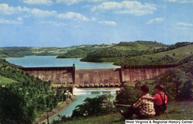
A postcard depicting children enjoying the view of Tygart Lake Dam
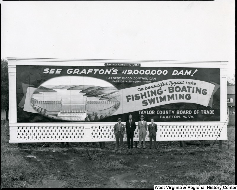
Billboard for the newly constructed Tygart Lake Dam in Grafton, WV
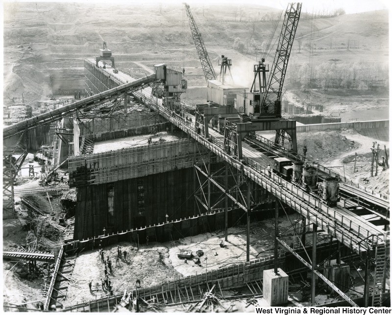
Construction of the Tygart Lake Dam in the 1930s
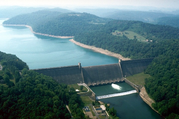
Current photograph of Tygart Lake and Dam
Backstory and Context
Text-to-speech Audio
Tygart Lake Dam is a product of one of the many initiatives of Franklin Delano Roosevelt’s New Deal: the Rivers and Harbors Act of 1935.1 Construction, led by the US Army Corps of Engineers, began in 1934 and finished in 1938. While many engineers worked on the project, Charles M. Wellons was the principal engineer. The dam consists of thirty-four concrete sections and ten gates to control water output.2 Over 3,000 workers helped to construct the dam, many of whom worked for the Works Progress Administration.3 In total, the extensive project cost $18.5 million to construct.4 To build the dam, 221 properties were acquisitioned, only eighty-nine of which were directly purchased; the other 132 tracts were acquisitioned through condemnation because many landowners were unwilling to sell. The dam is now listed on the National Register of Historic Places for its engineering and architectural feats and includes several other buildings near the dam.
A series of both floods and droughts provided the rationale behind building the dam; in 1888 and 1907, the area suffered widespread flooding; in 1930, drought plagued the region, nearly drying up the Monongahela River, of which the Tygart River is a tributary, making river transportation nearly impossible.5 The dam’s purpose was to control water flow through the Tygart River Valley and into the Monongahela River, which previously had been subject to extremely low or high water levels. The dam has prevented an estimated $1.2 billion in flood damage; during the floods of November 1985 alone, it prevented estimated damages of $195.8 million and decreased the Monongahela River’s flood level by 6.8 feet. Today, the dam manages a watershed of 1,184 miles.6
Tygart Lake Dam is located within Tygart Lake State Park, which is a popular, free recreational area. In the campground, both tent and camper sites, as well as more modern cabins, are available. Picnic areas are available for public use. A lodge is located within the park, which provides boarding and a small restaurant. Fishing and boating are popular activities during the warmer months; Tygart River, which flows out of the dam, is periodically stocked with trout, but the lake has several native species of fish including bass, walleye, muskie, crappie, perch, and pan fish. Scuba diving, kayaking, and swimming in the lake have been popularized over the years. The Pleasant Creek Wildlife Management Area also borders part of the lake and is open for public fishing and hunting.7
Sources
2 Lee R. Maddex (September 1994). "National Register of Historic Places Inventory Nomination Form: Tygart River Reservoir Dam" (PDF). State of West Virginia, West Virginia Division of Culture and History, Historic Preservation. Retrieved 3 April 2017.
3 "Tygart Dam and Lake." e-WV: The West Virginia Encyclopedia. 05 November 2010. Web. https://www.wvencyclopedia.org/articles/800 03 April 2017.
4 Tygart Lake. US Army Corps of Engineers Pittsburgh District. Accessed April 03, 2017. http://www.lrp.usace.army.mil/Missions/Recreation/Lakes/Tygart-Lake/.
5 "Tygart Dam and Lake." e-WV: The West Virginia Encyclopedia. 05 November 2010. Web. https://www.wvencyclopedia.org/articles/800 03 April 2017.
6 Tygart Lake. US Army Corps of Engineers Pittsburgh District. Accessed April 03, 2017. http://www.lrp.usace.army.mil/Missions/Recreation/Lakes/Tygart-Lake/.
7 Ibid.
Construction of Tygart Lake Dam, Grafton, W.Va. Photograph. From West Virginia Regional History Center at West Virginia University Libraries, West Virginia History OnView. Print, http://wvhistoryonview.org/catalog/wvulibraries:12654 (3 April 2017).
Billboard for Tygart Lake Dam, Grafton, W.Va. Photograph. From West Virginia Regional History Center at West Virginia University Libraries, West Virginia History OnView. Print, http://wvhistoryonview.org/catalog/wvulibraries:4740 (3 April 2017).
Children Sit on Hill Overlooking Tygart Dam, Grafton, W. Va. Photograph. Rex Heck News Company. From West Virginia Regional History Center at West Virginia University Libraries, West Virginia History OnView. Digital, http://wvhistoryonview.org/catalog/wvulibraries:46725 (3 April 2017).