Base and Meridian
Introduction
Text-to-speech Audio
Images
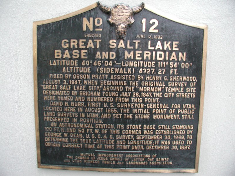
Historical Marker
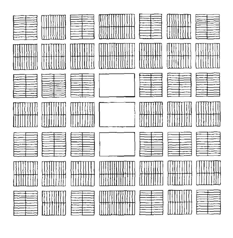
Joseph Smith's "Plat of Zion." Note the special blocks in the center intended to be occupied by 24 temples.
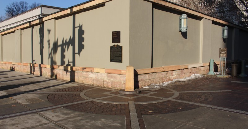
Base and Meridian on the corner of South and West Temple at Temple Square.
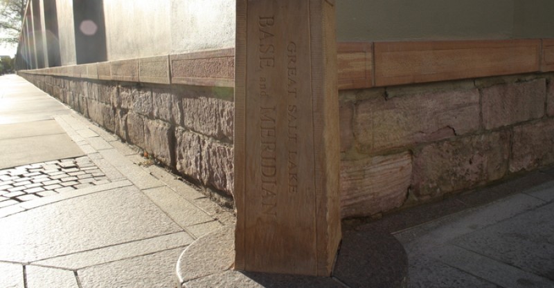
Closeup of the Base and Merdian
NASA Satellite Image

Backstory and Context
Text-to-speech Audio
Joseph Smith never had the opportunity to turn his utopian vision into a reality, however, as an anti-Mormon mob killed Smith in 1844. As a result of his death, church leadership fell to Brigham Young, who led LDS members to the Salt Lake Valley; they established Salt Lake City in 1847.
Sources
Laurence, Ray, Simon Esmonde Cleary and Gareth Sears. The City in the Roman West, c. 250 BC-c. AD 250. Cambridge, New York. Cambridge University Press, 2011.
"Plat of Zion." 99% Invisible. Accessed March 02, 2018. https://99percentinvisible.org/episode/plat-of-zion/.
Smith, Joseph. "An Explanation of the Plat of The City of Zion, Sent to the Brethren in Zion, The 25th of June, 1833." Urban Planning, 1794-1918: An International Anthology of Articles, Conference Papers, and Reports (Cornell University). Accessed March 02, 2018. http://urbanplanning.library.cornell.edu/DOCS/smith.htm. Selected, scanned, edited, provided with headnotes, and formatted as a web document by John W. Reps, Cornell University
Photo Sources
Historical Marker: Principal Meridian Project, http://www.pmproject.org/images/gslm/GSLBM-2.JPGJoseph Smith's Plat of Zion: Cornell University Library of Urban Planning: http://urbanplanning.library.cornell.edu/DOCS/smith.htm
Base and Meridian, and Closeup: Temple Square Website, https://www.templesquare.com/explore/base-and-meridian/
Satellite Image / NASA Image: Located in the Desert News Piece, "‘The Plat of Zion,’ Salt Lake’s grid system explained in new podcast," https://www.deseretnews.com/article/865671656/6The-Plat-of-Zion7-Salt-Lake7s-grid-system-explained-i...