Mouth of Symmes Creek Trail (1/4)- An Underground Railroad Trail of Lawrence County, Ohio, spanning the county from the Ohio River in the south to Poke Patch in the north.
Introduction
Text-to-speech Audio
Images
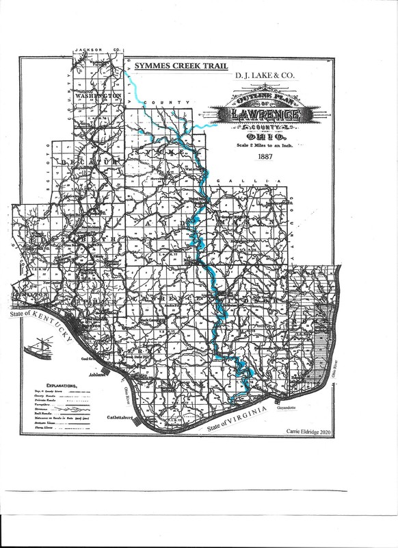
Route of Symmes Creek Underground Trail Across lawrence County, Ohio.
Mouth of Symmes Creek on the Ohio River, Chesapeake, Ohio (Indented river bank upriver of white houses.)

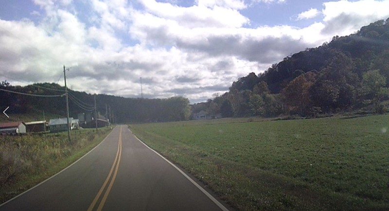
Rankins Creek Valley, Lawrence County, Ohio
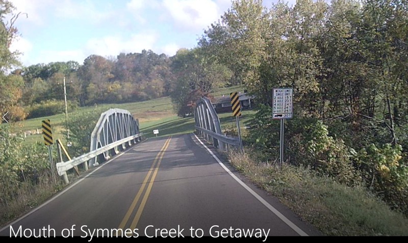
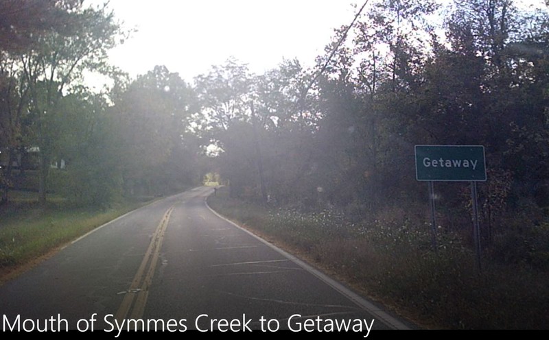
First Crossing of Symmes Creek at Getaway, Lawrence County, Ohio.
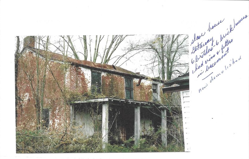
'slave catcher house' at Getaway. Now demolished, said to have chains and shackles in the basement.
Getaway Community, Lawrence County, Ohio. Some residents were Quakers and abolistionists.
Willow Wood Store still operating in the early 20th Century, Willow Wood, Lawrence County, Ohio

Crossing Symmes Creek near McDaniel's Crossroads, Gallia County, Ohio
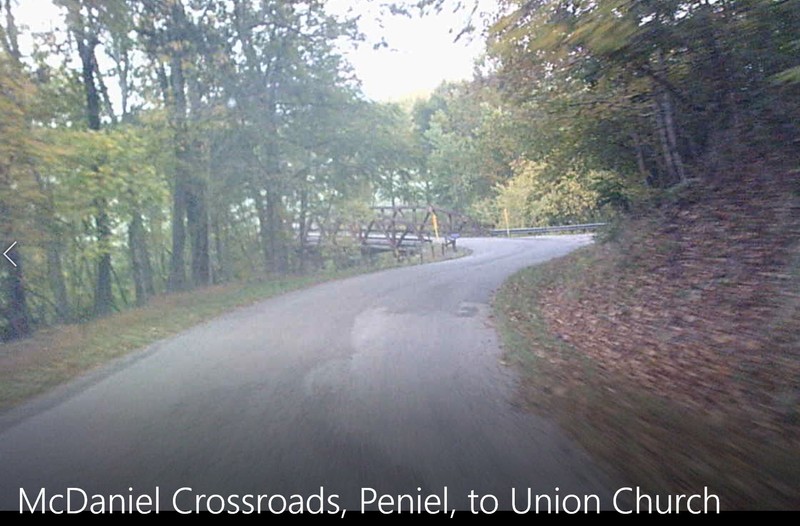
McDaniel's Crossroads (est. circa 1850), Gallia County, Ohio along one of the routes to Poke Patch.

Peniel Church (est. circa 1830 by Welsh immigrants), Gallia County, Ohio. It is between Gallia Furnace and and several roads that lead to Poke Patch.

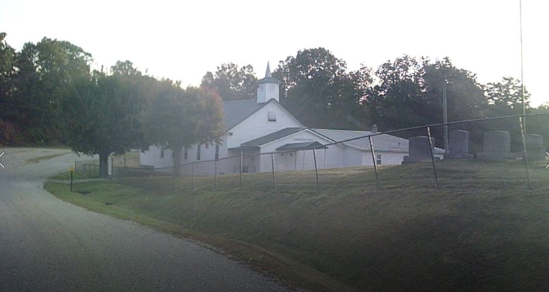
Union Church (est. 1819), Black Fork, Lawrence County, Ohio. (Poke Patch) member original Providence Association
Backstory and Context
Text-to-speech Audio
Between 1800 and 1860 escaping slaves tried to cross the Ohio River into the Northwest Territory where they would be free. Many of the routes north followed the streams flowing south into the Ohio River. Lawrence County, Ohio lies in the southeast corner of Ohio and across the Ohio River from both (West) Virginia and Kentucky. Although it was not a major crossing point many escaping slaves did cross the county looking for freedom farther north.
Symmes Creek is part of the ancient Teays River system and it is a mature river where the land has raised through the river valley. It has a wide valley, but passes around many hills and valleys as its meanders from its headwaters almost directly north of the Ohio River. Lying in the Symmes Creek head waters is the community of Poke Patch which was a known destination for those escaping slavery. Poke Patch, almost forty miles from the Ohio River, was the first site of organized help.
Although few people knew about the runaways, there were always "slave catchers" patrolling along the river. Lawrence County was heavily forested, with little or no help fugitive people ran through the woods, sheltered under rock over-hangs and hoped to reach a safe place before they were caught. The Symmes Creek Trail is one of at least four Lawrence County trails that assisted runaways into the Underground Railroad system that lead across Ohio and into Canada.
Please view 4/4 trails (1) Symmes Creek (2) Quaker (3) Macedonia/Old Jackson Road (4) The Iron Furnaces
Sources
D. J. Lake & Co. : An Atlas of Lawrence County, Ohio. 1887. - Reprinted by the Lawrence County Historical Society, 1985.
Eldridge, Mike: "A Brief Description of an escape trail in Lawrence County, Ohio". An Historical Trail registered with the Boy Scouts of America, 1986.
www.Lawrencecountyengineer.org : Lawrence County, Ohio Hazard-mitigation plan.pdf
www.lawrenceregister.org