Log Cabin, Colorado
Introduction
Text-to-speech Audio
Images
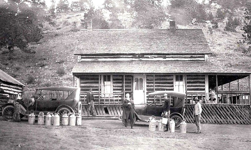
The Hotel at Log Cabin, Colorado.
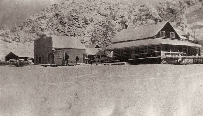
The Hotel, Post Office, and Store at Log Cabin, Colorado.
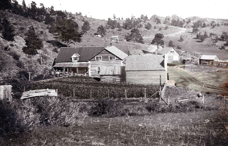
Settlement at Log Cabin, Colorado.
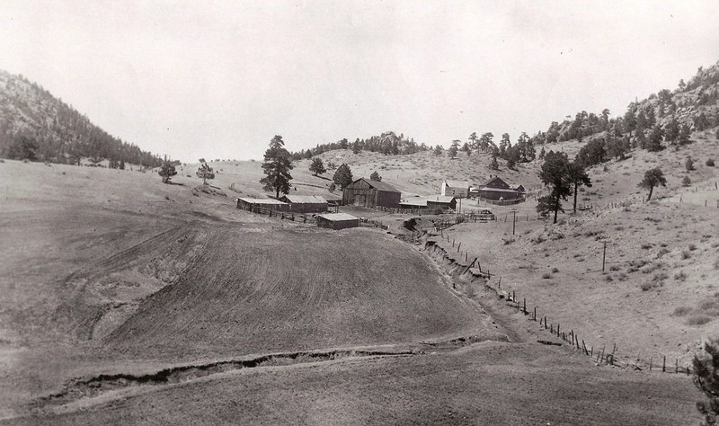
Stables, barn, outbuildings, meadow at Log Cabin, Colorado.
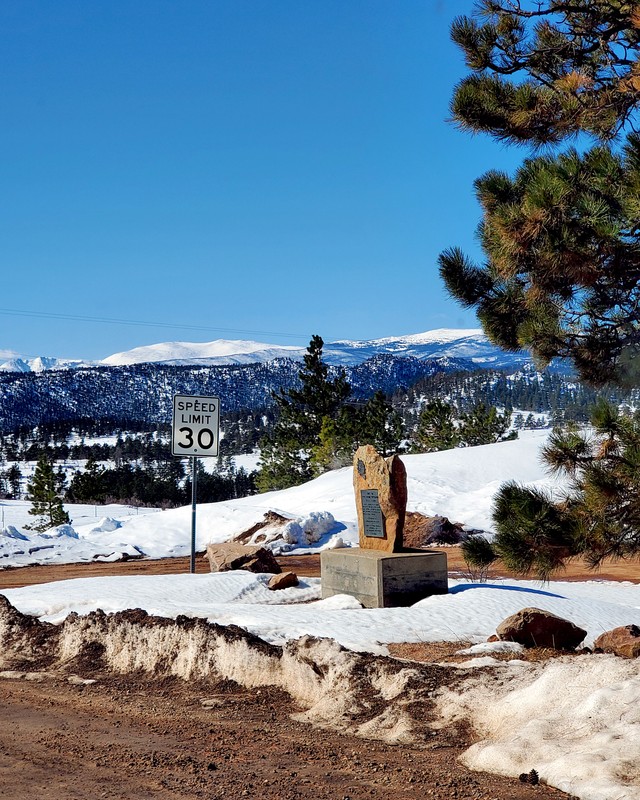
Historical Marker at Log Cabin, Colorado
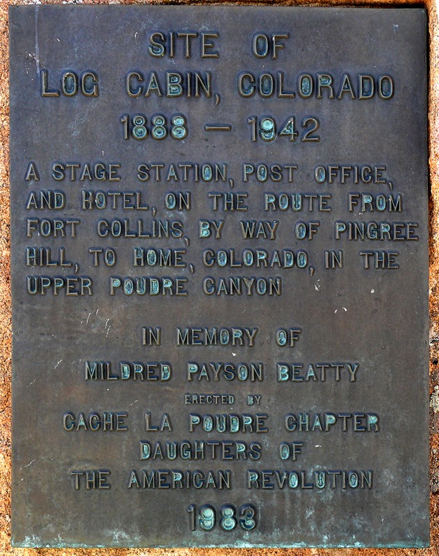
Historical Marker at Log Cabin, Colorado.
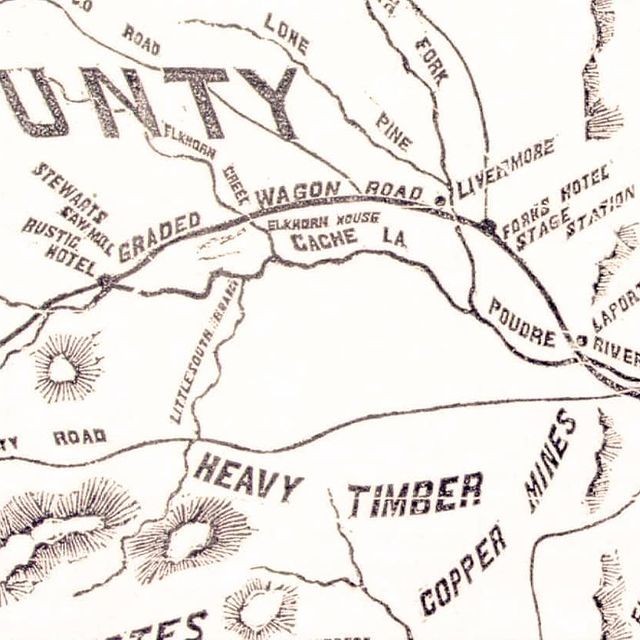
Historic Map of the Route, 1881.
Backstory and Context
Text-to-speech Audio
Along the path of the Overland Stage Route and the Cherokee Trail, access to this part of the West had been long established in history as part of the migratory pattern to Utah, Oregon, and California. Earlier than that, it was part of the area first explored and mapped by John C. Fremont in 1843. The Second Session of the Colorado State Legislature established access to this area as a priority, funding a road to this particular place and path over the Continental Divide.
Development of this route and its stage stations allowed first access to gold fields and to timber development for continuation of the construction of railroad lines in the American West. The headwaters of rivers feeding agriculture and population development became accessible through this route, with an extensive network of canals, then reservoirs, constructed in the early 1900s, all via this stage and freight route. All of this supported the advance of the legal infrastructure that would become the foundation of water management throughout the arid American West.
The hotel, post office, and stables at Log Cabin, Colorado, were at the midpoint of the route between Fort Collins and the next major settlement at Home, Colorado, in the upper Poudre Canyon. The hotel was first established in 1888; the post office in 1903. With the opening of a road through the lower Poudre Canyon finally opened in 1926, this route became unnecessary. The stage and postal service became focused on supporting the local ranching population and the development of the village at Red Feather Lakes.
Sources
Lang, Gail (ed.), The Early Hotels. Among These Hills: A History of Livermore, Colorado. Second edition. Livermore, Colorado. Livermore Woman's Club, 2009.
Case, Stanley R.. The Poudre: A Photo History. Bellvue, Colorado. Stanley R. Case, 1995.
Red Feather Historical Society Collection.
Red Feather Historical Society Collection.
Red Feather Historical Society Collection.
Red Feather Historical Society Collection.
Michael O'Neill, 2021
Michael O'Neill, 2021
Fort Collins History Connection.