Goblesville (Ghost Town)
Introduction
Text-to-speech Audio
Images
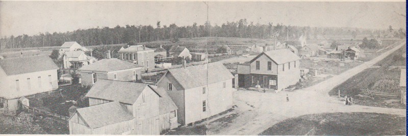
Goblesville about 1892
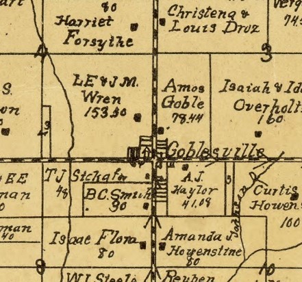
Goblesville on 1903 Map of Huntington County
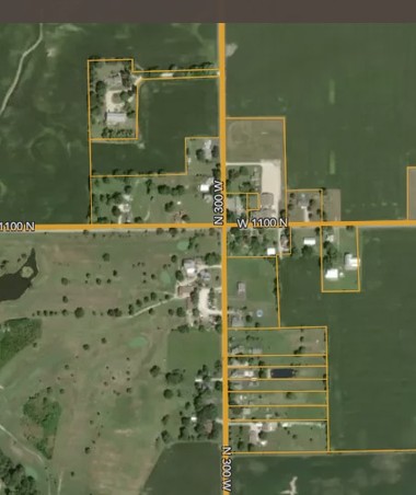
Goblesville today
Goblesville District 2 School Building
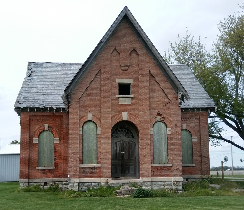
Goblesville District 2 School Building - Detail

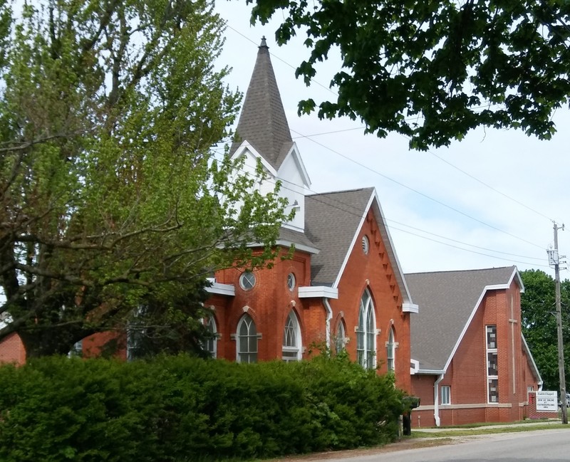
Goblesville Faith Chapel UMC
Backstory and Context
Text-to-speech Audio
Goblesville had its own post office from 1883 until 1905. Although it was never platted, it does/did? have its own water system and a single fire hydrant. It had a general store until 1969.
The 1866 map of the county shows a school (District #8) and a saw mill. By 1879, the school had been moved across the street to the northwest corner and renumbered District #2. The same map shows the presence of a U. B. [United Brethren] in the northeast corner. The District 2 School was most likely a frame structure. The existing building has dates to 1891. Classes actually ceased being held in the building after the 1925-26 school year when the 5 remaining district schools were all closed and all education in Clear Creek Township was moved to the new consolidated school building at the intersection of 900 N and 300W (2 miles south of Goblesville).
The exact date of the founding of the church is not recorded in existing histories, but it was undoubtedly between 1866 and 1879 since it appears on the latter map, but not the former. Through a succession of mergers, the name has changed until today it is called “Faith Chapel United Methodist.”
Goblesville is located at the intersection of four sections in the township (3, 4, 9, and 10). By looking in the 1879 Combined Atlas for these sections, we can surmise that at least the following businesses were located in what was soon to be called Goblesville at that time:
- A Threshing Machine & Patent Well Auger business owned by Isaac Goble.
- A Saw Mill owned by John H. Goble.
The 1914 county history has this to say about Goblesville:
“It is the outgrowth of a settlement that grew up about the sawmill started by John Goble some years ago. No regular plat of the village was ever filed in the recorder’s office, and, like Topsy in Uncle Tom’s Cabin, it “just growed.” Besides the sawmill, the business activities of Goblesville have been a Blacksmith shop and two or three general stores. Mail is supplied to the inhabitants by rural delivery from Huntington. Being situated in the midst of a rich agricultural district, it is a trading center of local importance, and according to Rand & McNally it had a population of 60 in 1910.”
For at least four years, between 1891 and 1895, Goblesville even had its own band.
Note: A hamlet is a rural, unincorporated, community with a small population (typically under 150) and no separate governance.
Sources
- Ghost Towns of Huntington County, by Doris Chambers, 1971, p15-20
- Indiana Herald, 9 Jun 1880, page 1
- History of Huntington County, Indiana: A Narrative Account. 1914. Frank Sumner Bash. Chicago: Lewis Pub. Co., p156
- Combination Atlas Map of Huntington County, Indiana. 1879. Kingman Bros.
- Map of Huntington Co., Indiana. 1866. Warner, Hayes & Warner. Ligonier, Ind.: E.B. Gerber & C.S. Warner.
- Huntington County, Indiana. 1903. Herman Taylor, Warsaw, Ind.: National Map Co. Rockford, Ill.: Hixson Map & Litho. Co.
- Contemporary Map Showing Aerial View of Goblesville, Indiana. https://www.acrevalue.com/plat-map/IN/?lat=40.989224&lng=-85.508644&zoom=16
- Ancestry.com. U.S., Appointments of U. S. Postmasters, 1832-1971 [database on-line]. Provo, UT, USA: Ancestry.com, 2010. Original data: Record of Appointment of Postmasters, 1832-1971. NARA Microfilm Publication, M841, 145 rolls. Records of the Post Office Department, Record Group Number 28. Washington, D.C.: National Archives
- History of Faith UMC - https://faithchapelumc.org/history
- Directory of the Huntington County Schools, 1925 – 1926.
- Directory of the Huntington County Schools, 1926 – 1927.
Ghost Towns of Huntington
1903 Map of Huntington County
https://www.acrevalue.com/plat-map/IN/?lat=40.989224&lng=-85.508644&zoom=16
author photo
author photo
author photo