Highest Point in Ohio
Introduction
Text-to-speech Audio
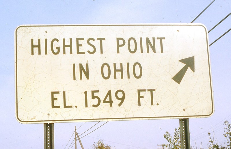
Campbell Hill is the highest point in Ohio, reaching 1,549 feet above sea level. There is an Ohio Historical Marker at the top of the hill in addition to a piece of marble, placed there in 1900 by the U.S. Coast and Geodetic Survey. The marble piece has an “x” marking the exact highest point on the hill. In addition to being the highest point in Ohio, this location used to house an Aircraft Control and Warning Squadron during the Cold War.
Images
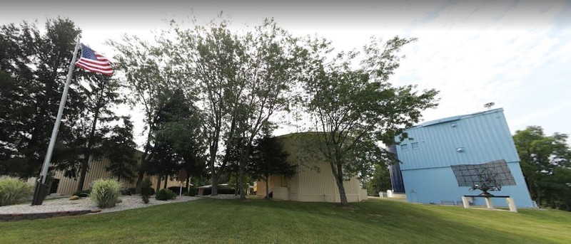
2021 Google Maps image of the Highest Point
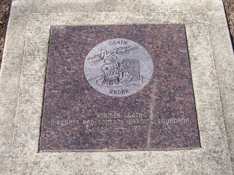
Marker for 664th Radar Base
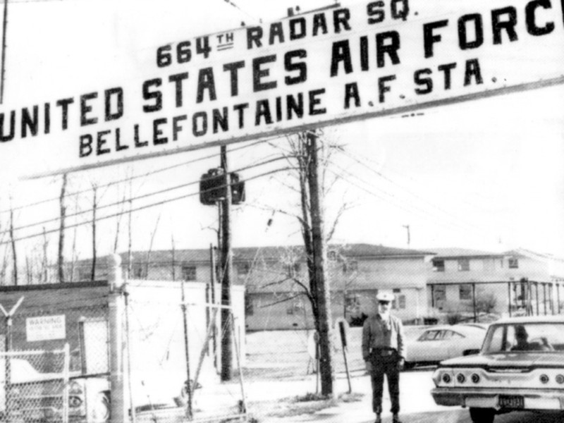
664th Base Entrance
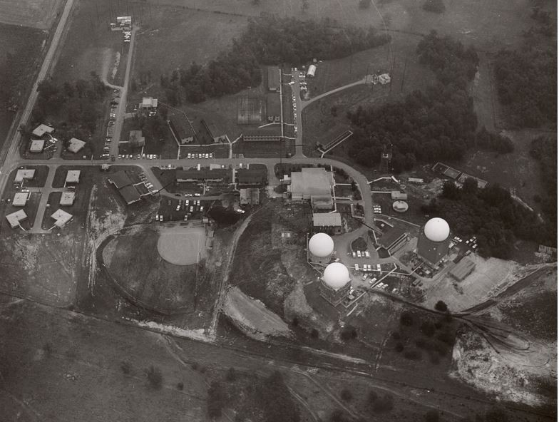
Aerial image of the 664th Base
Flag Raising at the Highest Point June 24, 1917
Backstory and Context
Text-to-speech Audio
According to local records, a man by the name of Solomon Hogue from Virginia secured a piece of 1,000 acres in Logan County from the government in 1830. Solomon soon sold most of the land and his nephew, John, secured 100 acres in the middle, which included the highest point in Ohio. The nickname for the highest point was “Hogue’s Hill,” after Solomon Hogue, until it was sold in 1898 to Bellefontaine resident Charles D. Campbell. The hill then became “Campbell’s Hill.” Campbell held onto the land for 39 years and then sold the land to beer magnate August Wagner in 1937. Wagner died in 1944 and left the tract to his daughter Helen. Helen deeded the highpoint and the surrounding 52 1/2 acres to the Federal Government in 1950.[1]
Besides being a landmark, the highest point in Ohio served another purpose after is was deeded to the government. After World War II, the tensions between the United States and the Soviet Union grew into what we know as the Cold War. The Cold War was waged mostly on political, economic, and propaganda fronts. However, this did not mean the possibility of using actual weapons was not a real threat, especially the newly revealed atomic bomb. Out of this fear the U.S. set up the Air Traffic Control & Warning System, designed to provide advanced warnings to the U.S. of a Soviet attack. This system was one of the first defense systems created during the Cold War during the 1950s. The system included coastal and interior surveillance, intercept sites and control centers.[2] In 1951, one of the systems was built on the highest point in Ohio. It was the 664 Aircraft Control & Warning System base. The base also assisted friendly aircraft in need of navigational help. The base used Semi-Automatic Ground Environment System (SAGE) to detect aircrafts. The SAGE system, which used radar and computer technology, allowed the bases to know which aircraft were friendly and which were a threat. The information gathered would then be sent to the direction center in Battle Creek, Michigan to be examined more closely. The 664th base was in operation from 1951 to 1969 and employed hundreds of soldiers and civilians in the Logan County community.
After the base ceased operations in 1969, the Ohio Hi-Point JVS, a vocational school, took its place and opened in 1974. The school offered six programs to students. Many of the original buildings from the base remained and were renovated for the school. In 1995 there was a $1.9 million addition to the main building and later that same year, the school's name was changed to Ohio Hi-Point Career Center. Today, the career center continues to provide further education and there are plans to open a museum highlighting the hill’s history.[3]
Additional story about Campbell’s Hill: A jokester from Ohio, Austin Kiplinger, claimed that the highest point in Ohio is actually located in Bethesda, Maryland. How is this possible? Austin claimed his father, Willard, took some soil from Campbell’s Hill in 1939 on a trip back to Logan County. When Willard returned home to Maryland, he placed the mound of dirt under a tree, placed a white fence around it, and put up a sign stating, “Ohio’s Highest Point.”
Sources
Galbraith, J. H. "Hogue's Hill is now Campbell's Hill." Columbus Dispatch (Columbus ) February 24th 1928. , 8-8.
Minahan, Tom . CAMPBELL HILL, OHIO America’s Strategic Highpoint, Highpointers Club. Accessed April 1st 2001. https://highpointers.org/history/oh-minahan.shtml.
Argonne National Laboratory . History of the Aircraft Control and Warning System in Alaska: Air Defense of Artic Skies , January 1st 2002. Accessed May 24th 2022. http://dnr.alaska.gov/parks/oha/publications/histaircontrol.pdf.
About Us, Ohio Hi-Point Career Center. Accessed May 24th 2022. https://www.ohiohipoint.com/page/about-us.
"Ohio High Point Pilfered in '30s." The Lima News (Lima) January 9th 1972.