Manitou Spring Incline
Introduction
Text-to-speech Audio
Images
Topographical Map of the Incline

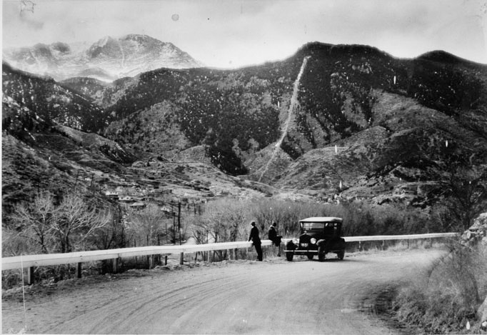
Picture of the Incline when it was completed in 1907
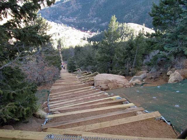
Visual of the view looking down
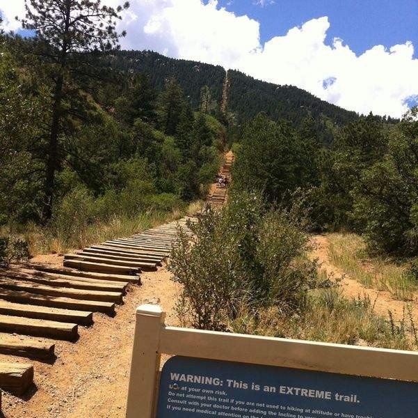
This is only the beginning....start point
Backstory and Context
Text-to-speech Audio
This massive trail boasts a one mile vertical hike to the top of Mt. Manitou in Manitou Springs, CO. It was built and completed in 1907 with the intention of aiding construction crew works in a cable car in support of a hydroelectric plan and its waterline. It was later sold and bought and turned into a tourist attraction by its owner boasting to have the “longest and highest incline on the globe.” By Dr. Brumbach. Mount Manitou also boasted an abundance of hiking trails stretching out by 10 miles in the park, which attracts runners, joggers, hikers, walker and even some Olympic athletes.
At the base of the Incline you start out at 6,530 ft. of elevation, and if an when you reach the top you will be at a whopping 8,550 ft. of elevation. This is part of the reason why this hiking trail is for the advanced, because the elevation alone can cause you to have headaches, dizziness, and shortness of breath among other things. For first time hikers, you definitely want to take it slow and look to the turnaround point. About ¾ of the way up the Incline intersects with the Barr trail and is used as the “bailout” point for those that can’t or won’t make it to the top. This is seen from below as the false summit, once you have arrived and determine that you can push through, there is still about 300 steps to go before reaching the very top. Upon completed this hiking trail, you can the Barr Trail down for about 2.5 – 3 miles. So be prepared for a workout like no other.
Length: 1 mile up, 2.5 miles down Barr Trail
Trail Difficulty: Advanced
Elevation Gain: 2,000+ in less than one mile
Cost: Free, but you have to pay for parking