Town of Manitowish
Introduction
Text-to-speech Audio
In 1889, the Chicago Northwestern Railroad tracks crossed the Manitowish River and established a modest rail stop. By 1890, loggers, trappers, guides, sportsmen, and pioneers rushed to the Manitowish rail stop as a launching point into the mostly untouched Northwoods wilderness. The rail stop at Manitowish grew quickly, and had a hotel and store by 1890. Ultimately, the town of Manitowish was a regional hub for transportation until about 1905 when Mercer, WI added a rail line to the towns of Winchester and Winegar (Presque Isle). Population patterns in Manitowish were noted in Wisconsin Gazetteers; 1895 population 50, 1911 population 100 and 1921 population 35. In the 1930's, the Work Progress Administration sponsored the recording of Iron County's History which did not included the Town of Manitowish. Rail service to Manitowish slowly began to decline after World War II. Summer trains and holiday Christmas trains continued to be very popular. Historian Michael Dunn recalls that the Christmas trains over the holidays of 1970-1971 marked the end of more than 80 years of rail service to the of Town of Manitowish.
The Town of Manitowish became the homes of many pioneer families. The Manitowish school was a point of pride for the entire town. What is today Manitowish Waters was strongly coupled to the Town of Manitowish. Manitowish rail stop was the primary source for supplies that had to be move over 7 miles by wagons or trucks to the Rest Lake Dam and beyond. Tourist most often used the Manitowish rail stop as well. Manitowish even provided postal service to Manitowish Waters until 1940.
Today, Manitowish, Wisconsin appears to be a crossroads of Highways 47 and 51, but careful examination of history reveals a deep and rich chapter of Northwoods heritage.
Images
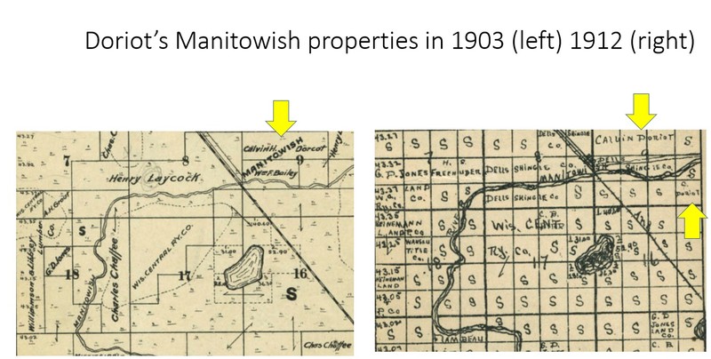
Early 2oth Century Plat Maps around the Town of Manitowish
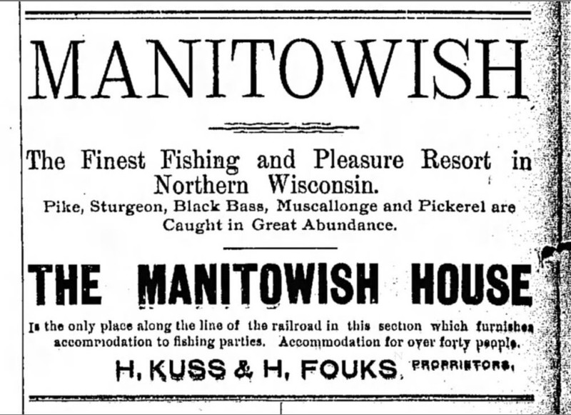
1893 ad for Manitowish Hotel run by Kuss and Fouks
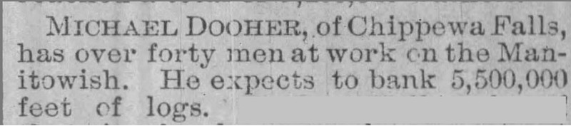
Logging operation in 1893
Doriot's 1899 land patent

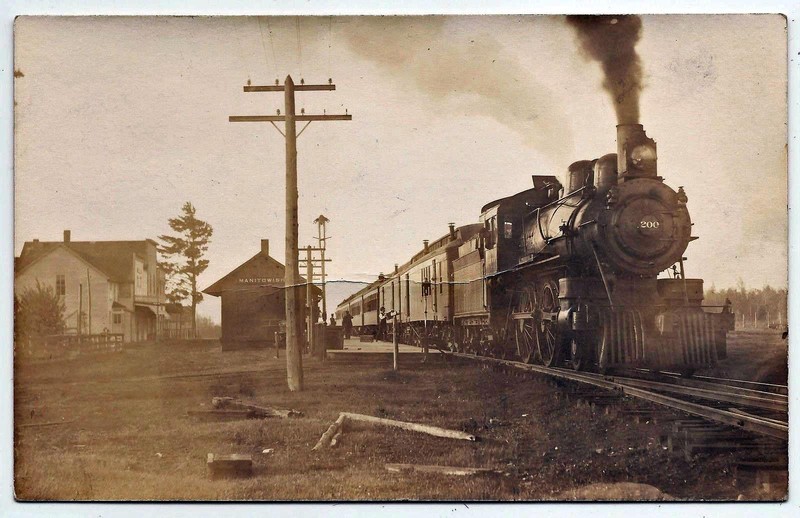
Manitowish Depot and train
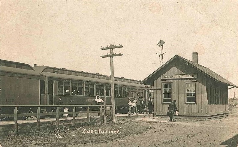
Departing from the train at Manitowish
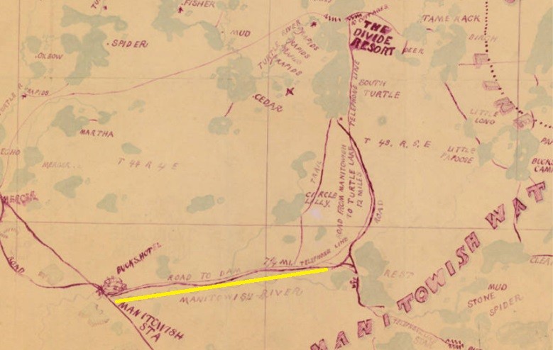
Buck's 1900 map illustrating a hotel at Manitowish and the 7 and 1/4 mile highlighted route to Rest Lake Dam
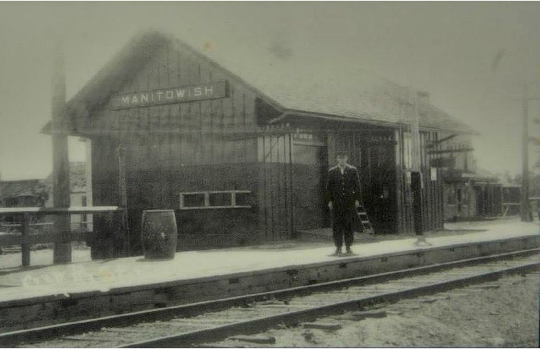
Manitowish Depot with Attendant
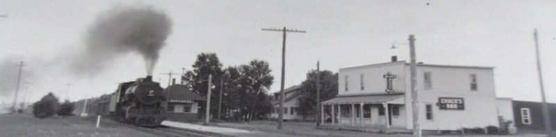
Train at Manitowish and Chuck's Bar
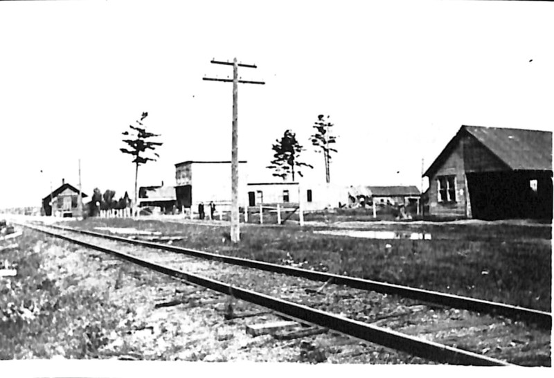
View across the tracks toward Manitowish
Manitowish Depot in 1920's with Nutter house in the background
.jpg)
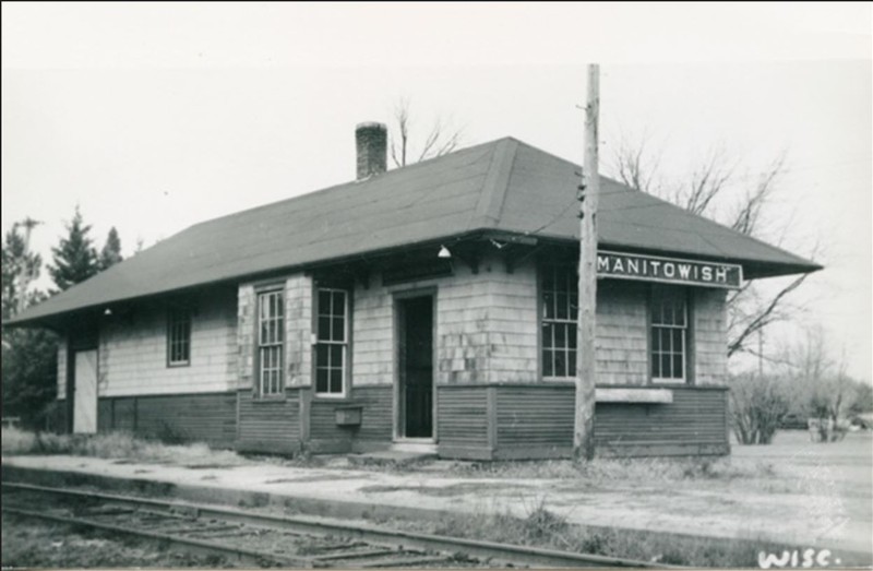
Close-up of Manitowish Depot
Manitowish School
%20(1).jpg)
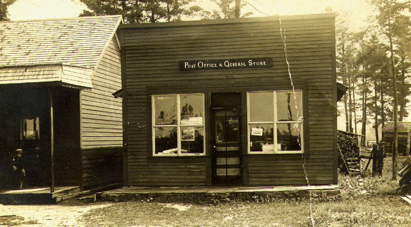
Manitowish Post Office
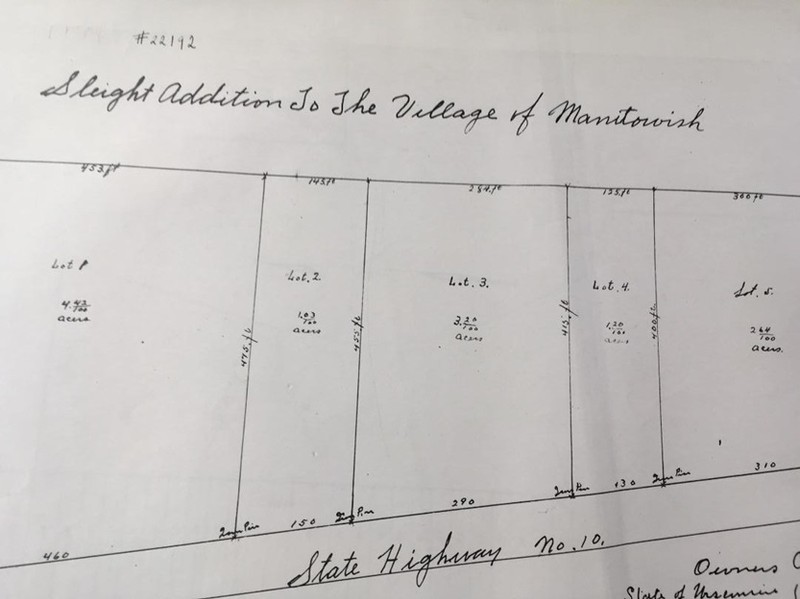
Richard Sleight Sr. establishes subdivided property in Manitowish in 1923, map
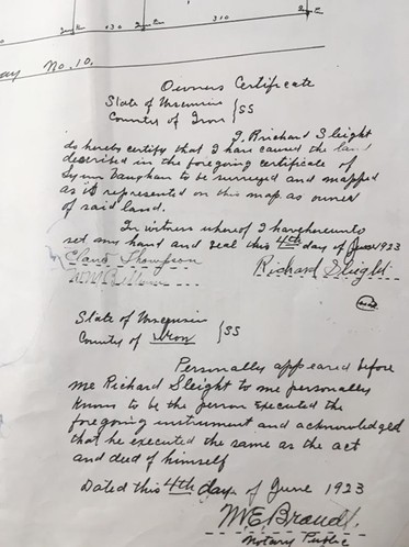
Richard Sleight Sr. establishes subdivided property in Manitowish in 1923, owner's certificate
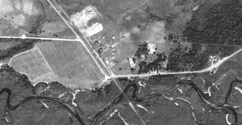
1938 aerial photo of Manitowish Wisconsin
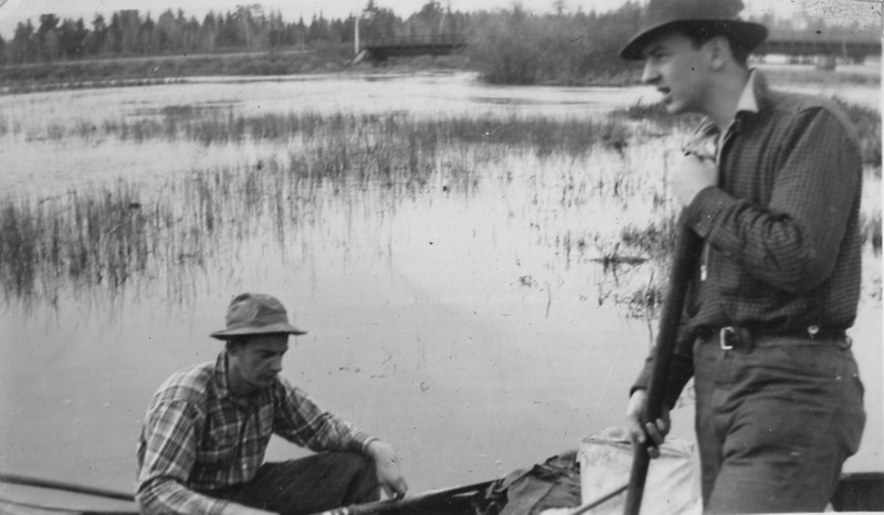
Sleight family loading canoes in the Town of Manitowish; note the railroad bridge and wild rice in the background
Sources
Buck, Fayette . Lakes tributary to G.W. Buck & Son resorts, Wisconsin Historical Society. 1900. Accessed December 19th, 2022. https://content.wisconsinhistory.org/digital/collection/maps/id/1572/rec/1.
STATE CARTOGRAPHER'S OFFICE. Mercer County, WISCONSIN HISTORIC AERIAL IMAGERY FINDER. August 4th, 1938. Accessed December 19th, 2022. https://maps.sco.wisc.edu/WHAIFinder/#13/46.1369/-90.0110
Manitowish Waters Historical Society
Manitowish Waters Historical Society
Manitowish Waters Historical Society
Manitowish Waters Historical Society
Manitowish Waters Historical Society
Manitowish Waters Historical Society
Buck, Fayette . Lakes tributary to G.W. Buck & Son resorts, Wisconsin Historical Society. 1900. Accessed December 19th, 2022. https://content.wisconsinhistory.org/digital/collection/maps/id/1572/rec/1.
Manitowish Waters Historical Society
Manitowish Waters Historical Society
Manitowish Waters Historical Society
Manitowish Waters Historical Society
Manitowish Waters Historical Society
Manitowish Waters Historical Society
Manitowish Waters Historical Society
Manitowish Waters Historical Society
Manitowish Waters Historical Society
STATE CARTOGRAPHER'S OFFICE. Mercer County, WISCONSIN HISTORIC AERIAL IMAGERY FINDER. August 4th, 1938. Accessed December 19th, 2022. https://maps.sco.wisc.edu/WHAIFinder/#13/46.1369/-90.0110
Manitowish Waters Historical Society