Carriage Road Network and Landscape (Rockefeller Pocantico Hills Estate Historic District)
Introduction
Text-to-speech Audio
The Rockefeller Pocantico Hills Estate Historic District is an expansive historic landscape that was developed in the later nineteenth and early twentieth century on land owned by the Rockefeller family. The historic landscape, which now includes both public and private land holdings, reflects the family's development of more than 3,000 acres of land on the southwest bank of the Hudson River that was once the two adjoining properties of John D. Rockefeller Sr. and his younger brother and Standard Oil business associate, William A. Rockefeller. The signature physical feature of the district is its system of interrelated carriage roads. The carriage roads progress through open fields and meadows bordered by stone walls, alongside water features, and over hills and ridges. The network connects the family's Neo-Georgian house, Kykuit together with its surrounding park and the Rockwood Hall estate of William Rockefeller, which was subsumed by the Pocantico Hills estate after his death. Also included in the district is the farm complex, now the non-profit Stone Barns Center for Food and Agriculture. The Rockwood Hall property and several thousand acres are now part of the NY Rockfeller State Park Preserve. The family home Kykuit and the surrounding 250 acre park is open to the public and owned by the National Trust for Historic Preservation.
The Rockefeller Pocantico Hills Estate Historic District was placed on the National Register of Historic Places in 2019. The address used for this entry is the entrance and Visitors Center for the Rockefeller State Park Preserve.
Images
Carriage on the trails

Carriage trail in woods

Landscape vista across meadows

Swan Lake

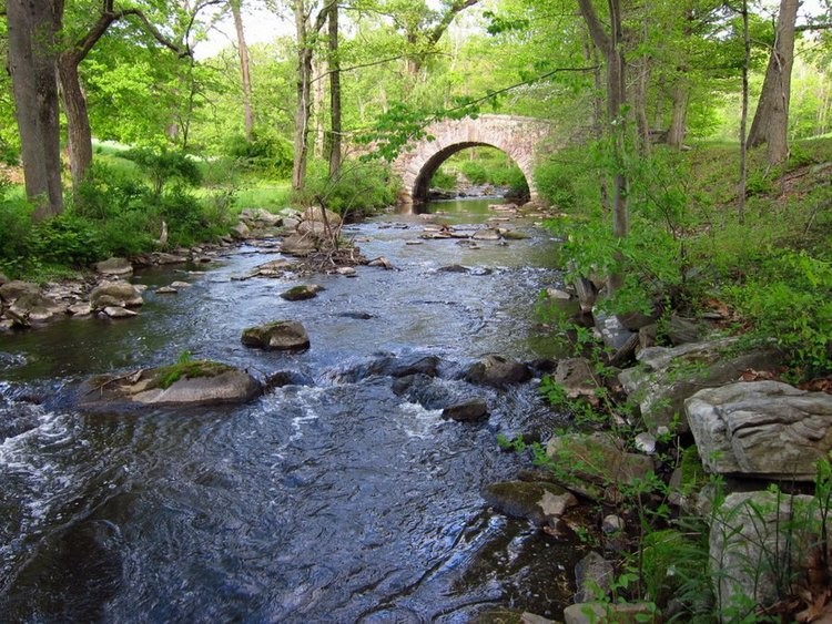
Pocantico River with Bridge
Backstory and Context
Text-to-speech Audio
By imposing the 2013 USGS grid pattern onto historic nineteenth century mapping, it is possible to comprehend the extent to which the vast geographic area, largely located in the Town of Mount Pleasant and bounded to the west the the Village of Sleepy Hollow and the Hudson River and to the east by the Saw Mill River, was transformed by the activities of two generations of the Rockefeller family. The historic district nomination divides the area into a grid of 10 rectangular-shaped maps. The descriptive passage for each includes an overview of the carriage road system and the associated principal character-defining topographic, landscape, architectural and engineering features. Although many of the carriage roads are described as "trails," they are nevertheless carriage roads and were conceived and built to that standard.
The carriage roads are the constant feature in what is otherwise a diverse and complex natural landscape of seemingly innumerable characteristics. The carefully considered landscape vignettes are a means to experience the scenically diverse natural environment. The road system moves through intimate wooded stretches and sometimes alongside water features; other times it traverses open topography as it moves through stone-walled agricultural fields and meadows. Some roads were built to provide elevated vantage points of the surrounding landscape and distant points can be viewed. Built roadway characteristics are found in the retaining walls and bridges. In grid Map Unit B-2 there are bridges designed by architect Charles Stoughton in 1931. Stoughton is well known for his work on the Bronx River Parkway. Approximately 55 miles of the historic carriage road system is currently accessible to the public.
The district remains a distinctive, sprawling and remarkable complex cultural landscape, sensitively fashioned over the course of many decades by the Rockefeller family, under its direct oversight, and with considerable financial resources.
Sources
National Register of Historic Places Registration Form, Rockefeller Pocantico Hills Estate Historic District, prepared by William E. Krattinger, NYS Division for Historic Preservation , 2018.
Barton & Loguidice and Coplon Associates. "Rockefeller State Park Preserve Carriage Road Maintenance Manual" (2015).
"Road Map of the Estate of John D. Rockefeller Jr. at Pocantico Hills, N.Y." 1931/1937/1957. Collection of Rockefeller State Park Preserve.
Roberts, Ann Rockefeller, Mr. Rockefeller's Roads: The Untold Story of Acadia's Carriage Roads & Their Creator, Camden, NE, Down East Books, 1990.
Bearss, Edwin C. "History of the Pocantico Hills Estate." Untitled manuscript on the cultural history of Pocantico Hills (March 1970).
Friends
Friends
Friends
Friends
Friends