Milo (Ghost Town)
Introduction
Text-to-speech Audio
Milo had a post office from Mar 1881 to May 1920. It is on the southern county line (with Grant County) in Jefferson Township one mile west of Meridian Road. Except for Mt. Etna which is shared with three other townships, Milo was the biggest settlement and had the longest-lived post office in the township. It first appears on the 1895 county map and is still found using Google Maps and on current plat books.
During the oil boom years of the early 20th century, Milo was just 2 miles east of 48 producing wells. And, one of the most productive wells in the county was about 1 ½ miles north.
Images
The second oil well in Huntington County. It was dry. Outlet of Silver Creek in Dallas Township.
Modern Aerial View of Milo
Milo in 1903 (not labelled)
Milo about 1920.
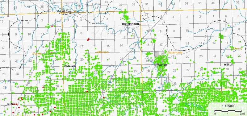
Active and historic gas (red) and oil (green) wells in Huntington County
Backstory and Context
Text-to-speech Audio
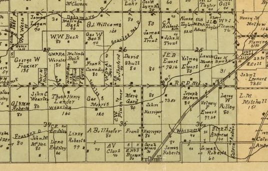
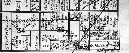
Milo came into existence when then the Delphos, Bluffton, and Frankfort narrow gauge railroad, the predecessor to the Cloverleaf Railroad was built. This is the same railroad that runs through Warren, Buckeye, and Boehmer and is now owned by the Wabash Central Railroad. Milo was never officially platted.
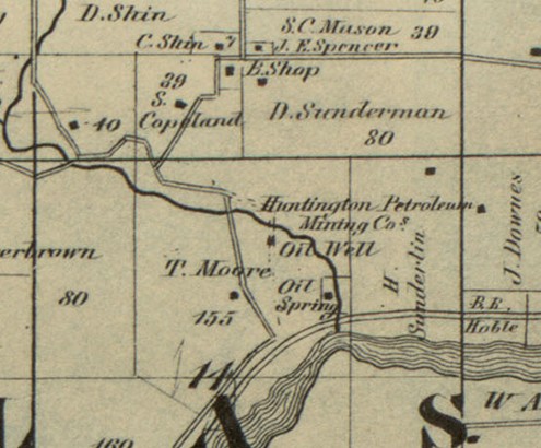
At its peak Milo had a post office and general store combination as well as a blacksmith shop, a tile mill, and a Friends Church. The church was on the west side of town and was organized in 1889. By 1917 it was dissolved, the building sold and torn down. Both the railroad and the interurban had stops here on its way between Warren and Marion. Both were gone by the 1930s, more victims of the automotive age. The train continues through town, but it does not stop. Today, there are no businesses, but there are a number of homes within ¼ mile of the intersection of 1200 S and 100 E (the latter being a Wells County road and equivalent to 100W in Huntington County addresses).
One of the most productive oil wells in the county was about 1 ½ miles north of Milo and produced 200 barrels/day at its peak. The wells in the township typically ranged from 1,000 to 1,065 feet in depth. Gas was usually struck before the oil was hit. The gas helped operate the well pumps.
In 1889 a successful oil well was drilled in southern Wells County. Naturally this started a rush to find oil in southern Huntington County. But, it was not the first time people had drilled hoping to find either gas or oil. Around 1866 speculation based on the rock formations in the area resulted in two wells being drilled. The first, just south of the Little River in what is now the City of Huntington, and the second 2 ½ miles west, near the outlet of Silver Creek into the Wabash River in Dallas Township. Both wells were seeking natural gas. Both failed to find it at depths of a bit over 1000 feet. Although the wells in Jefferson, and to a lesser extent, Wayne townships showed some early promise, there wasn't enough oil at high enough pressure to sustain the industry. By the early 1920s, the drilling stopped. A few of the wells still pump a low amount of oil. According to the Petroleum Database Management System (PDMS) from Indiana University, there have been a total of about 1479 oil and gas wells drilled in the county, 680 of which were in Jefferson Township. Of that number, 31 are still active, and 17 are in Jefferson Township.
Sources
- Ghost Towns of Huntington County. 1971. Doris Chambers, p98-102
- Ancestry.com. U.S., Appointments of U. S. Postmasters, 1832-1971 [database on-line]. Provo, UT, USA: Ancestry.com, 2010. Original data: Record of Appointment of Postmasters, 1832-1971. NARA Microfilm Publication, M841, 145 rolls. Records of the Post Office Department, Record Group Number 28. Washington, D.C.: National Archives
- History of Huntington County, Indiana: A Narrative Account. 1914. Frank Sumner Bash. Chicago: Lewis Pub. Co., p10-11, 104, 161, 253
- Map of Huntington Co., Indiana. 1866. Warner, Hayes & Warner. Ligonier, Ind.: E.B. Gerber & C.S. Warner.
- Map of Huntington Co., Indiana. 1895. H. H. Wagoner, Huntington, Ind. (poor photocopy)
- Huntington County, Indiana. 1903. Herman Taylor, Warsaw, Ind.: National Map Co. Rockford, Ill.: Hixson Map & Litho. Co.
- Plat Books of Indiana Counties, Vol. 3. Map of Jefferson Twp (T26N R9E), ca. 1920. Lombard, IL: Sidwell Studio, p85.
- State of Indiana 2021 Rail System Map. Available on https://www.in.gov/indot/multimodal/railroad/maps, accessed 5 Aug 2023.
- IGS Map: PDMS Oil and Gas. Indiana Univerisity. https://igws.indiana.edu/pdms/Map Accessed 7 Aug 2023
- Well Record Tables. [Online Database]. Indiana Univerisity. https://igws.indiana.edu/pdms/WellSearch.cfm Accessed 7 Aug 2023
- Modern aerial photo. Beacon GIS for Huntington County. Intersection of 1200S and N 1100E. https://beacon.schneidercorp.com/ Accessed 9 Aug 2023.
1866 Huntington County Map
Beacon GIS
1903 Huntington County Map
Plat Books of Indiana
IGS Map: PDMS Oil and Gas