Bayou Mills (Ghost Town)
Introduction
Text-to-speech Audio
Bayou Mills was a small town that started out as a miller and his family and grew to eventually have a post office, a school and a cemetery.
Images
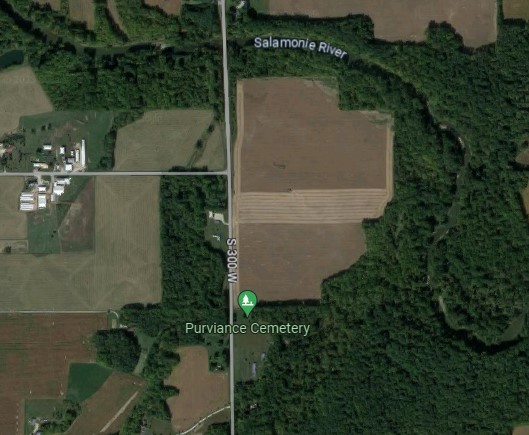
Modern Aerial of Bayou Mills
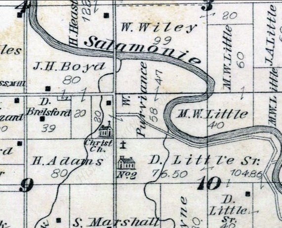
Bayou Mills in 1879 Atlas
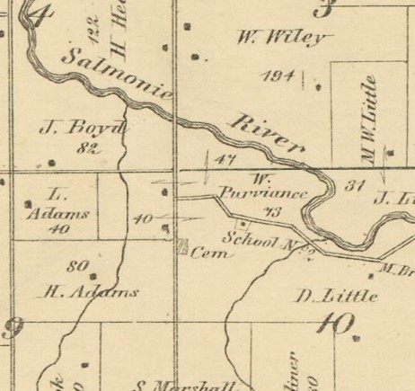
Bayou Mills 1866 Map
Backstory and Context
Text-to-speech Audio
In 1843, Bernard Alexander decided to move his saw mill from a dam outside of Warren to six miles downriver and called it Bayou Mill. He operated his mill for many years before handing off operations to his children.
In August 1857, John Addington applied for a post office to be set up in Bayou Mills on the south side of the river. The request was granted and John Addington became postmaster on August 12, 1857 and held the position until William Fancher took over on February 26, 1858. Mr. Fancher was the postmaster for the majority of the post office's life, working there until the office was discontinued on September 3, 1861.
Nearby on William Purviance's property, then in Section 9, the second school in the township was conducted in 1840. When the free public school system was formed in 1854, a new schools building, titled "District School 2" was constructed on William Purviance's newer property in Section 10. After the post office was closed, a group of people organized a Christian Church in 1868. This was the first church organized in Jefferson Township. The Purviance Chapel was built by them in 1870, next to a cemetery that had been established sometime around 1844. The chapel continued to have occasional services there until after 1914. The last known burial in the cemetery occurred in 1942.
Sources
- Ancestry.com. U.S., Appointments of U. S. Postmasters, 1832-1971 [database on-line]. Provo, UT, USA: Ancestry.com, 2010. Original data: Record of Appointment of Postmasters, 1832-1971. NARA Microfilm Publication, M841, 145 rolls. Records of the Post Office Department, Record Group Number 28. Washington, D.C.: National Archives
- M1126, Post Office Department Reports of Site Locations 1837-1950. Roll 162: Indiana, Hancock – Jasper Counties. Image 785 of 1190 – Application for a post office at Bayou Mills. 1986. National Archives and Records Administration. Online access at https://catalog.archives.gov/id/68325942.
- History of Huntington County, Indiana: A Narrative Account. 1914. Frank Sumner Bash. Chicago: Lewis Pub. Co., p104, 326, 345.
- Map of Huntington Co., Indiana. 1866. Warner, Hayes & Warner. Ligonier, Ind.: E.B. Gerber & C.S. Warner.
- Combination Atlas Map of Huntington County, Indiana. 1879. Kingman Bros.
- FindAGrave for Purviance Chapel. Earliest burial found. https://www.findagrave.com/cemetery/86490/purviance-cemetery Accessed 14 Aug 2023.
- Modern aerial photo. Google Maps. [LOCATION]. https://maps.google.com Accessed 14 Aug 2023.
Google Maps
1879 Combined Atlas
1866 Huntington County Map