Cut Bank Creek
Introduction
Text-to-speech Audio
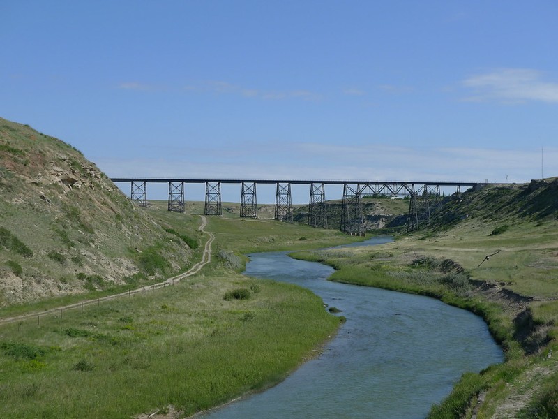
As we approach the city of Cut Bank we will be crossing the 1,200 foot long, 160 foot high Cut Bank Creek Bridge. The current structure was opened to rail traffic in 1900. Because of oil production in the area, the trestle was considered strategic to the World War II effort and needed to be protected. During that time, armed guards were posted on this bridge 24 hours a day to prevent sabotage.
Images
Cut Bank Creek
Backstory and Context
Text-to-speech Audio
As we cross the bridge you can see the distinctive banks of the creek that give Cut Bank its name. Cut Bank Creek is the eastern boundary of the Blackfeet Nation. Before the Great Northern Railway arrived in 1890 to open a small station and construct one of the larger trestles on the line across Cut Bank Creek, few Americans had been to this area, though it was inhabited by the indigenous people of the Northern Great Plains. Meriwether Lewis and his small party traveled and camped along Cut Bank Creek over 200 years ago. Cut Bank’s population has varied widely over the last century, mostly in response to the ups and downs of the railroad and the oil and gas industry. In the 1970s, the town had over 5,000 residents; today it’s about 3,000 residents. Cut Bank is susceptible to extreme weather. According to the National Weather Service, the hottest temperature on record was 107°F (42 C) back in August, 1961. The coldest temperature on record is -47°F (-44 C) in February, 1936, and the coldest wind chill temperature is -86°F (-66 C).