Pilot Mountain
Introduction
Text-to-speech Audio
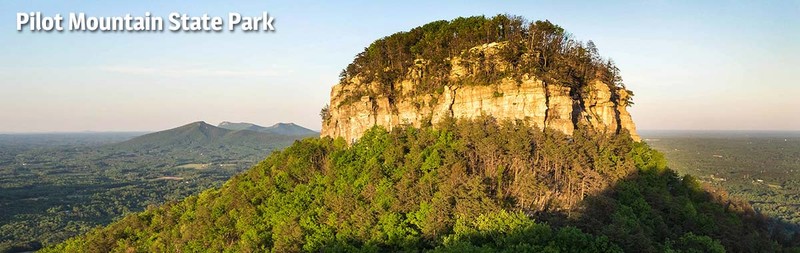
In Surry County, North Carolina situated near Route 52 is a noticeable and memorable landmark. Pilot Mountain has to be one of the most distinctive natural features in the area. It is captivating as one travels through the area. It has served as a navigational beacon for years. Mount Pilot was extremely important before maps, before GPS, and before smart phones that could indicate where you are located simply because it was a very noticeable beacon. The Saura Native Americans are generally accepted as the first inhabitants of this area. They referred to Pilot Mountain as Jomeokee. Jomeokee means pilot or great guide. There is no doubt this was the case as it stands over 1400 feet from the valley floor. The Sauras, Cherokees, and Moravians all lived in this area and utilized Pilot Mountain as a navigational tool. The paths the Native Americans used in this area became part of the Great Wagon Road.
The mountain was mapped in 1751. The mappers were Joshua Fry and Peter Jefferson, father of Thomas Jefferson. It was owned privately until 1968. In 1968, local residents made a push to have it become a state park. The push was successful and it became the 14th state park in North Carolina. It was designated as a National Register of Natural Landmarks location in 1974. The state park is open for many activities.
Images
Pilot Mountain
Sources
“National Register of Natural Landmarks, North Carolina,” National Register of Natural Landmarks, June 2009, ( accessed June 26, 2016), https://www.nature.nps.gov/nnl/docs/NNLRegistry.pdf
“Pilot Mountain State Park,” North Carolina Parks, ( accessed June 26, 2016), http://www.ncparks.gov/pilot-mountain-state-park/history
“Pilot Mountain State Park,” Blueridge National Heritage Area, ( accessed June 26, 2016), http://www.blueridgeheritage.com/attractions-destinations/pilot-mountain-state-park