Stop 1: Confederate Camp Gauley
Introduction
Text-to-speech Audio
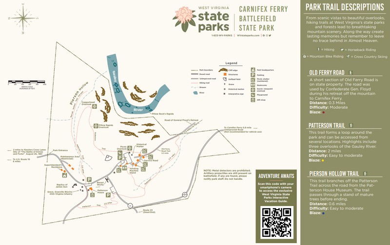
To begin the Carnifex Ferry battlefield tour make your way to the first stop on Rt. 23, which branches off the main park road. If you are parked in the main parking area take the Patterson Trail Connector located just past the playground and when you intersect with the Patterson Trail continue to the right. Alternatively, you can walk down the main road and turn left onto Rt. 23 to bypass the first section of the Patterson Trail.
Images
Topographical Map of Carnifex Ferry Battlefield State Park
Colonel Henry Heth, 45th Virginia Infantry
Colonel Gabriel Colvin Wharton, 51st Virginia Infantry
.jpg)
Colonel Alexander Welch Reynolds, 50th Virginia Infantry
Colonel John McCausland, 36th Virginia Infantry
Colonel Christopher Q. Tompkins, 22nd Virginia Infantry
Carnifex Ferry Battlefield State Park Trail Map
Backstory and Context
Text-to-speech Audio
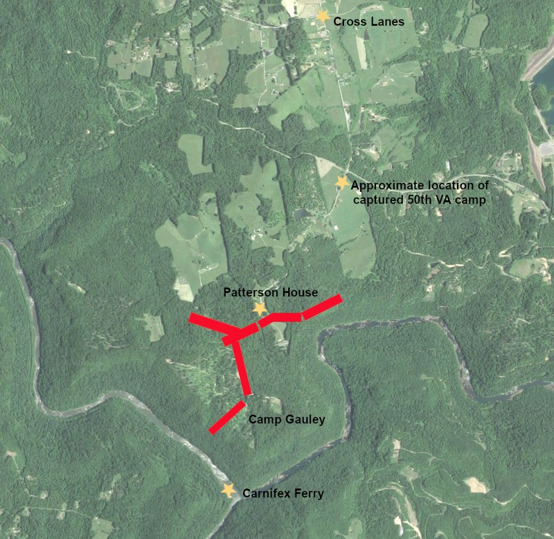
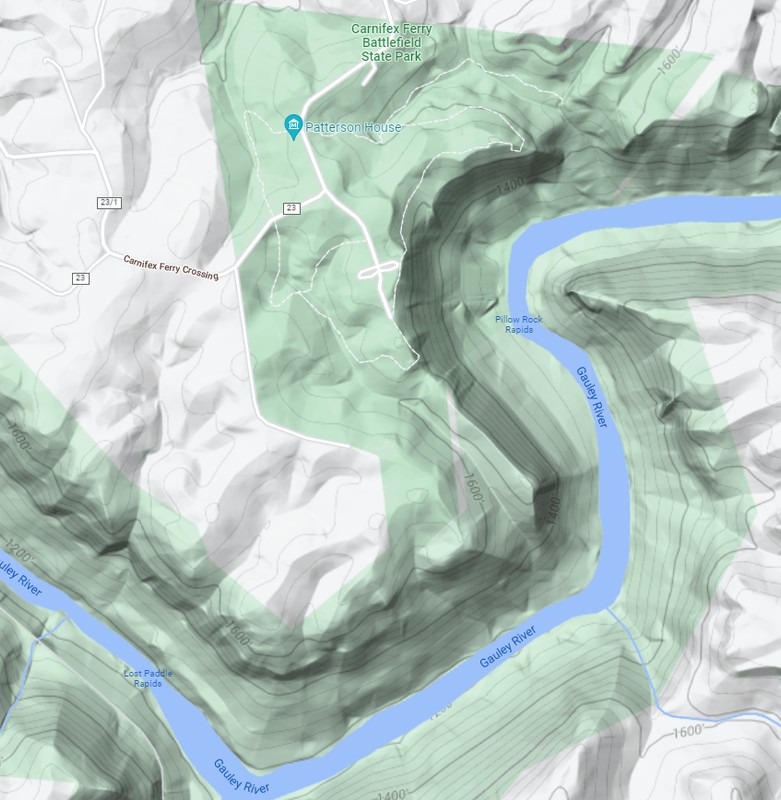
When Floyd’s Confederate force crossed the Gauley River on August 21st and began entrenching on the cliffs above Carnifex Ferry, Floyd named the site Camp Gauley. The Confederate line stretched across the peninsula created by the horseshoe bend in the Gauley River, with the river and cliffs to their rear. The main defensive fortification of the line was an earthen redoubt just to the left of the ferry road. This redoubt was 312-350 feet wide with wooden palisades reinforcing each side. At the parapet was Captain John Henry Guy’s company of Goochland Artillery consisting of four six-pounder guns and 100 men. Approximately 150 yards in front of the artillery battery was the Henry Patterson house and farm. From the artillery redoubt log breastworks stretched in both directions with both Confederate flanks resting on the cliffs above the Gauley. On the Confederate left there was a double line of breastworks.
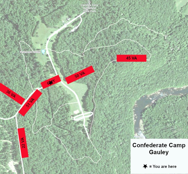
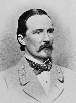
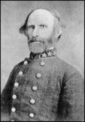
At the beginning of the day on September 10th Floyd had the 45th Virginia, commanded by Colonel Henry Heth, extending to the right of the artillery battery and the 51th Virginia, commanded by Colonel Gabriel C. Wharton, extending to the left. The 50th Virginia, commanded by Colonel Alexander W. Reynolds, was positioned about a mile ahead of the main line on the Cross Lanes road. While Floyd was confident in his entrenchments, he realized that the Union had the superior numbers and he called for reinforcements. Thinking that Rosecrans would attack either September 12th or 13th, Floyd called for Wise to send two regiments from his force. He also asked for North Carolina and Georgia soldiers stationed at Lewisburg and for 800 militia under General A. A. Chapman from south of the Kanawha.
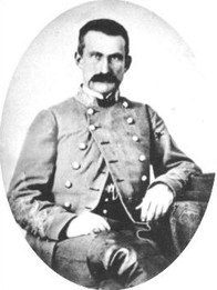
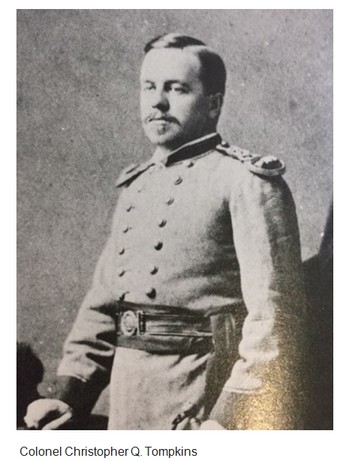
The two regiments requested from Wise did arrive just prior to the battle. The 36th Virginia, commanded by Colonel John McCausland arrived around 12:30pm and they took a position on the outer line of entrenchments protecting the Confederate left. The 22th Virginia, commanded by Colonel Christopher Q. Tompkins, arrived around 2:00pm and occupied the second set of breastworks on the left, behind the 36th Virginia. With the arrival of these two regiments, the 51st Virginia moved closer to the center of the Confederate line.
Once Rosecrans’ Union column began advancing from Cross Lanes down the Ferry Road, the 50th Virginia withdrew from their forward camp about a mile ahead of the main line. Falling back, the regiment took up a position near the central artillery battery. At the beginning of the battle Floyd’s Confederate line was structured thus: Directly surrounding Guy’s artillery and extending to the right was the 50th Virginia, the right flank of the Confederate line was held by the 45th Virginia, to the left of Guy’s Artillery and the 50th Virginia was the 51st Virginia, the 36th Virginia held the forward left breastworks, and behind them the 22nd Virginia held the second line of left entrenchments. In addition, there were three artillery pieces, likely from Lieutenant Thomas E. Jackson’s Company of Horse Artillery, positioned somewhere between the 36th Virginia and 22nd Virginia.
Sources
Lesser, W. Hunter. Rebels At the Gate: Lee and McClellan on the Front Line of a Nation Divided. Naperville, IL: Sourcebooks, Inc., 2004.
Lowry, Terry. September Blood: The Battle of Carnifex Ferry. Charleston, WV: Quarrier Press, 2011.
Shaffer, Dallas B. “The Battle at Carnifex Ferry.” State of West Virginia. Produced by the Department of Natural Resources, Division of Parks and Recreation. C. 1963.
Snell, Mark A. West Virginia and the Civil War: Mountaineers Are Always Free. Charleston, SC: The History Press, 2011.
Stutler, Boyd B. West Virginia in the Civil War. Charleston, WV: Education Foundation, Inc, 1966.
Base map from Google Maps. Edited by Kathleen Thompson.
Base Map from Google Maps. Edited by Kathleen Thompson.
Google Maps. Accessed May 30, 2022.
"Henry Heth." Wikipedia. Accessed May 27, 2022. https://en.wikipedia.org/wiki/Henry_Heth
"Gabriel C. Wharton." Wikipedia. Accessed May 27, 2022. https://en.wikipedia.org/wiki/Gabriel_C._Wharton.
"Alexander W. Reynolds." Wikipedia. Accessed May 27, 2022. https://en.wikipedia.org/wiki/Alexander_W._Reynolds.
"John McCausland." Wikipedia. Accessed May 27, 2022. https://en.wikipedia.org/wiki/John_McCausland.
Gauley David. "Mistress of the Mansion, Ellen Tompkins of West Virginia's Gauley Bridge: Caught Between Two Opposing Armies." Medium. November 17, 2019. Accessed May 27, 2022. https://medium.com/@gauley.david/mistress-of-the-mansion-ellen-tompkins-of-west-virginias-gauley-bridge-caught-between-two-cc9c9dfc53d.
Carnifex Ferry Battlefield State Park. Accessed May 30, 2022. https://wvstateparks.com/wp-content/uploads/2020/09/CarnifexFerryBattlefieldStateParkMap.pdf.