Mason-Dixon Historical Park
Introduction
Text-to-speech Audio
Images
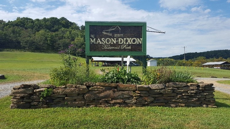
Mason-Dixon Historical Park.
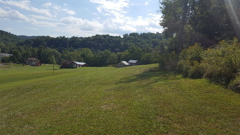
A view of the bottom of the park before beginning the ascent to the terminal point marker.
Terminal Point Marker.
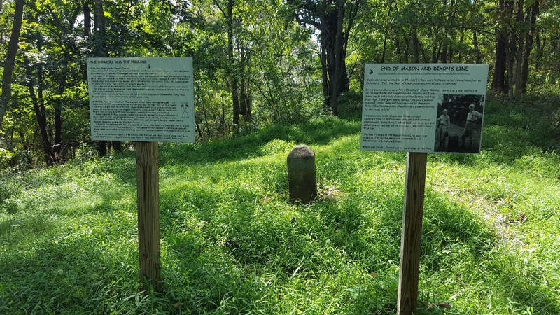
This stone marker was placed in 1883, as the original wood and earth marker had deteriorated significantly.

Backstory and Context
Text-to-speech Audio
In 1681, William Penn challenged the Calvert family of Maryland when he settled Philadelphia. Penn had been granted a great tract of land north of the 40th parallel — now known as Pennsylvania — but desperately desired a port town on the Delaware River. Penn knew Philadelphia was just south of the parallel but settled there anyways banking on the Calvert family’s inability to respond. Penn’s gambit paid off, especially when a court ruling seventy years later moved Pennsylvania’s southern border almost twenty miles south of the 40th parallel. Both the Penns and the Calverts balked at various boundary decisions made by American surveyors, so they jointly wrote to the Royal Society in Great Britain to request a formal and definitive survey. In 1763, Charles Mason and Jeremiah Dixon arrived in Philadelphia to settle boundary disputes.
Both Mason and Dixon came from relatively humble backgrounds; the former lacked university education, while the latter was an ostracized Quaker. However, they were brilliant astronomers and geographers and displayed immense natural talent for complex calculations. At the time of their arrival in America, Mason was thirty-five and Dixon, thirty. The two men brought a variety of measuring instruments and equipment with them. Most important of their tools was a six-foot zenith sector used to measure latitude. At the time, this was a new improvement on previous latitude tools. The sextant was the standard before, but it required an unobstructed view of the horizon and was only accurate within a few miles. In contrast, Mason and Dixon’s zenith sector required no view of the horizon and was accurate to ten feet. The instrument was made by famous craftsman John Bird. Mason and Dixon also brought a veritable army of assistants with them. The assistants helped carry equipment, herd the expedition’s livestock, and cut paths through the old growth forests. Curiously, the expedition also carried limestone markers quarried in England and shipped to America. It is unclear why Mason and Dixon shipped over four hundred markers, which were often five feet tall, instead of using native stone as they went. Five total men initially embarked on the mission, though by the end more than one hundred fifteen were supporting Mason and Dixon.
For their first two years in America, Mason and Dixon ran a line between Maryland and Delaware on the north-south border. The western line was begun in the spring of 1765. To the north was Pennsylvania and to the south were Maryland and Virginia (now West Virginia). The surveyors’ progress was slow. Wide swaths had to be cut through the forests and typically these clearings were between twenty and thirty feet wide. Mason and Dixon also spent much of their time meticulously verifying and double checking data points; when they stopped for the 1765 winter, they took the travel back east as an additional opportunity to gather extra data. Once back on the coast, the two men spent a relatively luxurious winter sightseeing and vacationing. The survey resumed in March of 1766. By the middle of the year, progress was halted by diplomatic issues with Native American tribes. Negotiations continued for almost a year before a tenuous agreement was reached. In June of 1967, the expedition finally continued, this time with a significant escort of Seneca and Delaware Native Americans.
In early October of 1967, Mason and Dixon’s survey was forced to terminate early just thirty miles short of the south western Pennsylvania corner. Shawnee war parties were known to be active in the area and the Native American escorts unanimously agreed that the survey must not extend further. The surveyors ascended a point near Dunkard Creek known as Brown’s Hill and took their final measurements. Upon returning east, Mason and Dixon were hailed as heroes. Both Pennsylvania and Maryland were greatly impressed with the survey work and gladly paid the men their fee — about $500,000 adjusted for inflation. Sadly, both Mason and Dixon have been largely forgotten in Great Britain. Mason completed uninspired start charts for the Royal Society for several years before falling into financial and physical decline and eventually dying in 1786. Dixon practically vanished after the American enterprise: there is little information about him between his departure from Philadelphia and his death in 1779.
The Mason-Dixon line is important for scientifically, politically, and culturally. It was the most advanced geodetic survey in the world at the time of its completion. The line defined state borders that are maintained to Mason and Dixon’s specifications to this day. The Mason-Dixon Line has also been instrumental in defining America in terms of north and south. Some etymologists even suggest that the nickname for the south, Dixie, comes from Jeremiah Dixon’s last name. Mason-Dixon Historical Park was founded in the 1970s on almost three hundred acres of land and both commemorates Mason and Dixon’s remarkable venture and contains the terminal point of the Mason-Dixon line. The terminal point was initially marked by a wooden cross on a small mound of earth. These completely eroded over the years and were replaced by a stone marker in an 1883 resurvey of the Mason-Dixon line. A short hike brings visitors from the parking area to the terminal point. Other park offerings include fishing sports, shelters, and sports facilities. Mason-Dixon Historical Park is a West Virginia public venture, though it borders the privately owned Mason-Dixon Park in Pennsylvania.
Sources
Danson, Edwin. Drawing the Line: How Mason and Dixon Surveyed the Most Famous Border in America. New York, NY. John Wiley & Sons, 2001.
Hayes, John. Why there are two Mason-Dixon parks, Pittsburgh Post-Gazette. October 15th 2016. Accessed April 13th 2021. https://www.post-gazette.com/life/recreation/2016/10/15/Why-there-are-two-Mason-Dixon-parks/stories/201610150010.
Hubbard, Bill, Jr. (2009). American Boundaries: the Nation, the States, the Rectangular Survey. University of Chicago Press. pp. 20–29. ISBN 978-0-226-35591-7.
Kemp, E.L. Mason and Dixon Survey Terminal Point - Brown's Hill, National Register of Historic Places. September 1st 1972. Accessed April 13th 2021. http://www.wvculture.org/shpo/nr/pdf/monongalia/73001922.pdf.
Linklater, Andro. Measuring America : how the United States was shaped by the greatest land sale in history. New York, NY. Walker & Co., 2002.
Mason, A. Hughlett and William F. Swindler. Mason & Dixon: Their Line and its Legend. American Heritage Magazine. February 1st 1964.
Mawson, Phil. The men who drew the Mason-Dixon Line, BBC News. September 2nd 2017. Accessed April 13th 2021. https://www.bbc.com/news/uk-england-40638673.
Mentzer, Robert. How Mason & Dixon Ran Their Line, Accessed April 13th 2021. https://caf783ab-f4aa-469d-a4ff-2c3a19268299.filesusr.com/ugd/6f029b_b08999b366b24ef79bdbeff2278b80e0.pdf.
The Original Mason-Dixon Historical Park, Mason-Dixon Historical Park. Accessed April 13th 2021. http://www.masondixonhistoricalpark.com/index.html.
Walker, Nathan J. Historic American Land Surveys: The Mason Dixon Land Survey, PDH Academy. Accessed April 13th 2021. https://pdhacademy.com/wp-content/uploads/2020/06/Historic-American-Land-Surveys-The-Mason-Dixon-Land-Survey-Course-for-Website-1.pdf.
Walker, Sally M. Boundaries: How the Mason-Dixon Line Settled a Family Feud and Divided a Nation. Somerville, MA. Candlewick Press, 2014.