Burnsville Lake & Dam
Introduction
Text-to-speech Audio
Images
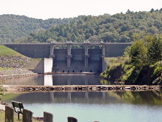
The Burnsville Dam's concrete spillway and tailwaters feeding into the Little Kanawha River.
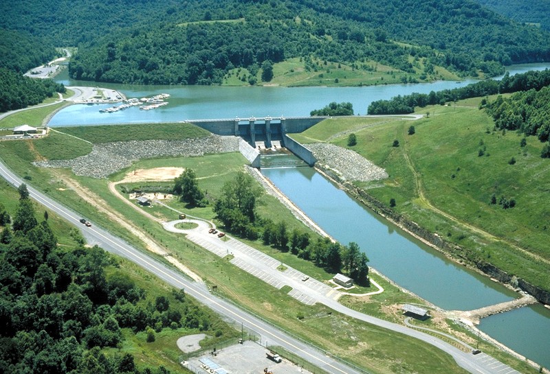
Aerial view of the Burnsville Dam and Lake.
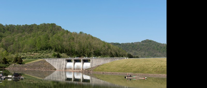
The dam spillway from lakeside.
Backstory and Context
Text-to-speech Audio
Construction on the Burnsville Dam began in 1972 by the U.S. Army Corps of Engineers, and the project was complete with the dam fully functional by December of 1978. The dam is located only a short drive up the Little Kanawha River from the town of Burnsville near Interstate 79. Burnsville Dam is an earth-fill combined with a concrete structure that spans 1,400 feet and stands at 90 feet tall. Authorized under the Flood Control Act of 1938 the dam's primary purpose is to control flooding on the Little Kanawha River and serve as a recreational site. On any ordinary day, water flows through the dam’s gates, but following a significant storm that causes potential for flooding the gates are closed, and water is held in the lake until it is safe to release. The site for the dam, lake, and recreational areas includes over 13,224 acres of land, which provides a fantastic location for enjoying the mountain state.1
As with most of the dams in West Virginia, the Burnsville dam’s function is flood control for the Little Kanawha River. During the winter months when the risk of flooding increases, the water level in the lake is lowered so if needed water can be withheld in the reservoir to prevent the river from rising. Throughout the history of the lake, the water level has never exceeded 52% of its total capacity.2 In the Summer months when the risk of flooding decreases, the water level in the lake is raised to help support favorite recreational activities like boating, kayaking, and fishing.
Many of the Army Corps of Engineer’s projects produce tax revenue for their supporting communities and local governments through tourism and recreation. However, during the work on the Burnsville Dam, several local officials in the Braxton County government called into question the actual revenue benefits from the dam's construction. In 1976, a Braxton County report stated that the promise of new industry and revenue had yet to occur and that the Burnsville Dam and nearby Sutton Dam on the Elk River cost the county $93,000 in lost tax revenue. Construction of the two dams resulted in the loss of over 18,000 acres in private property valued at 5.3 million and blocked access to natural resource development on the two sites. Braxton County Assessor Billy Jack said that: “Right now, coal is a hot item in this county, but quite a chunk of coal, oil, and gas have been locked up.”3
Despite the early concerns, the Burnsville dam is a prominent tourist attraction in Braxton County drawing three-quarters of a million people yearly. Boating and fishing are two of the lakes more prominent attractions along with camping. Anglers can target a wide variety of species at the lake like crappie, bluegill, walleye, small & largemouth bass, catfish, and even the elusive muskie. The recreational area supports two campgrounds both with boat ramps: Bulltown and Riffle Run. Along with camping, the area around the dam has a vast network of trails that spans roughly 88 miles. The trail network also includes the Weston & Gauley Bridge Turnpike Trail that connects to Stonewall Jackson Lake ten miles to the north. This trail features some fabulous scenery and is on the National Register of Historic Places since the turnpike offered a vital means of transit for troops during the nearby battle of Bulltown.
The attractions around Burnsville Lake are not just limited to the outdoors, at the lower end of the lake there the Bulltown Historic Area. Scenic trails surround the location and are woven around several buildings that date back to the 19th century. Near Bulltown is the site of a former grist mill at a section of small falls on the Little Kanawha River. Bulltown is also the location of a minor Civil War rkirmish that is reenacted biannually. The Battle of Bulltown occurred on October 13, 1863 and lasted for about 12 hours. Both sides suffered casualties during the engagement, and a local civilian named Moses Cunningham was clipped by a bullet when he came running from his house shouting: “Hurrah for Jefferson Davis.”4
Burnsville Dam is a vital engineering structure that has helped to protect West Virginia communities from flooding for almost four decades. Not only are the lake and dam necessary or flood control, but they contribute to the greater culture of the area by providing a fantastic recreational spot and opportunities to explore history at the nearby Bulltown Historic Area and a Civil War battlefield.
Sources
2. Johnson, Skip “Burnsville dam.” e-WV: The West Virginia Encyclopedia. 31 May 2012. Acessed April 1, 2018.
3. Johnson, Skip. “Benefits Not Realized, Braxton Report States.” Sunday Gazette-Mail (Charleston), October 24, 1976, Sunday ed. Accessed March 30, 2018. https://www.Newspapers.com/image/?spot=18766502.
4. "Bulltown Historical Area." U.S. Army Corps of Engineers Huntington District. Accessed March 30, 2018. www.lrh.usace.army.mil/Portals/38/docs/recreation/BulltownHistoricalArea.pdf
5. Highsmith, Carol M, photographer. The dam, and a portion of a marina, at the Burnsville Dam and lake on the outskirts of Burnsville, West Virginia. Burnsville United States West Virginia, 2015. -05-06. Photograph. Retrieved from the Library of Congress, https://www.loc.gov/item/2015631751/. (Accessed April 13, 2018.)