South End
Introduction
Text-to-speech Audio
Images
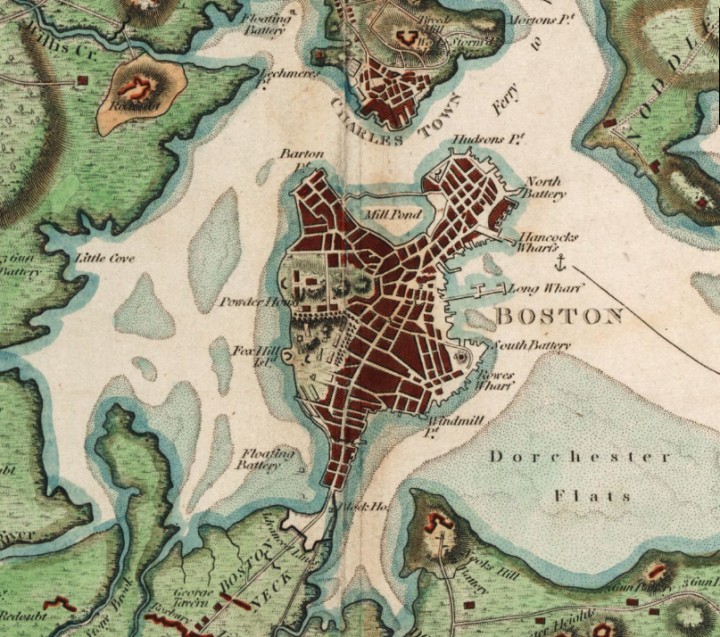
Map depicting the Boston area before the 19th century landfill projects. The East Side of the “Boston Neck” was filled to make way for South End. Source: R. Phillips - Boston Public Library, Norman B. Leventhal Map Center.
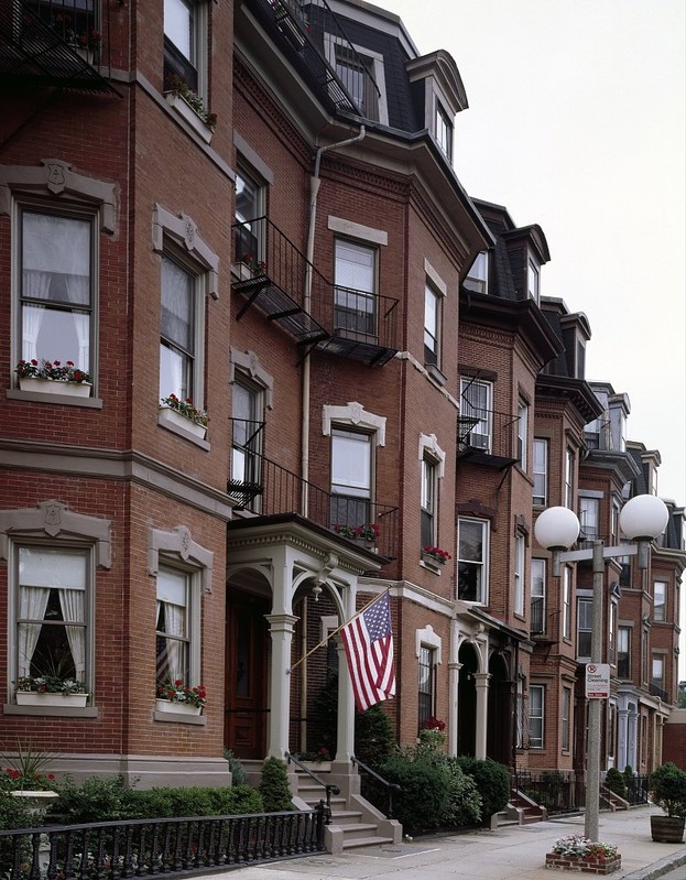
South End today. The famous Victorian rowhouses prompted national acknowledgement of South End as a National Register Historic District in 1973. Source: https://picryl.com/media/bowfront-buildings-on-warren-street-in-south-end-boston-massachusetts
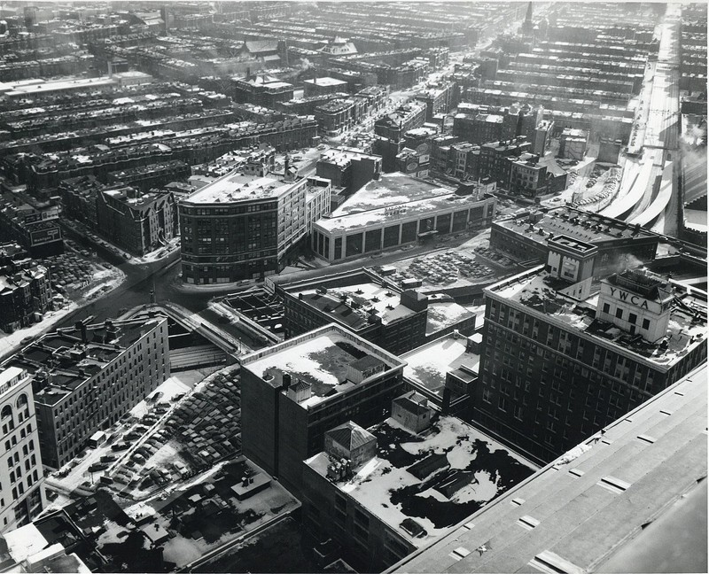
1959 view of the South End from the John Hancock Tower in Back Bay. Source: https://commons.wikimedia.org/wiki/File:South_End_from_old_John_Hancock_Building,_February_1959.jpg
Backstory and Context
Text-to-speech Audio
The construction of South End began in 1849 on the tidelands on either side of the Boston Neck—a strip of land that connected the downtown Boston area to rural outposts such as Roxbury. During its construction, planners envisioned the neighborhood as an enclave of townhouses and rowhouses (houses with shared sidewalls) that would draw in wealthy tradespeople.[1]
Contrary to the expectations of city planners, affluent individuals neglected South End in favor of the more-convenient and posh Back Bay, which was the result of another landfill project just North of the neighborhood. Economic elites began to leave South End as Back Bay townhouses became available in the 1870s.[2]
The financial crisis of 1873 in Europe and North America triggered a depression that further exacerbated the movement of wealth out of South End. At the same time, it contributed to the influx of working class immigrants of over 35 distinct linguistic groups who sought cheap housing and new opportunities in Boston. Irish, Lebanese and Greek immigrants came to dominate the area in the 1880s. By the 1940s, South End also hosted a substantial African American middle class population and a growing gay population that eventually led to South End’s reputation as a “gay ghetto” in the 1970s and 80s.[3]
At the same time, the South End became one of Boston’s poorest neighborhoods: Most of the rowhouses built at the neighborhood’s inception became boarding houses for those who could not afford them, and over 70% of the adult population at the time did not receive a high school education. Subsequent gentrification movements in the 70’s remediated poverty in the local area, reducing the number of adults without high school education to 35% by 1980 and 14% in 2015.[4]
Around the same time period, in the 1960s and 70s, a movement to protect South End’s buildings was sparked by members of the South End Historical Society. As a result, South End’s housing area was eventually recognized for its historical significance, becoming a National Register Historic District in 1973. The district is the oldest remaining enclave of Victorian architecture in the USA.[5]
Alongside its renowned architecture, today, the South End supports young families, professionals, gay individuals, and a burgeoning Hispanic population on top of other cultural groups.[6]
Sources
[1] Boston Parks and Recreation Department, “Open Space Plan 2002-2006.” 217-231. Accessed November 13, 2018. https://www.cityofboston.gov/parks/pdfs/os3n.pdf
[2] “Architectural Ambler: South End Historic District | Trust for Architectural Easements.” July 2009. Accessed November 13, 2018. https://architecturaltrust.org/architectural-ambler-south-end-historic-district/.
[3] South End Historical Society, “South End History, Part I: The ‘New’ South End.” February 2012. Accessed November 13, 2018. https://www.southendhistoricalsociety.org/south-end-history-part-i-the-new-south-end/.
Tissot, Sylvie. “Loving Diversity/Controlling Diversity: Exploring the Ambivalent Mobilization of Upper-Middle-Class Gentrifiers, South End, Boston.” International Journal of Urban and Regional Research 38, no. 4 (July 1, 2014): 1181–94. https://doi.org/10.1111/1468-2427.12128.
[4] Lima, Alvaro, Jonathan Lee, Christina Kim, Phillip Granberry, Matthew Resseger, Kevin Kang, Kevin Wandrei, et al. December 2017. “Historical Trends in Boston Neighborhoods since 1950.” Accessed November 13, 2018. http://www.bostonplans.org/getattachment/89e8d5ee-e7a0-43a7-ab86-7f49a943eccb
Tissot, Sylvie. “Loving Diversity/Controlling Diversity: Exploring the Ambivalent Mobilization of Upper-Middle-Class Gentrifiers, South End, Boston.”
[5] Sammarco, Anthony Mitchell. Boston’s South End. Arcadia Publishing, 2006.
[6] Lima, Alvaro, Jonathan Lee, Christina Kim, Phillip Granberry, Matthew Resseger, Kevin Kang, Kevin Wandrei, et al. December 2017. “Historical Trends in Boston Neighborhoods since 1950.”