Camp Rankin & Fort Sedgwick (Former Location)
Introduction
Text-to-speech Audio
Images
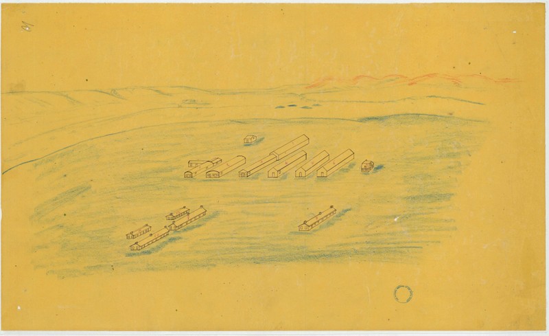
1866 military drawing of floor plan and elevations of buildings on Fort Sedgwick. (Courtesy of the Map Division, Archives II, NARA)
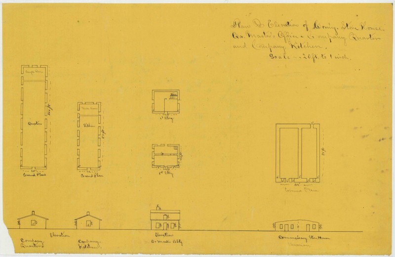
1866 military drawing of floor plan and elevations of buildings on Fort Sedgwick. (Courtesy of the Map Division, Archives II, NARA)
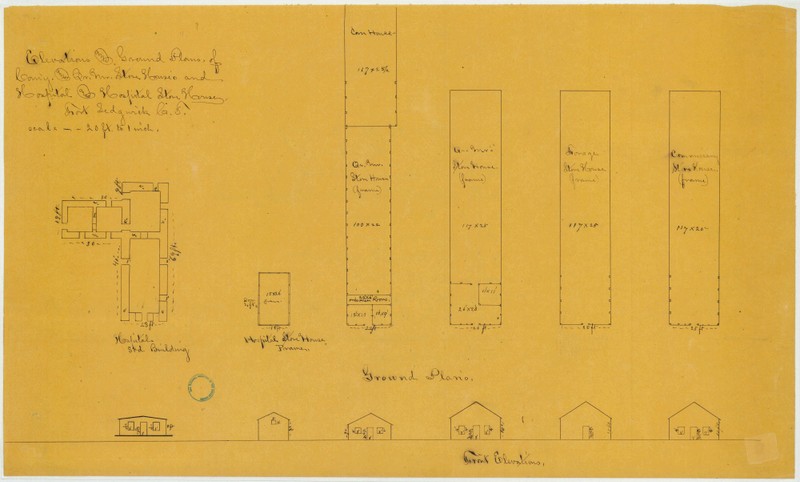
1866 military drawing of floor plan and elevations of buildings on Fort Sedgwick. (Courtesy of the Map Division, Archives II, NARA)
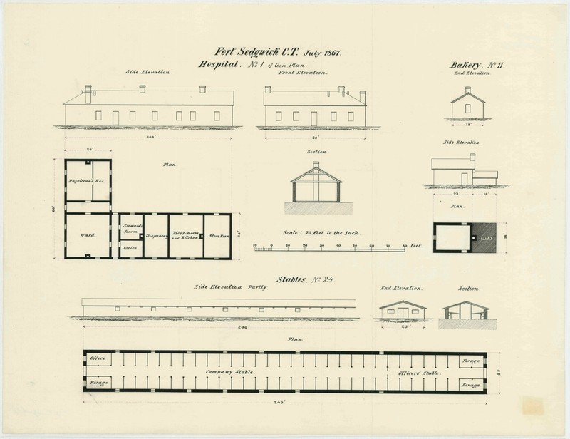
July 1867 military architectural plans for the bakery, stable, and hospital at Fort Sedgwick (Courtesy of the Map Division, Archives II, NARA)
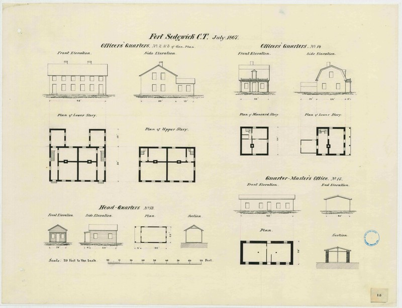
July 1867 military architectural plans for the officers' quarters, headquarters, and quartermaster's office at Fort Sedgwick (Courtesy of the Map Division, Archives II, NARA)
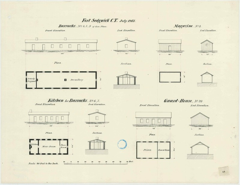
July 1867 military architectural plans for the barracks, kitchen, magazine and guard house at Fort Sedgwick (Courtesy of the Map Division, Archives II, NARA)
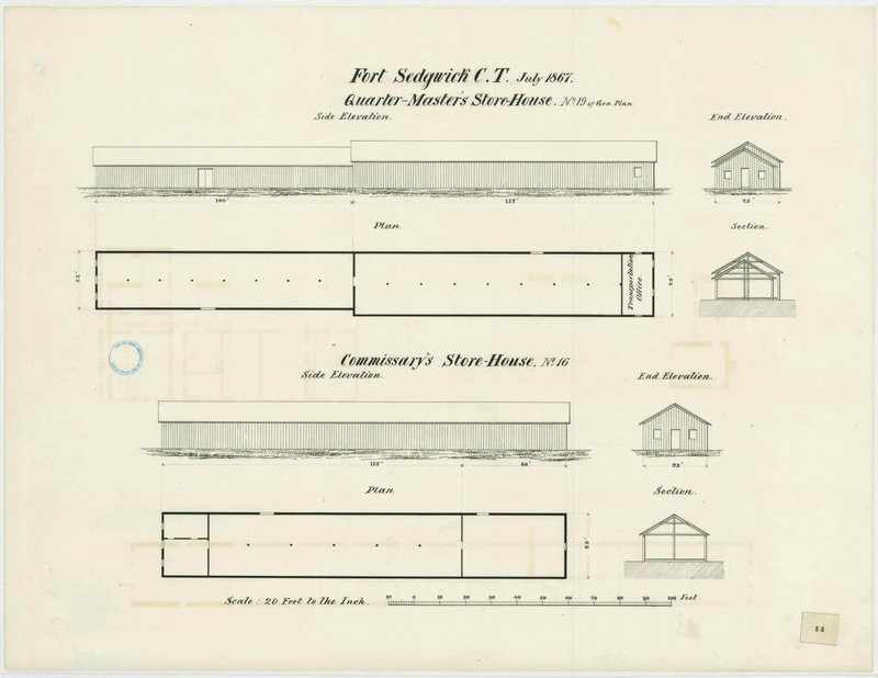
July 1867 military architectural plans for the quartermaster's store houses and saddler's shop at Fort Sedgwick (Courtesy of the Map Division, Archives II, NARA)
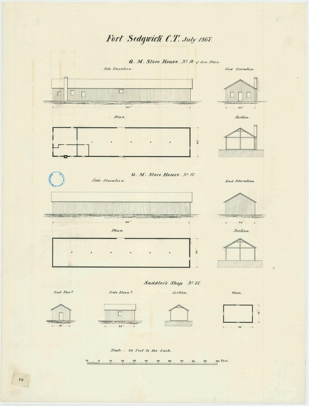
July 1867 military architectural plans for the quartermaster's store houses and saddler's shop at Fort Sedgwick (Courtesy of the Map Division, Archives II, NARA)
This is the survey map for Township 11 North, Range 45 West of the 6th Principal Meridian. The plat was drawn in June 1887 after the military reservation was turned over to the Department of the Interior (Courtesy of BLM GLO).
Backstory and Context
Text-to-speech Audio