Samuel Albright House
Introduction
Text-to-speech Audio
Images
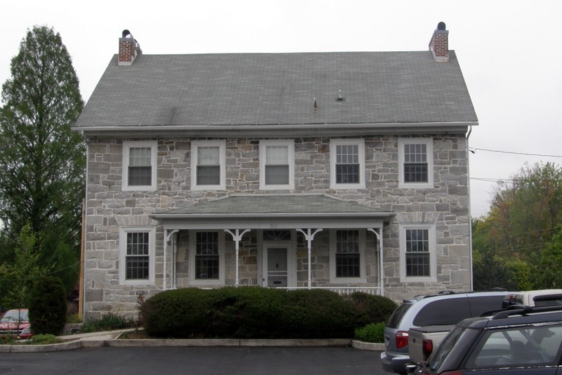
The Samuel Albright House
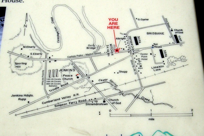
Map showing the location of the Albright House and surrounding area in June 1863
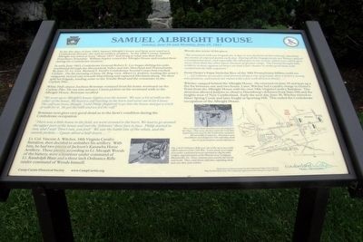
The Samuel Albright House Historical Marker
Backstory and Context
Text-to-speech Audio
During the Confederate invasion of Pennsylvania in late June of 1863, Confederate troops under the command of General Albert G. Jenkins advanced from Carlisle to Mechanicsburg, reaching the town on June 27. Jenkins, who was under the command of Lt. General Richard S. Ewell, sent his forces east toward the Pennsylvania capital of Harrisburg. On June 28, Confederate forces ran into two New York regiments and Landis' Philadelphia Battery of Light Artillery near Oyster Point (present-day Camp Hill).
During this time, Lt. Col. Vincent A. Witcher of the 34th Virginia Cavalry Battalion established an artillery position at the Albright House. The Confederate forces shelled Union militia from this position on and off for two days during the Skirmish of Oyster Point. Witcher eventually created a diversion by leading a cavalry charge against Union forces at Oyster Point. This diversion allowed General Jenkins to observe Harrisburg's defenses from Slate Hill and New Cumberland Heights. The Confederates abandoned the Albright House on June 30 as they were ordered to retreat west toward Mechanicsburg, thus ending the occupation of the Albright House. The Battle of Sporting Hill would follow immediately after as Union forces pursued retreating Confederate forces along the Carlisle Pike.
One citizen of the town, Zacheus Bowman, recounted his experience viewing the Albright House around the time of the Confederate invasion:
“There was a little house in the field, we went around to the barn. We had to go around the upper part of the house and met the “Johnnies” there face to face. Philip started to run and I said ‘Don’t run, you fool!’ We saw the battle line of the rebels and the outside pickets. – I guess about a half dozen ….”
The Samuel Albright House Historical Marker is part of a project by The Camp Curtin Historical Society hoping to map out the Civil War road to Gettysburg. The Albright Marker is one of six in the West Shore area. The signs were funded through a combination of individual donations and a grant from the Cumberland County Visitors Bureau, totaling about $12,000. The project hopes to keep expanding the Civil War history in Pennsylvania, including more battle sites and even some markers covering the Underground Railroad in the future.
Sources
Samuel Albright House Historical Marker, The Historical Marker Database. Accessed April 15th 2020. https://www.hmdb.org/m.asp?m=94702.
Skirmish at Oyster Point (June 1863), House Divided. Accessed April 15th 2020. https://housedivided.dickinson.edu/sites/blogdivided/2010/09/07/skirmish-at-oyster-point-june-1863/.
Wingert, Cooper H.. The Confederate Approach on Harrisburg: The Gettysburg Campaign's Northernmost Reaches. Charleston, SC. The History Press, 2012.
Dunn, Rachel. West Shore Civil War markers hope to connect missing pieces of history, Penn Live Patriot News. June 19th 2015. Accessed November 17th 2020. https://www.pennlive.com/midstate/2015/06/west_shore_civil_war_markers_h.html.
Photograph by Larry Gertner
Photograph by Larry Gertner
Photograph by Larry Gertner