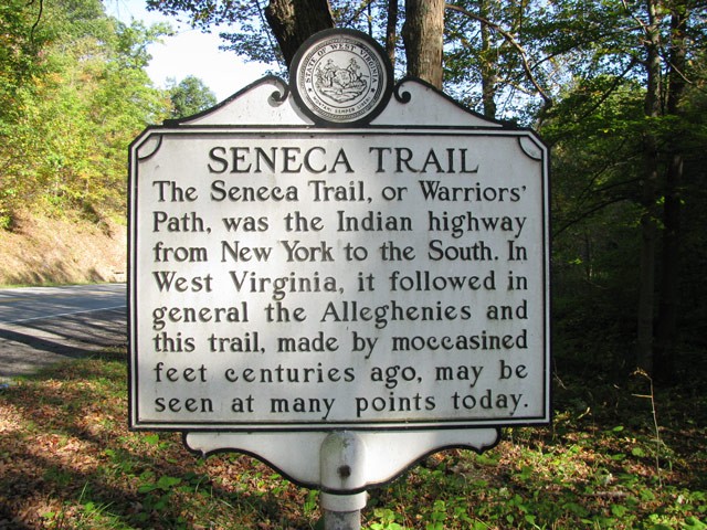
Seneca Trail Historical Marker
Introduction
Text-to-speech Audio
Images
Seneca Trail Historical Marker
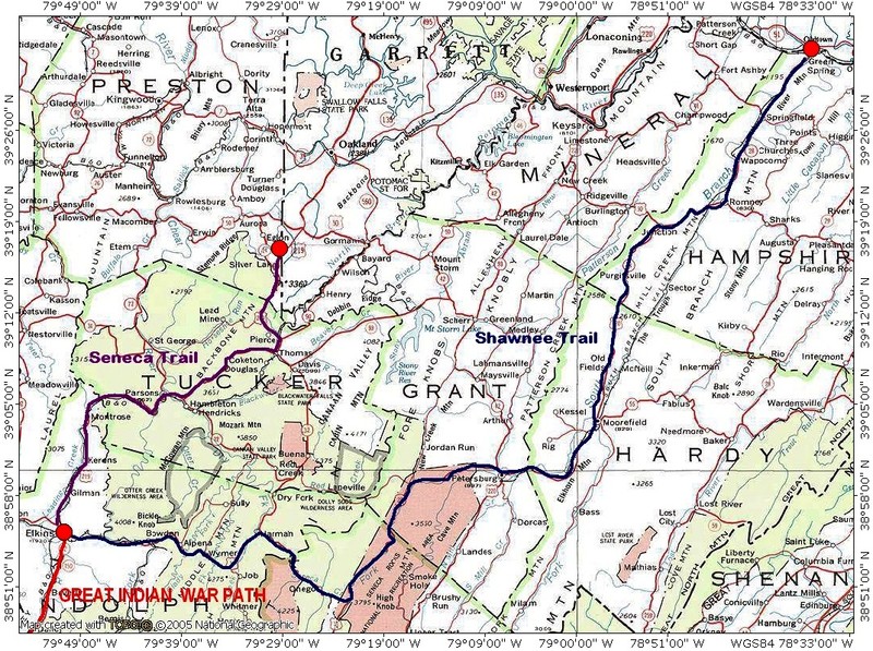
Seneca Trail Map
Backstory and Context
Text-to-speech Audio
The route it followed through West Virginia was an old one, and well-traveled. Long ago, it had been a major Indian footpath. The Seneca Trail, known also as the Great Indian War and Trading Path, was a part of a network of trails stretching from the Deep South to modern day New York that was used by the Catawba, various Algonquian tribes, the Cherokee, and the Iroquois Confederacy.
As European settlers began moving westward through this area, King George III drew a boundary in the Proclamation of 1763 that followed sections of the Seneca Trail. No settlers were to move west of this line. The explorers and pioneers could not be held back, however, and some of the roads left by their great westward push still intersect Route 219 today. Today’s US Route 60 approximates the James River and Kanawha Turnpike, a route proposed by a young surveyor named George Washington seeking to give Virginia access to trade in the West.
It was Thomas Jefferson who, in 1809, authorized the construction of the Cumberland, or National, Road. This road, the first major improved highway built by the US government, connected the Potomac and Ohio Rivers and further opened the settling of the West. The Northwestern Turnpike was completed at about this same time, and was one of the first major roads crossing the Appalachian Mountains. Both the Cumberland Road and the Northwestern Turnpike are followed approximately by today’s Route 50. Shortly after, the Staunton-Parkersburg Turnpike (now US 250) was engineered through the steep terrain by Claudius Crozet in order to connect the upper Shenandoah Valley to the Ohio River.
The modern wayfarer may know nothing of this history as they zoom along Route 219. Yet they may find that they ease off the gas a little as they drive this mostly rural, scenic highway. This road has been traveled before, and a trip down it is meant to be savored.
Sources
Graves, Birch. “The Seneca Trail.” Traveling 219: The Seneca Trail. Accessed September 1, 2020. http://www.traveling219.com/stories/elkins-marlinton/the-seneca-trail-history/.
“Native American Clashes with European Settlers.” West Virginia Archives & History. Accessed September 2, 2020. http://www.wvculture.org/history/archives/indians/indland.html.
Rice, Donald L. “The Seneca Trail.” The West Virginia Encyclopedia. Accessed September 1, 2020. http://www.wvencyclopedia.org/articles/243.