Mount Porte Crayon
Introduction
Text-to-speech Audio
Images
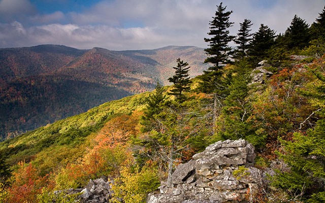
Photo Credit: The Nature Conservancy
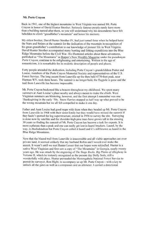
Page 1 of a written account of the naming of Mount Porte Crayon by Sara Strother King, great-great grand-daughter of David Hunter Strother.
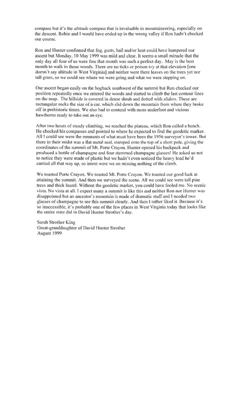
Page 2 of a written account of the climbing of Mount Porte Crayon by Sara Strother King.
Backstory and Context
Text-to-speech Audio
Mount Porte Crayon is named after David Hunter Strother, who served as a news correspondent during the Civil War. A native of Martinsburg, West Virginia, Strother often went by the pen name Porte Crayon and was a well-known writer and illustrator. Some of his published works are “The Blackwater Chronicle” and “A Visit to the Virginia Canaan.”
Hikers can get to the preserve by the south of the 4,770-foot summit of Mount Porte Crayon, along the Allegheny Front in Pendleton County, West Virginia. The preserve is surrounded by U.S. Forest Service lands including the Monongahela National Forest. This preserve is remote and largely inaccessible. Public access to Mount Porte Crayon Preserve is through the Roaring Plains Wilderness Area via the Flat Rock Run Trail or Roaring Plains Trail. Formal trails do not reach the summit and considerable bushwhacking is involved through thick red spruce and rhododendron. Good navigation skills, map, compass and/or GPS are highly recommended. An old railroad grade serves as a guide in much of the length of the property but is degraded in many portions leaving hikers to cross over wet and rocky terrain. Storms can move in rapidly so hikers should be prepared for varied weather conditions. The U.S Forest Service Office located in Elkins can be contacted for weather conditions.