Conflict & War: The Morrison Property Remains
Introduction
Text-to-speech Audio
Images
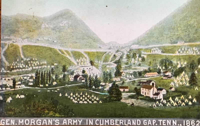
"General Morgan's Army in Cumberland Gap"
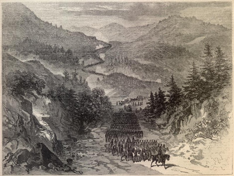
"The Battle of Cumberland Gap"
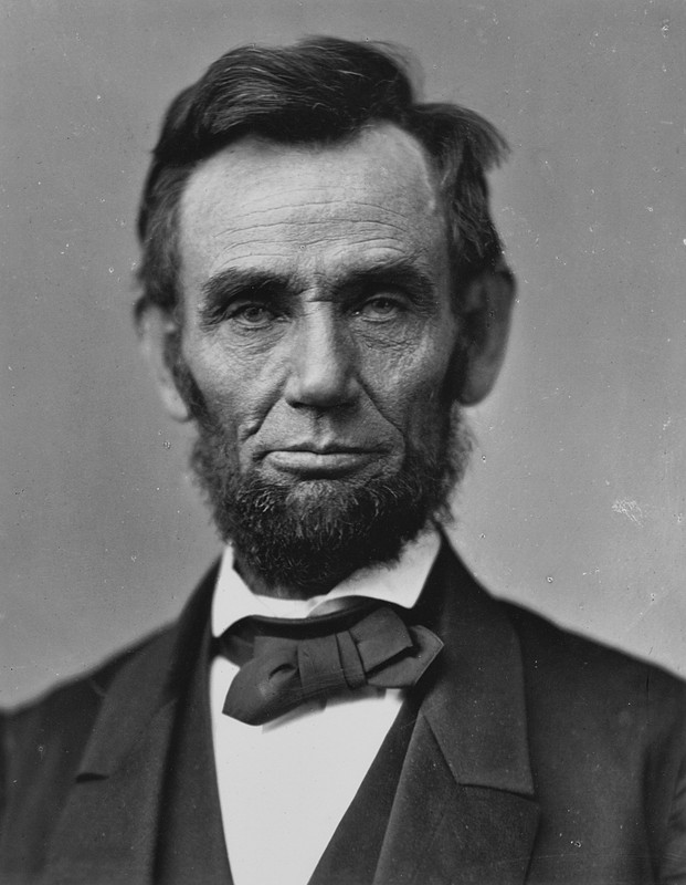
“I wish a movement made to seize...the mountain pass called Cumberland Gap.” -Abraham Lincoln (Oct. 1, 1861)
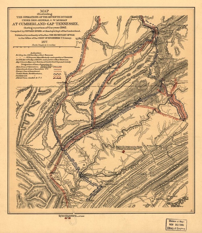
A Civil War Map of the Cumberland Gap Region
Backstory and Context
Text-to-speech Audio
For centuries, the passage was utilized by both Cherokee and Shawnee hunters and warriors, with clashes between the tribes occurring frequently. The path was known as Athowominee to the Shawnee — the warrior’s path. During the years of Daniel Boone’s passage through Cumberland Gap, the conflict between natives and settlers did not stop the mountain pass’s development into a road for pioneers. Boone’s legacy as a trailblazer is complex — reaching beyond simply cutting down trees. The success of his campaign came at the expense of the indigenous people who relied on the region for hunting and travel. In the following years, the geographical advantage presented by the gap set it up to remain a point of conflict during the Civil War. While only minor skirmishes were fought in the gap, both forces occupied the area at different points during the war, under difficult circumstances of bad weather, dwindling supplies, and extensive periods of little to no activity. The latter being immortalized in the folk ballad Cumberland Gap’s line “lay down boys and take a little nap.” The occupation flipped back and forth between Union and Confederate forces several times. As a preventative tactic, departing troops destroyed ammunition, timber, and other resources in the hopes of rendering the post unusable. The destruction resulted in much of the town having to be rebuilt once the war ended. The remains of this lot, known as the Morrison Property, are the only surviving pre-civil war structures of the town. The home that once stood here housed General Morgan at one point, while the property later served as a stable.
“The greatest distress that came under my observation during the war was in the fall of 1862, according to my recollection. It was in October. The leaves were still green on the trees. The weather turned very cold, and there was a snowfall to the depth of 3 inches that covered the ground. It was a strange sight to see the leaves so green and the ground so white...
At this time General Bragg retreated with his army out of Kentucky. He was in command of a very large force. They were several days passing by. We lived on the main road leading from Cumberland Gap to Knoxville. Most of his army passed by on this road. Many of them told me that they had traveled on double quick time, and hadn’t had a morsel to eat in three days. This was a distressing scene indeed. A great many of the men were overcome with fatigue and fell by the wayside, while others took shelter in the churches or the waste houses or with families wherever they could get shelter.” - Hansard, Mary A. Old Time Tazewell. Kingsport, TN: Kingsport Press, Inc., 1979, p. 38.
Sources
Cumberland Gap, The Traditional Ballad Index. Accessed May 7th 2021. http://www.csufresno.edu/folklore/ballads/R498.html.
Holt, Edgar A. . Claiborne County. Memphis, TN. Memphis State University Press, 1981.
National Register of Historic Places Registration Form, February 23, 1990.
The Bell County Historical Society
By Sgt. Brennan - General Burnside's Army Occupying the Cumberland Gap Harper's Weekly, October 10, 1863, accessed August 6, 2010, Public Domain, https://commons.wikimedia.org/w/index.php?curid=4262235
Wikimedia Commons, public domain, Portrait by Alexander Gardner, November 1863
Ruger, Edward. Map illustrating the operations of the Seventh Division under Brig. General G. W. Morgan at Cumberland Gap, Tennessee, during a portion of the year. [S.l, 1877] Map. https://www.loc.gov/item/99448847/.