Walwood Place
Introduction
Text-to-speech Audio
User Note: After the previous entry, follow the sidewalk to the left side of Walwood Hall towards the green space. Feel free to walk down the steps and explore the area. Look towards the right side of the space to see the remnants of a road that once led up Prospect Hill. Feel free to explore the path, which is the former Walwood Place walkway, to the left of the greenspace to see the terraced landscape where the houses were located. The residences were located in a line between these two roads and in front of Walwood Hall.
Intro: The six residences, known as the Walwood Place homes, were located near the former site of the Kalamazoo Medical and Surgical Sanitarium. In the late 1930s, the homes and surrounding land were acquired by Western for the construction of Walwood Hall and Union. These homes were occupied by families, for whom the houses were each named, until the early 1940s before being used for student activities and housing. Western continued to use the residences until they were demolished in the 1960s.
See below for more information
Images
Bartoo House

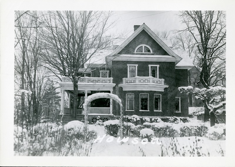
Howson House
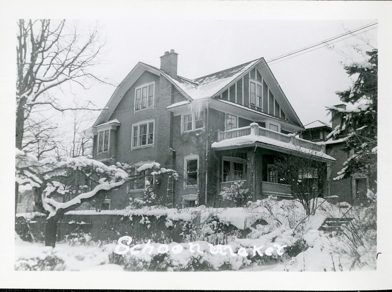
Schoonmaker House
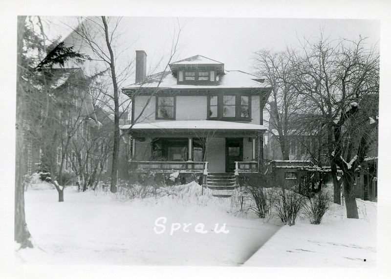
Sprau House
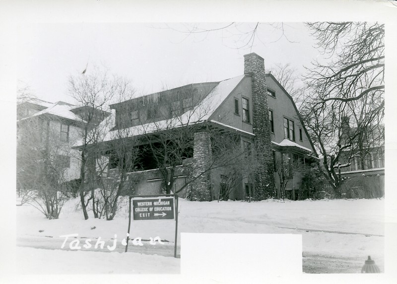
Tashjian House
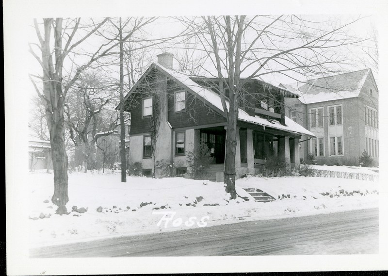
Ross House
Backstory and Context
Text-to-speech Audio
Context: Before Walwood Hall and Union was constructed, this land had been previously used for the Fletcher Sanitarium, also known as the Kalamazoo Medical and Surgical Sanitarium, which burned down in 1914, and was presently home to six residences. The homes, which were named after the families that resided in them, sat on Walwood Place. This street traversed Prospect Hill and was used by those living in the Davis Street neighborhood to travel up and down the hill. From east to west, the homes were named Bartoo, Howson, Schoonmaker, Sprau, Tashjian, and Ross. These families continued to live in the houses during and shortly after the construction of Walwood Hall and Union.
In 1943, Walwood Hall, as well as Vandercook Hall and Spindler Hall, was used to house military personnel due to the V-12 operations that were taking place on campus during World War II. During this time, the families that had resided in the Walwood Place homes left and the homes were used to house the women from Walwood Hall. The women returned to Walwood Hall after the war ended and Western utilized the residences for various purposes. Howson House was used for the Colhecon Club, also known as the College Home Economics Club, Schoonmaker House was used for offices, and the other homes were used as faculty residences.
Western continued to use these residences until they were demolished in the 1960s. Today, the former site of these homes is used as a parking lot for Walwood Hall and Union, as well as a green space.
Sources
“Guided Tour Binder.” Kalamazoo: Heritage Hall Alumni Center, n.d.
“Walwood Hall Becomes Men's Dorm in September.” Western Herald. May 20, 1955.
1940 United States Federal Census. 15th ed. Washington D.C., District of Columbia: United States of America, Bureau of the Census, 1940, https://www.ancestrylibrary.com/discoveryui-content/view/85691023:2442?_phsrc=tvz535&_phstart=successSource&gsfn=george&gsln=sprau&ml_rpos=1&queryId=8055099695c61855ecb6899aa69a33f5, 5B.
“1952 Campus Map.” Map. Western Michigan University Facilities Management. Accessed May 9, 2022. https://wmich.edu/facilities/planning/maps.
Sanborn Fire Insurance Map from Kalamazoo, Kalamazoo County, Michigan. Sanborn Map Company, Vol. 2, Republished 1958, 1958. Map. https://www.loc.gov/item/sanborn04060_009/, 201.