Jefferson Pier Stone
Introduction
Author-Uploaded Audio
Historian David Trowbridge shares the history of this obscure but fascinating marker
Text-to-speech Audio
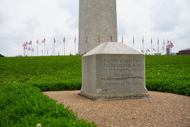
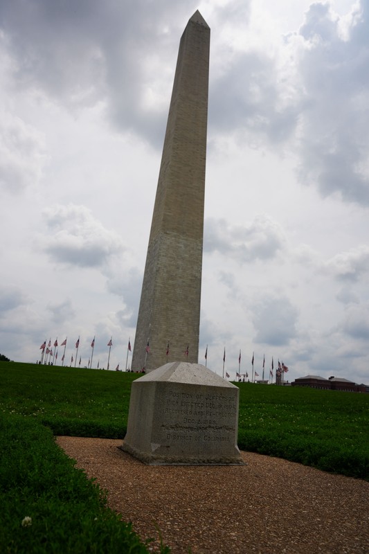
At just three feet tall, the Jefferson Pier Stone may seem oddly placed compared to the nearby Washington Monument, which reaches a height of 555 feet. However, the stone's history reveals the aspiration of American leaders who hoped this location would be recognized as the world's prime meridian line instead of several competing claims in European capital cities. An arbitrary north-south line, the prime meridian is recognized as zero longitude and marks the dividing line between the eastern and western hemispheres. The stone also serves as the southwest corner of a right triangle that connects the White House, the U.S. Capitol, and the originally-planned location of the Washington Monument. The Washington Meridian, as the line was called, formed the short side of the triangle line between the White House and the Washington Monument. The pier stone was placed here in 1804 and a replacement was erected in 1889. By that time, a line derived from the Greenwich Prime Meridian was accepted by most nations and had been used by ship captains around the globe.
Images
The Jefferson Pier Stone was first erected in 1804, replacing a wooden post inserted into the ground in 1793. This replacement was erected here in 1889.
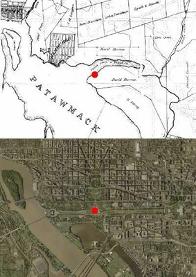
The top map shows where the wooden post was located (the red dot) at the confluence of the Potomac River and Tiber Creek. The bottom image is a modern aerial view of Washington D.C.
The Jefferson Pier Stone with the Washington Monument in the background
A closeup of the stone

Backstory and Context
Text-to-speech Audio
In 1793, the land where the National Mall is now was once at the confluence of the Potomac River and the Tiber (or Goose) Creek. A wooden post was placed on the south side of the creek to mark the location of the meridian and the southwest corner of the triangle, which was a major feature of the layout of Washington designed by French engineer Pierre Charles L'Enfant (1754-1825). A statue of George Washington astride a horse was intended to be erected at the corner but this never came to fruition. The Washington Monument was also supposed to be built on the corner but the soil proved to be unsuitable such a large structure. As a result, the monument was built just to the east.
Thomas Jefferson was one of the most vocal advocates of the idea for a U.S.-based prime meridian line, an aspirational assertion that American leaders hoped would be recognized by other nations in future generations. Such recognition would symbolize not only the new country's autonomy from Britain, American leaders believed, but also its ascent to global leadership.
Placing the nascent capital city as the center of the globe was symbolic as many other nations made similar claims. In the early and mid-19th century, the global prime meridian would be increasingly recognized as running through the Royal Observatory in Greenwich. Many European nations had their own competing prime meridians through their capital, so the American assertion of centrality was representative of the era. The stone was removed and replaced several times before the current one was erected in 1889. The United States officially accepted the prime meridian line in Greenwich, England in 1912.
Sources
Carter, Elliot. "Jefferson Pier Marker." Atlas Obscura. May 2, 2017. https://www.atlasobscura.com/places/jefferson-pier-marker.
Doyle, David R. & Dragoo, Alan. "Where Freedom Stands." National Geodesic Survey. Accessed January 9, 2023. https://www.ngs.noaa.gov/PUBS_LIB/freedom_stands.html.
"The Jefferson Pier." DC Design Tours. Accessed January 9, 2023. https://dcdesigntours.com/the-jefferson-pier.
Photo by David Trowbridge
Wikimedia Commons
Photo by David Trowbridge
Photo by David Trowbridge