Troy City (named place)
Introduction
Text-to-speech Audio
Troy City was organized in 1900, located around 450 W and Indiana 218, Warren, Huntington County, Indiana. High hopes attended its founding as a company city. A plat map was prepared (although apparently never submitted), and plans were made for a post office (also never followed up on). Though controversy repeatedly rocked this small town, from murder to counterfeit coins, the church would go on to be one of the longest-standing buildings in the community. Now, all that remains of Troy City is a single house.
Images
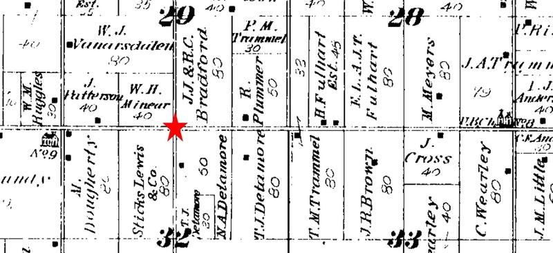
Troy City location in 1879 atlas
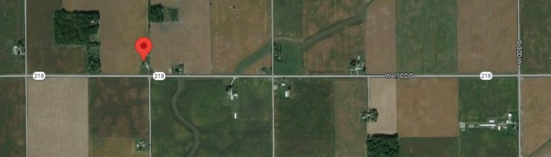
Modern Aerial of the Troy City location
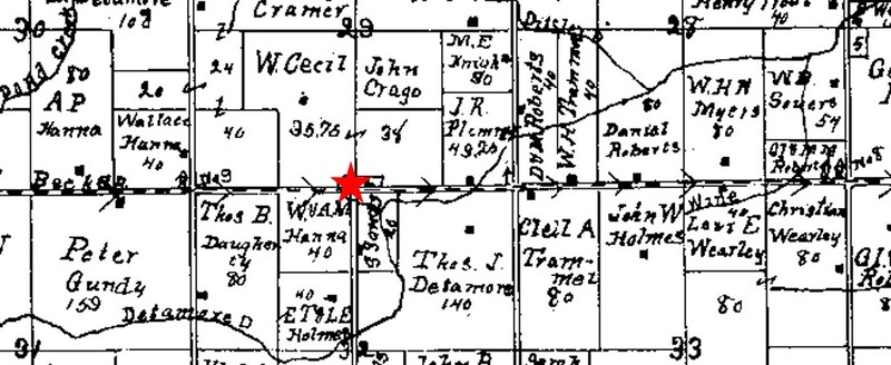
1903 map of Troy City location
Backstory and Context
Text-to-speech Audio
Organized in 1900, the hamlet of Troy City at one time had a general store and a corporate office. Two churches and two couple schoolhouses were located within a mile. The town was an oil town, run by the Troy Oil Company. As the Troy Oil Co. building was torn down, materials for counterfeiting were found, including a machine for counterfeiting dollar coins, enough metal to make fifteen to twenty dollars, a gas-powered metal forge, and an undersized half dollar. No counterfeit coins were found in the community, leading people to believe the oil men took the coins out of town on trips. The machine and other counterfeiting materials were later confiscated by “government men” from the Secret Service.
Another notable event took place in this small town in 1905, when a local man, Shadwick "Shad" Thomas, was tragically killed by his brother-in-law, Thomas Souers. The two men had gone to Warren on business and went to the saloon afterwards. By the end of the evening, Thomas was ready to drive home but Souers wanted to continue drinking. The two men fought one another and Thomas ended up leaving Souers behind. Outraged, Souers threatened to kill Thomas but no one took him seriously, thinking he would cool off on his walk back to Troy City. However, once he made it back to the city, Souers found Thomas with some friends at the local store and started a new fight that ended with a single gunshot. Shadwick Thomas died just outside the local store and Thomas Souers was charged with manslaughter and convicted.
Prior to the town’s creation, a church was formed in 1886 one mile east. It was the result of two revival meetings, and was called Plummer’s Chapel after the man on whose land it was built. Though the church would be destroyed in a windstorm in 1911, the congregation would quickly rebuild, as well as make several additions. The last public service was held in 1968. Reverend Alfred Clough wished to revive the church, but he was unable to do so, due to the members having moved on to different churches. The building was sold in 1969 and used for storage until it was torn down. The parsonage still stands as a single family home.
Sources
- Ghost Towns of Huntington County. 1971. Doris Chambers, p102-108.
- 'VCR trip to the Zoo.' Warren Weekly, 29 Aug 1990, p8.
- Combination Atlas Map of Huntington County, Indiana. 1879. Kingman Bros.
- Huntington County, Indiana. 1903. Herman Taylor, Warsaw, Ind.: National Map Co. Rockford, Ill.: Hixson Map & Litho. Co.
- Modern aerial photo. Google Maps. [LOCATION]. https://maps.google.com Accessed 14 Aug 2023.
1879 Combination Atlas
Google Maps
1903 Huntington County Map