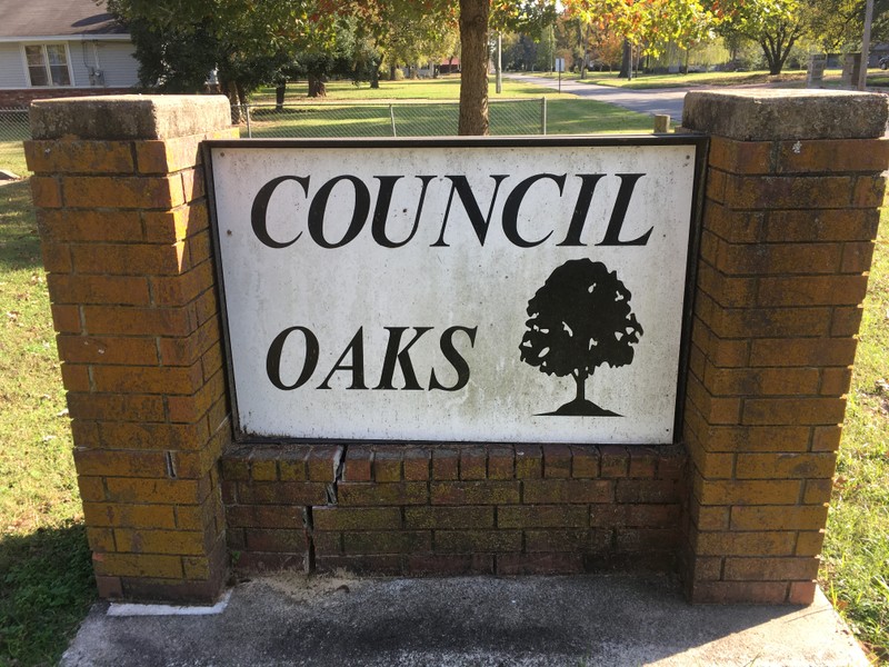
Council Oaks Park
Introduction
Text-to-speech Audio
Images
The lone surviving white oak tree at Council Oaks Park.
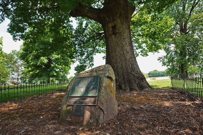
Located in a beautiful and quiet part of Dardanelle.
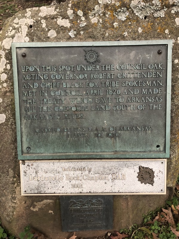
Dedication marker by the D.A.R.
Estimated to be 300-500 years old.
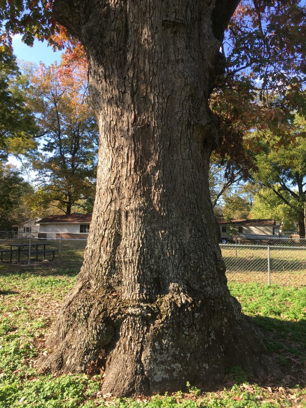
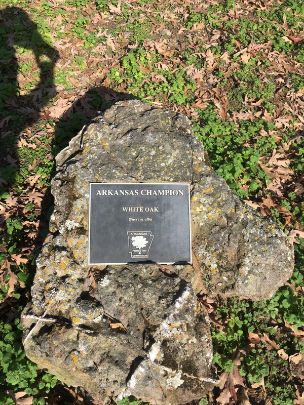
The massive council oak is an Arkansas Champion tree.
Backstory and Context
Text-to-speech Audio
The migration of the Cherokees into the land that would become the Territory of Arkansas started in the 1780s and went through the 1820s. The Arkansas Cherokees came from east of the Mississippi River from their native lands in eastern Tennessee, Georgia, North Carolina, and South Carolina. This immigration of the Cherokees into the soon to be Arkansas Territory was caused mainly by the pressure of white settlers moving west into native American lands, although some of the Cherokees came from eastern Tennessee because of Indian wars. One group of eastern Cherokees from Tennessee, led by chief Tahlonteskee, arrived in the Arkansas Territory in 1810. By 1812 this group had moved into the Arkansas River Valley.
Two treaties were agreed to in 1817 and 1819 between the eastern Cherokees and the United States. In these treaties the Cherokees agreed to an exchange of land from their native territory in Tennessee, Georgia, North Carolina, and South Carolina for lands west of the Mississippi River. The Treaty of 1819 gave the Cherokees over three million acres of land in Arkansas Territory located north of the Arkansas River. This new land reserve for the Arkansas Cherokees covered almost the entire Arkansas Ozarks.
Tahlonteskee died in 1819 and was replaced by his brother, John Jolly, as Principal Chief of the Arkansas Cherokees. Besides dealing with disputes over the boundaries of the Cherokee Territory, Chief John Jolly had to contend with a constant conflict between the Arkansas Cherokees and the Osage Nation who bordered the Cherokee lands. Another area of contention was also the delay in the payment of an annuity promised to the Cherokees in the treaties with the United States government. These issues of land boundaries, the conflict with the Osage Indians, and the non-payment of annuities were all reasons for council meetings between the Arkansas Cherokees and officials of the United States government. Many of these council meetings took place in Dardanelle at a Cherokee council site located on the Arkansas River under the canopy of white oak trees.
The famous meeting, for which the city park in Dardanelle was dedicated, took place on June 24, 1823 at the Cherokee council site. The Arkansas Cherokees were represented by Principal Chief John Jolly, Chief Black Fox, Chief Walter M. Webber, Chief Water Minnow, Chief Young Glass, Chief Thomas Graves, and Chief George Morris. The United States delegation was led by Robert Crittenden, the Acting Governor of the Arkansas Territory. The Cherokee chiefs in a letter to Secretary of War John C. Calhoun wrote, “on this day we have had a talk in council to Robert Crittenden the acting governor of this Territory, in which council, amoung other things the boundaries of our nation was discussed.” One of the main points of contention after the Treaty of 1819 was that a number of Cherokees were living on the south side of the Arkansas River. According to former Cherokee Agent, Col. David Brearley in a letter, dated April 24 1823, to Secretary Calhoun, “about two fifths of the Cherokees, are Settled on the South side of the Arkansas River…”. Crittenden concurs with Brearley in a letter to Secretary Calhoun when he writes that “the Cherokees Twelve Hundred of whom are residing on and cultivating the land ceded by the recent treaty to the Choctaws.” This was the territory south of the Arkansas River. The Cherokee Nation in Arkansas wrote to President James Monroe in 1819 that “the President had given the Cherokees land at the Dardanelles. We were so much pleased that we came here, where we now are.” Also, the Cherokees now claimed that the Choctaw Indians were allowing them to be on the south side of the Arkansas River and that it was of no concern to the United States. Crittenden writes in the same letter to Secretary Calhoun, “I told them the Choctaw Treaty was founded on mistake, and consequently no Treaty;”. The result of the council meeting was that the Cherokees did receive payment of their annuity but there was no final agreement on the boundaries for their nation until 1828.
Due to the encroachment of white settlers into Cherokee lands and the need for new citizens in any future application for statehood, the United States put pressure on the Arkansas Cherokees to exchange their lands in Arkansas Territory for lands west in what would become Indian Territory (the future state of Oklahoma). The Arkansas Cherokees were reluctant to make this agreement, especially Chief John Jolly. But after a much-disputed tract of land, Lovely’s Purchase, part of which was ceded to the Cherokees, the Treaty of 1828 was agreed on. The Treaty of 1828 between the Arkansas Cherokees and the United States saw the removal of the Cherokee Nation from the Arkansas Territory.
Council Oaks Park was dedicated on March 20, 1930 by the Daughters of the American Revolution (D.A.R.) of Arkansas. The park is also famous for the massive white oak trees that occupied the council site. Only one of these old oaks is still standing. It received the award, from the Arkansas Department of Agriculture, in 2011 as White Oak Champion Tree, signifying that it was the largest white oak tree (Quercus alba) in Arkansas at that time. Council Oaks Park is open year-round and is located in a beautiful, quiet part of Dardanelle.
Sources
Bolton, S. Charles. Arkansas, 1800–1860: Remote and Restless. Fayetteville: University of Arkansas Press, 1998.
Carter, Clarence Edwin, ed. The Territorial Papers of the United States. Vol. 19, The Territory of Arkansas, 1819–1825. Washington DC: U.S. Government Printing Office, 1953.
DuVal, Kathleen. Native Ground. Philadelphia: University of Pennsylvania Press, 2006.
Eno, Clara B. "The History of the Council Oak." The Arkansas Historical Quarterly 6, no. 2 (1947): 198-200.
Gleason, Mildred Diane. Dardanelle and the Bottoms. Fayetteville: University of Arkansas Press, 2017.
Hoig, Stanley. The Cherokees and Their Chiefs. Fayetteville: University of Arkansas Press, 1998.
Markman, Robert Paul. “The Arkansas Cherokees: 1817-1828.” PhD. diss., University of Oklahoma, 1972.
White, Lonnie J. "Arkansas Territorial Indian Affairs." The Arkansas Historical Quarterly 21, no. 3 (1962): 193-212.
Arkansas Department of Parks and Tourism
Joe Grimes, Jr.
Willie Lawhon, Supervisor Dardanelle Parks and Rec.
Joe Grimes, Jr.
Joe Grimes, Jr.