Marias Pass
Introduction
Text-to-speech Audio
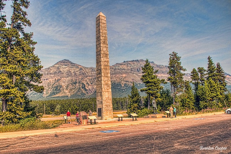
We have now climbed to nearly a mile above sea level and we are at the summit of Marias Pass. Marias Pass is the lowest and easiest transcontinental railway route across the Rocky Mountains between Canada and New Mexico. The Continental Divide marks the point where water to the west flows to the Pacific Ocean and water east of the divide flows to the Gulf of Mexico. The Continental Divide is marked by a tall stone obelisk to our right across US Highway 2. The obelisk is dedicated to President Theodore Roosevelt, who was an early proponent of the establishment and preservation of lands for our National Parks. To its left is a statue of John F. Stevens, who first explored Marias Pass for the Great Northern Railway in 1889.
Images
Backstory and Context
Text-to-speech Audio
On our left you may see the mountains known as the Glacier Park Ramparts. Sometimes the mountains are obscured by clouds. Notice the prominent horizontal line midway up the mountains. That line is the result of major geologic movement. The Rocky Mountains were formed over a period of 130 million years as two of the earth’s crustal plates collided and crumpled the continent into a chain of mountains thousands of miles long. Here the pressure was so intense that a 350 mile long section of very old rocks was shoved up and over the much younger rocks for a horizontal distance of 50 miles. This upside-down situation is known as the Lewis Overthrust.
Sources
Photo by Brenton Cooper
Brenton Cooper