Battle of La Mesa
Introduction
Text-to-speech Audio
Images
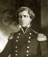
Brigadier General Stephen Kearny (1794-1848) played a pivotal role in the battle.
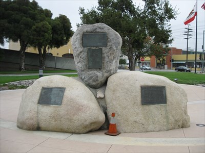
The larger marker for battle. This is located the address for this entry.
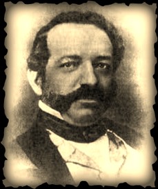
Jose Maria Flores (1818-1866) served as the Governor of Atla California commanded the Mexican forces in defense of the territory during the war.
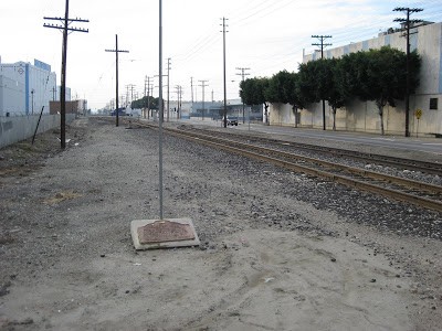
The smaller marker for the battle. Address located at the beginning of overview.
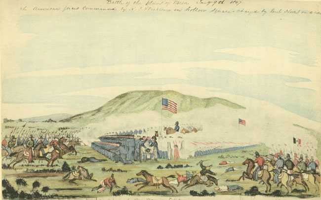
Drawing of Battle of La Mesa made shortly afterward by a soldier who participated. Kearny is seen on a horse, commanding the battle as the Mexicans failed to break through while charging on both flanks of the Americans.
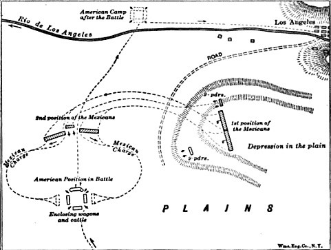
Though referred to as the Battle of San Gabriel map, this sketch outlines troops movements for both sites in La Mesa soon after the Battle of San Gabriel.
Backstory and Context
Text-to-speech Audio
The Battle of La Mesa of the Mexican War occurred on 9 January 1847, in present-day Vernon on, the day after the Battle of San Gabriel during the California Campaign.
Not finding any Californians at Pio Pico's ranch after their victory at the Battle of San Gabriel, the Americans crossed the plain between the San Gabriel River and the Los Angeles River called La Mesa. They encountered Jose Maria's 300-strong force of loyalist Californio militia, including artillery, near where the city of Vernon now stands, about 4 miles south of Los Angeles.
The Californian guns were ineffective, while the American guns responded from their square as the Americans advanced. Flores extended his line and brought up two more guns. Stockton halted and formed his guns into a single battery. After fifteen minutes, Stockton's fire drove the Californian artillery from effective range. Flores sent his lancers against the American left flank but were driven back and most deserted, allowing the Americans to advance into Los Angeles.
The battle was the last armed resistance to the American advance in California, and General Flores returned to Mexico. The conquest and annexation of Alta California (Upper California) was settled with the signing of the Treaty of Cahuenga by US Army Colonel John C. Fremont and Californio General Andres Pico on January 13, 1847.