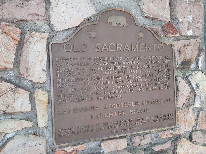
Old Sacramento Historical Marker
Introduction
Text-to-speech Audio
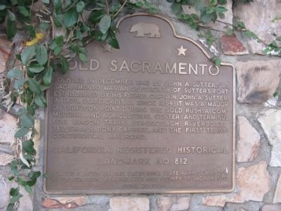
Dedicated in 1966, this historical marker notes the development of the city of Sacramento from its origins as a frontier fort established by Captain John A. Sutter in 1839. Following the discovery of gold in 1848 at Sutter's Mill in the nearby foothills, the site became a commercial hub during the California Gold Rush. As the first three thousand people poured into the area in search of gold, merchants also arrived, opening stores along the Sacramento River to take advantage of the waterfront location. The city first developed as a trading area for gold miners, and unlike many other mining boom towns, the community continued to grow after the initial gold rush. The original 1850s business district, which is known as Old Sacramento, was designated as a National Historic Landmark and a California State Historic Landmark, with the historical marker at this location erected by the California State Park Commission. The marker is adjacent to several others highlighting the history of Old Sacramento as a 19th-century commercial and agricultural center.
Images
Old Sacramento Historical Marker
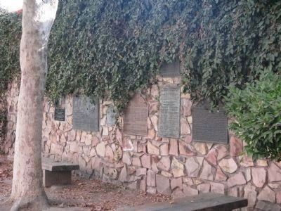
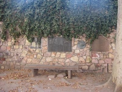
Stone wall with historical markers in Old Sacramento
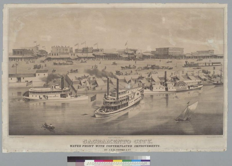
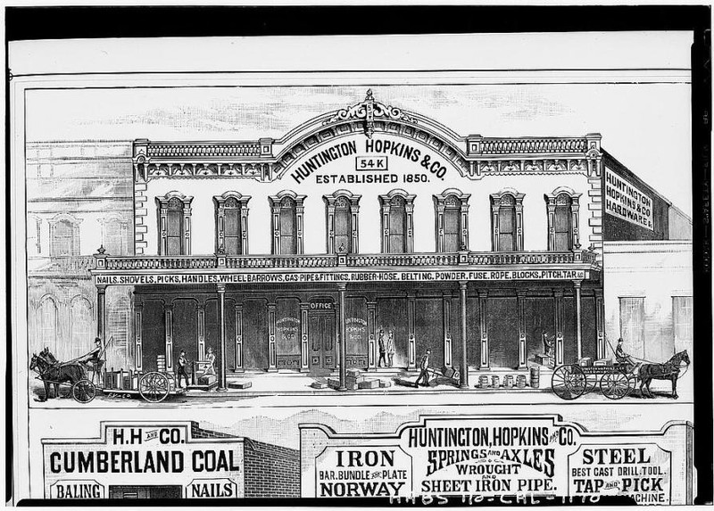
Mid-1800s Old Sacramento waterfront
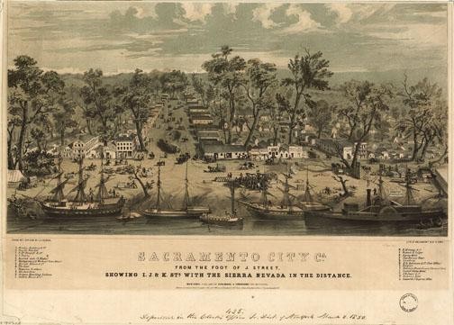
Mid-1800s Old Sacramento
Stone wall with historical markers in Old Sacramento
Old Sacramento Historical Marker
The aftermath of the 1852 Flood in Old Sacramento
.jpg)
Old Sacramento commercial district
Stone wall with historical markers in Old Sacramento

Backstory and Context
Text-to-speech Audio
In the mid-19th century, Old Sacramento's location along the Sacramento River facilitated its emergence as a bustling business district during the California Gold Rush from 1848 to 1855. Yet the Sacramento waterfront was also susceptible to extreme flooding, compromising its location as a commercial center. The area was also struck by several severe fires, during an era when most buildings were hastily constructed from wood or were otherwise temporarily assembled with flammable materials, such as canvas tents, to serve the rapid influx of miners. After two severe floods struck the city in 1850 and 1852, Sacramento embarked on a monumental project that attempted to raise the height of the city above the flood level. Because the proposed project was so costly, it was not until another flood hit the city in 1861 and threatened to destroy Sacramento that the city moved forward to implement the plan.
To complete the ambitious project, wagonloads of dirt were trucked into the city, and the street level was raised through the addition of thousands of cubic yards of earth. Some of the basements of older homes, boardwalks, and historic buildings in Sacramento still show the original street level. Once the project was completed, the commercial center of Sacramento gradually moved east, further away from the waterfront, and as a result, the older section of city began to suffer from economic neglect and dilapidation. Eventually, the original waterfront area, which was then known as Sutter's Embarcadero, became associated with poverty and crime, leading some politicians to call it "the worst skid row west of Chicago." In response, turn-of-the-century reformers sought to improve the area, but few of their efforts were successful, as a new business district had instead formed to the east of Old Sacramento.
During the mid-20th century, amidst a wave of legislation and tax credits aimed at historic preservation, the significance of Old Sacramento was rediscovered, and the area was redeveloped as a historic district, the first of its kind in the western United States. More than fifty historic buildings were preserved, and the site became designated as a National Historic Landmark with a listing on the National Register of Historic Places, in addition to being listed as a California State Historic Landmark. Currently, the twenty-eight acres that comprise Old Sacramento contain a greater density of historic properties than almost any other historic district of a comparable size in the U.S. The waterfront area has also been successfully redeveloped as a bustling commercial and cultural hub with shopping, restaurants, and events, while the Old Sacramento State Historic Park has been developed as a destination for both locals and tourists.
Sources
"History", Old Sacramento Waterfront. Accessed June 20th, 2023. https://www.oldsacramento.com/history.
"The California Gold Rush", PBS. Accessed June 21st, 2023. https://www.pbs.org/wgbh/americanexperience/features/goldrush-california/.
"Old Sacramento State Historic Park", California State Parks & Recreation Department. Accessed June 20th, 2023. https://www.parks.ca.gov/?page_id=497.
Whittle, Syd. "Old Sacramento Historical Marker", Historical Marker Database. September 10th, 2008. Accessed June 20th, 2023. https://www.hmdb.org/m.asp?m=11486.
Syd Whittle / Hmdb
Syd Whittle / Hmdb
Old Sacramento
Old Sacramento
Syd Whittle / Hmdb
Syd Whittle / Hmdb
Old Sacramento
Old Sacramento
J. Makali Bruton / Hmdb