The White House Hotel
Introduction
Text-to-speech Audio
This historic Missouri hotel was built from 1866 to 1868, a period of growth thanks to the expansion of regional railroad networks in the years that followed the Civil War. The hotel was widely considered one of the finest on the Missouri Pacific Railroad Line. In its early years, the hotel was home to "The First and Last Stop Saloon." The original cupola and roof succumbed to a fire that swept through downtown Hermann in 1886, but post-fire reconstruction was swift, and five years later the building was one of the first in the region to offer electricity. Following World War II, travel patterns shifted towards interstate motels and the hotel and building declined, but the structure was saved in the 1970s and reponed to overnight guests in 2022.
Images
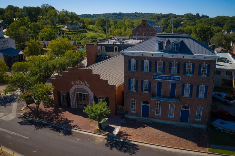
The White House Hotel
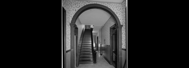
Second Floor Hallway, Looking East
The First and Last Stop Saloon
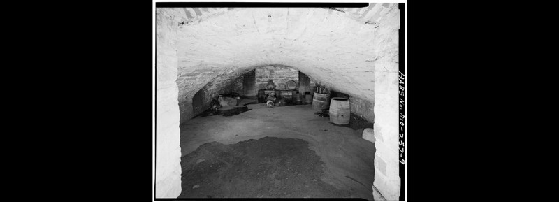
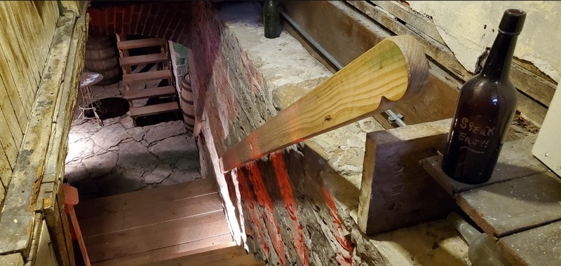
Wine Cellar in Basement
Speakeasy Entrance
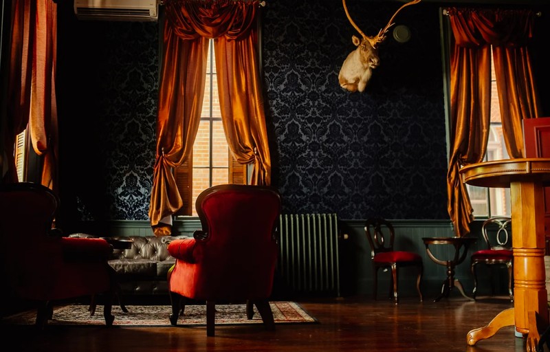
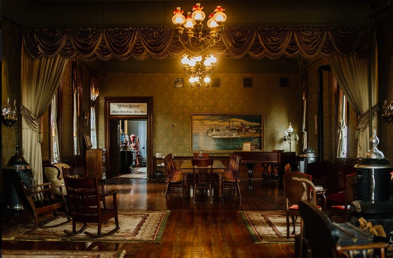
Grand Ballroom
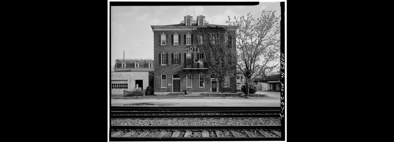
North Front - White House Hotel
Backstory and Context
Text-to-speech Audio
The land where the hotel stands was purchased three years after the new settlement of Hermann was founded on the Missouri River. In 1840, John S. Botterman bought the lot at 232 Wharf Street. One year after the conclusion of the Civil War,Gottlieb Rippstein began construction on the federal-style hotel. The building was finished in 1868 and boasted fine craftsmanship throughout the three-floor brick structure, including a wraparound second-floor balcony, a windowed cupola on the roof for guests to take in the view of the Missouri River; “The First and Last Stop Saloon” on its first floor; and a cellar with an indoor well to draw water. These furnishings helped make the White House “one of the largest and finest hotels found on the Missouri Pacific Railroad Line.”
On July 29, 1886, Gussie Pfautsch, a fifteen-year-old worker in the basement of an adjoining building, set an accidental fire that destroyed the hardware and cutlery store where he was working and severely damaged the White House Hotel just eighteen years after its opening. The hotel’s cupola and roof were destroyed in the fire, known as “The Great Hermann Blaze of 1886,” along with severe damage to the second-floor balcony and woodwork. An insurance settlement partially funded the rebuilding of the hotel just one month later, in August 1886. Much of the furniture was thrown from the windows of the hotel to escape the fire and was replaced in the rebuilding with newer pieces reflecting the Victorian style then current. Electricity came to the White House Hotel in 1898, and a two-story outhouse was installed the same year, forestalling the need for indoor plumbing until 1913.
In the leadup to the Second World War, sailors and soldiers who stopped while their trains were refueled began filling the White House Hotel’s saloon. Their numbers soon outstripped this space, and the grand ballroom was converted into “The Missouri Pacific Railway Dining Hall” in order to feed hundreds of travelers at a time.
The White House fell into disrepair in the 1970s, when the Plummer family bought the building for $37,500. Robert and Judith Plummer prevented the White House from being converted into an apartment building and spent the next 50 years restoring the hotel to its Gilded Age 1886-era glory. The current owners purchased the White House Hotel in 2021, and reopened the building to public tours. In 2022, overnight guests were finally reintroduced to the hotel’s amenities, and the site has once again become a travel destination as well as a place of historical interest.
Sources
Jones, Devry Becker. "White House Hotel", Historical Marker Database. March 25, 2021. Accessed May 20, 2024. https://www.hmdb.org/m.asp?m=169351.
"Last Chance Oktoberfest Celebrations", VisitHermann.com. Oct. 17, 2021. Accessed May 20, 2024. https://visithermann.com/last-chance-oktoberfest-celebrations/
"White House Hotel, 232 East Wharf Street, Hermann, Gasconade County, MO Photos from Survey HABS MO-257", Historic American Buildings Survey. 1933. Accessed May 20, 2024. https://www.loc.gov/resource/hhh.mo0341.photos?st=gallery
"White House Hotel", White House Hotel website. 2021. Accessed May 20, 2024. https://www.thewhitehousehotel1868.com/history.
"White House Hotel, 232 East Wharf Street, Hermann, Gasconade County, MO", Historical American Buildings Survey. 1933. Accessed May 20, 2024. https://www.loc.gov/item/mo0341/
https://visithermann.com/last-chance-oktoberfest-celebrations/
https://www.loc.gov/resource/hhh.mo0341.photos?st=gallery
https://www.thewhitehousehotel1868.com/tours
https://www.loc.gov/resource/hhh.mo0341.photos?st=gallery
https://www.thewhitehousehotel1868.com/tours
https://www.thewhitehousehotel1868.com/tours
https://www.loc.gov/resource/hhh.mo0341.photos?st=gallery