This entry includes a walking tour! Take the tour.
Introduction
Text-to-speech Audio
The Rochelle Park-Rochelle Heights Historic District is comprised of over 270 residential buildings in two neighborhoods in New Rochelle, NY. Rochelle Park, the community’s first residential park, was begun in 1885, and the development of the adjacent Rochelle Heights began in the early 1900s, with the majority of the construction taking place after World War I, in the 1920s. In 1986 the combined neighborhoods became New Rochelle’s first locally designated historic district, which was listed on the National Register of Historic Places in 2005. “Rochelle Park was perhaps the nation’s first suburban enclave within an existing suburban town,” (Robert Stern et al). A walk through the present-day district is like a walk through America of the late nineteenth and early twentieth centuries. The popular architectural styles of the periods are prominent, and a number of homes have been residences of notable individuals.
Images
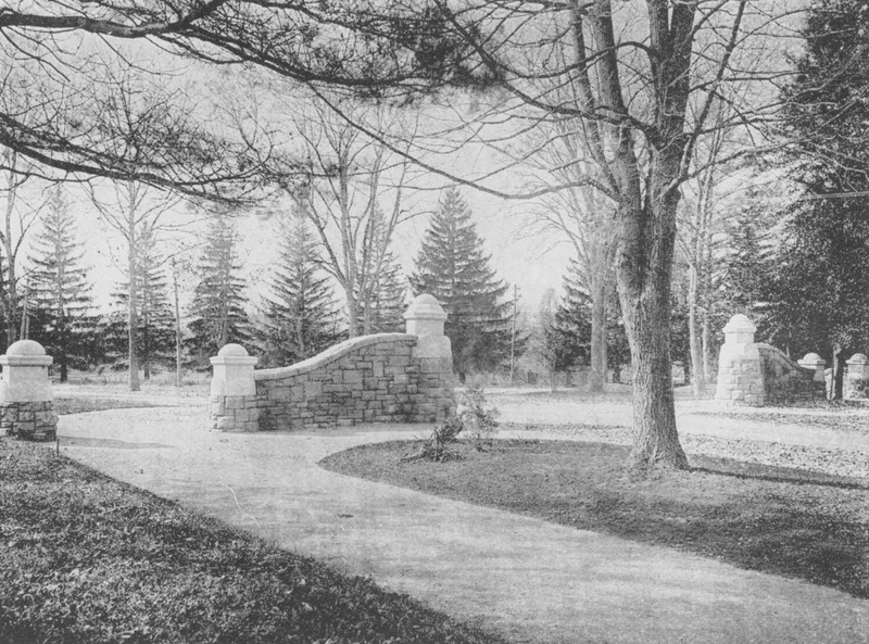
Rochelle Park entrance
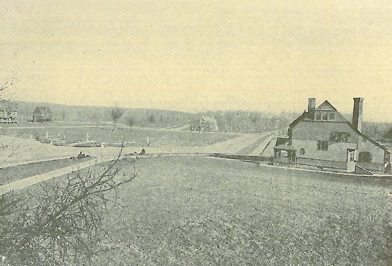
The Lawn, looking east, in 1888
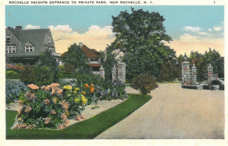
Postcard of Rochelle Hights entrance
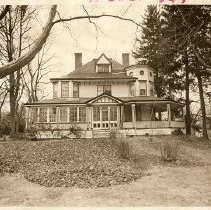
#6 The Boulevard, Rochelle Park
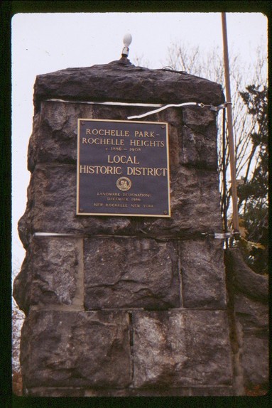
Rochelle Park and Rochelle Heights National Register Plaque
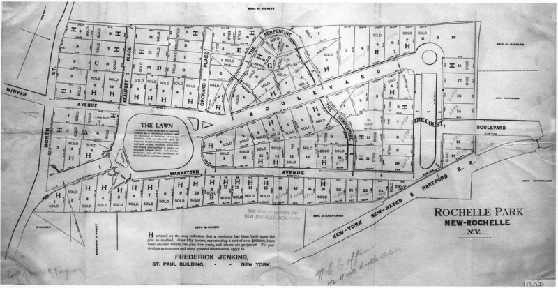
Rochelle Park Map
Backstory and Context
Text-to-speech Audio
Backing up onto North Street (now Avenue) and just to the east of the stone wall that divided the Town of New Rochelle from the Village, Rochelle Park was laid out on land that had been farmed by J. Carpenter until the 1870s, and then owned by Wakeman Hull, whose 70-acre estate was taken by the Manhattan Life Insurance Company through foreclosure proceedings in 1881. The company chose to transform the somewhat rugged territory into a residential park, following the success of Tuxedo Park in New York and Llewelyn Park in New Jersey. A new concept in the second part of the nineteenth century, these early suburban neighborhood developments were “to give the place a character wholly its own, to make it a park, a community, a neighborhood restricted to houses of an established standard, built on plots large enough to avoid crowding," as described in a 1904 House & Garden article. Aesthetically pleasing roadways that highlighted natural topography, common and open areas, setback requirements, a limit to one dwelling per lot, and required membership in a homeowners association, were all part of the formula.
For Rochelle Park, preeminent landscape architect Nathan Barrett was hired to design the streets, open spaces, and lot placements to give the neighborhood a distinctive character in harmony with its natural attributes. Local civil engineer, Horace F. Crosby, drew up the plans that were completed in 1886. Six acres were designed as common areas: “The Lawn” and “The Court” were open spaces that could be used for events by the homeowners. The remaining acreage was divided into 115 house lots. Each owner was required to join the Rochelle Park Association, which maintained the roads and other communal spaces and hired the private police force to secure the “gated” community. Rochelle Park was within easy walking distance to the train station of the New Haven line into Grand Central in New York City.
By 1904 many of the building lots had been sold, the most expensive ones being those along The Boulevard, at about $5,000 apiece. Many prominent individuals were among the early neighbors. The newcomers hired their own architects and most chose to construct "substantial" homes in the popular styles of the day: Queen Anne, Tudor Revival, Classical Revival, and Colonial. The overwhelming success of Rochelle Park led to the development of the adjacent neighborhood, Rochelle Heights, which abutted Rochelle Park’s northern border. The property was the former estate of Wall Street financier George G. Sickles, whose son, former Civil War General, Daniel B. Sickles, hired the New York architectural firm of Mann, MacNeille, and Lindeberg to prepare site plans for the estate, with Horace B. Mann serving as the lead architect. The plans for Rochelle Heights were completed in stages, starting in 1905, yet most construction took place after World War I.
The large homes in Rochelle Park and Rochelle Heights were particularly hard to maintain during the Great Depression, and many homeowners defaulted on mortgages. Several homes were converted into boarding houses. Then, when I-95 was constructed in the mid-1950s, seventeen homes along the eastern side of Manhattan Avenue in Rochelle Park were demolished, as the interstate right-of-way was immediately adjacent to the neighborhood. Property values dropped, real estate brokers stopped showing properties to white customers, and Rochelle Park and Rochelle Heights became primarily African American neighborhoods.
In the 1980s, a majority of homeowners in Rochelle Park and Rochelle Heights joined together to fight for protection as a historic neighborhood. In 1986 it became the first locally designated historic neighborhood in New Rochelle, under the newly enacted local landmark law overseen by the Historical Landmarks and Review Board. This designation provides the district’s 275+ properties with the most protection, as the Board is mandated to regulate all demolition, relocation, new construction, and major exterior alteration of locally-designated sites. The Rochelle Park-Rochelle Heights Historic District was listed on the National Register of Historic Places in 2005. The primary boundaries of the district are North Avenue, Beaufort Place, I-95, Potter’s Avenue, and Fifth Avenue.
Sources
- Brown, Betsy. “Neighborhood Plea.” New York Times, June 23, 1985.
- Brown, Betsy. “When Zoning and Covenants Conflict.” New York Times, May 27, 1984.
- Davis, Barbara. “New Rochelle’s Lifeline, Heritage Can Be Found in Neighborhoods.” Soundings, Gannett Suburban Newspapers. Aug. 14, 1997.
- Davis, Barbara. “Slip Back in Time, See Rochelle Park.” Soundings, Gannett Suburban Newspapers. Oct. 23, 1996.
- Halbfinger, Caren. “There Goes the Neighborhood: Rochelle Park Residents Upset Over New Courthouse, Police HQ Nearby.” Gannett Suburban Newspapers, Nov. 22, 1991.
- Jovanovitch, Milena. “Two Residential Areas Ask Historic Status.” New York Times, Sept. 28, 1986.
- Larson, Neil. “Rochelle Park-Rochelle Heights Historic District, New Rochelle, Westchester County, New York: A Nomination to the National Register of Historic Places, Prepared for Historical and Landmarks Review Board, City of New Rochelle, New York.” 2004. https://nrpl.org/wp-content/uploads/2022/02/Rochelle-Park-Rochelle-Heights-Historic-District-Natl-Reg.-Application.pdf
- “New Rochelle in Pictures.” The Standard Star. 1931.
- New Rochelle on the Sound. John Rosch, publisher. 1903.
- New Rochelle: The City Beautiful. Knickerbocker Press. 1911.
- Panetta, Roger. Westchester: the American Suburb. Fordham University Press. Jan. 28, 2006.
- “Preserved: Rochelle Park and Rochelle Heights Today.” “Profile on Place: New Rochelle’s Landmark District.” “What Is the HLRB? Introducing the Historical and Landmarks Review Board.” The Preserver. New Rochelle Historical & Landmarks Review Board, Spring 1997.
- “Rochelle Park-Rochelle Heights Historic District.” National Register of Historic Places. United States Department of the Interior/National Park Service. 2005. https://catalog.archives.gov/id/75323193
- Stern, Robert, Thomas Mellins, David Fishman. New York 1880: Architecture and Urbanism in the Gilded Age. The Monacelli Press. 1999.
- Swift, Samuel, "Community Life at Rochelle Park." House & Garden. May 1904.
- The New Rochelle Pioneer. Nov. 7, 1885. Page 2.
- Williams, Gray. Picturing Our Past: National Register Sites in Westchester County. Westchester County Historical Society. 2003.
Collection of the New Rochelle Public Library
Collection of the New Rochelle Public Library
Collection of the New Rochelle Public Library
Westchester County Historical Society