Climate Change Plaque
Introduction
Author-Uploaded Audio
Listen to a narration of this entry's description by Nicky Rehnberg.
Text-to-speech Audio
Recommended Time: 10 minutes
From Del Sol, walk towards Storke from El Colegio and walk into UCSB’s West Campus Family Student Housing following the path along the playground fence. Continue walking through the parking lot to the road (passing the apartment complex on your right) which leads down a hill toward the open space. After a couple minutes you will reach the open space and find a large sign that says “Climate Change” attached to a wooden fence post. This place was the beginning of many adventures for me when I lived on campus, and maybe it has been for you, too. While the road that we are going to walk along to reach the beach was created in service of oil companies in Ellwood Devereux, today pedestrians, runners, bikers, CCBER workers, and other animals all make use of this pathway.
Have you ever walked by here before? This is one of my most favorite places and it has changed a lot over the past several years. Not long ago it was occupied by a golf course and has been transformed by CCBER into the restoration site you see today. Land is constantly changing – that is all that land really does or can do – with different forces acting upon it and shaping the landscape and experiences of the flora and fauna that call it home. You can imagine, then, that Ellwood Devereux looked very different a few hundred years ago.
Images
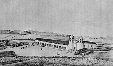
Typical use of farmland and mission buildings, sketched during the mid-19th century
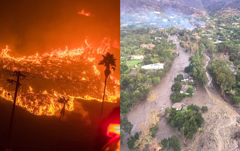
Climate change has helped spurn on both fire and floods that Santa Barbara County have experienced in the last decade
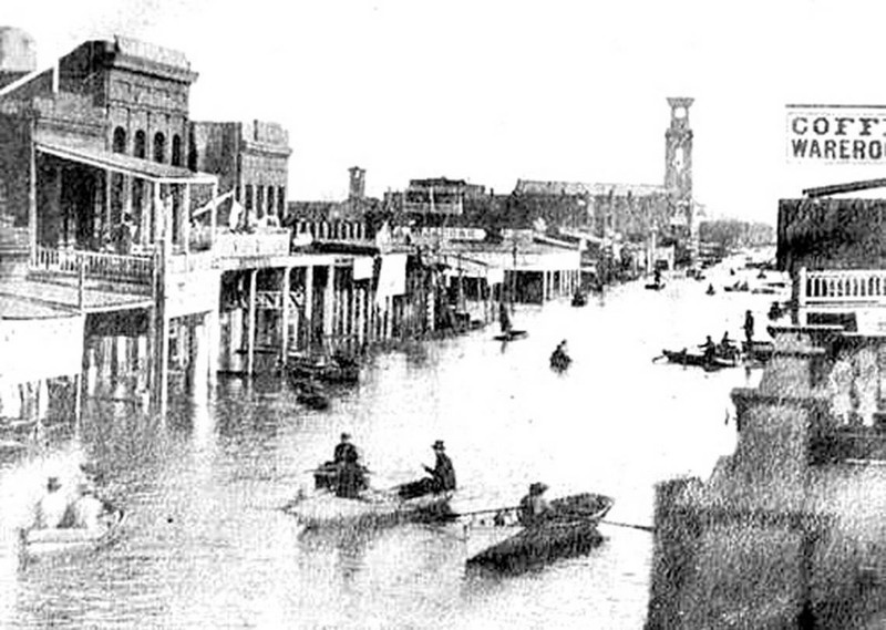
Sketch of the Great Fllod of 1862 in San Luis Obispo, California
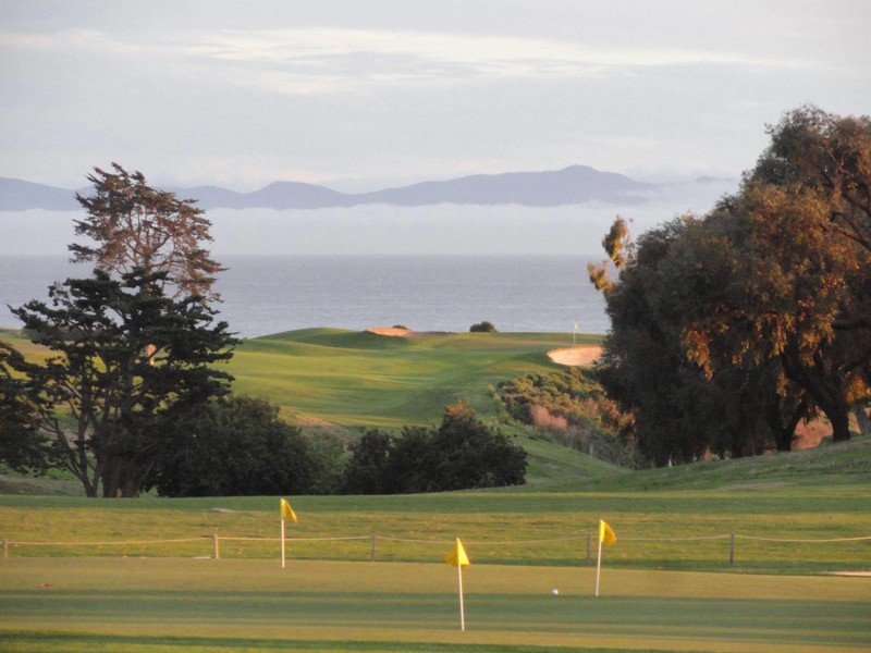
Former Ocean Meadows Golf Course
Backstory and Context
Author-Uploaded Audio
Listen to a narration of this entry's description by Nicky Rehnberg.
Text-to-speech Audio
Climate change refers to long-term shifts in the patterns of temperature and weather that we can observe on a global scale. While the Earth has always experienced fluctuations in global temperature, reflected in the fossil record, presently the climate of our planet is changing more quickly due to anthropogenic (human-centered) climate change. Since 1945, we have been in a period called “The Great Acceleration,” where human activity has fundamentally altered the physical, chemical, and biological systems of the planet. These changes have created potentially irreversible changes in ecological systems, processes, and biodiversity. All of this has led to a new geological period commonly referred to as the Anthropocene.
How has Anthropocene shown up on this part of the California coast?
Today, the unofficial motto of Goleta, the city Ellwood Devereux is in, is “the Good Land.” This is in part because Goleta has surprisingly fertile soil and a mild climate. But climate change has dramatically altered the relationship between water and earth this area that so many flora and fauna call home. The landscape used to look very different. Let’s talk about some of the changes that have happened here.
It is important to recognize that California has not always been in a drought. During the Jurassic Period, water was abundant and thick fog used to roll onto the Pacific Coast of the North American continent, watering the Coast Redwood forest that covered what is now the Santa Barbara coast and the northwestern quadrant of the continent. During the Ice Age, about 10,000 years ago, the Pacific Ocean was at least 200 feet lower than it is now and the land extended approximately five miles to the west and south before hitting the ocean. The Chumash have been adapting to climate change, sea level rise, and the submergence of their coastal lands for thousands of years.
The Great Flood of 1862 transformed several estuaries (brackish coastal water partially enclosed by land) into salt marshes. You can spot the salt marshes if you walk along some of the trails further into the Coal Oil Point Reserve. The coastline itself also constantly changes the appearance of the land, but the more recent work on native grasses by UCSB restoration projects has helped stabilize the coast’s constant erosion. But there are even more concerns.
In the twenty-first century, California focuses on the need for water, with new drought records recorded nearly every year. This sign reminds us that climate change is exceptionally present in Ellwood Devereux. In the face of these changes, local environmentalists have advocated since the 1970s to ensure that Ellwood Mesa does not fall into the ocean due to powerful weather events, overworked soil, and introduced species. These activists have also planned so that Devereux Slough – with its salt marshes, open water, and mudflats, servicing dozens of species of birds – does not shrivel into dust.
There are plenty of reasons why we want to make sure that Ellwood Devereux does not disappear. Most of them have to do with the fact that this place has been home to so much flora and fauna. Keep an eye out the many different kinds of birds – both waterfowl and shorebirds – that call this area home. It would be hard to complete this tour without seeing a handful of different bird species. Depending on the season you may see herons, egrets, hawks, geese, ducks, loons, hummingbirds, owls and more. The mouth of the Devereux Slough, which we will get to in a few stops at Sands Beach, is an overwintering and breeding habitat for the Western Snowy Plover, which has been protected by the Endangered Species Act since 1993. Because of this, the Audubon Society, the premier bird conservation organization in the world, has strongly advocated for Ellwood Devereux and its use as bird habitat.
Exploration Questions
- Is water visible from where you stand right now? What factors do you think influence how much water is present at any given time?
- How would you describe the relationship between the flora, fauna and human built environments in this place today?
- Sketch some views or describe what you imagine this same place looked like during the Great Flood of 1862, during the Ice Age, and during the Jurassic period.
- How many birds have you seen on this tour so far? What are they doing? If you see multiple species of birds at once, how are they interacting?
Sources
Beebe, Rose Marie and Robert M. Senkewicz. “The End of the 1824 Chumash Revolt in Alta California: Father Vicente Sarría’s Account.” The Americas 53, no. 2 (1996): 273–83.
Ferren, Jr. Wayne. Interview with the Author. April 2021.
Kettmann, Matt. "Searching for 200-Year Storms." Santa Barbara Independent. https://www.independent.com/2012/09/06/searching-200-year-storms/
National Park Service, Department of the Interior. Discover Our Shared National Heritage Travel Itinerary: American Latino Heritage. https://www.nps.gov/nr/travel/american_latino_heritage/santa_barbara_mission.html
https://www.nps.gov/nr/travel/american_latino_heritage/santa_barbara_mission.html
Kettmann, Matt. "Searching for 200-Year Storms." Santa Barbara Independent. https://www.independent.com/2012/09/06/searching-200-year-storms/
https://www.google.com/url?sa=i&url=https%3A%2F%2Fwww.sanluisobispo.com%2Fnews%2Flocal%2Fnews-columns-blogs%2Ftimes-past%2Farticle39515184.html&psig=AOvVaw3fy2DxbvbohSOxfVN1VrTp&ust=1681218198288000&source=images&cd=vfe&ved=0CBMQjhxqFwoTCLj-vYmwn_4CFQAAAAAdAAAAABAI
https://www.allsquaregolf.com/golf-courses/california/ocean-meadows-golf-club