Coal Oil Point Pond Trail
Introduction
Author-Uploaded Audio
Listen to a narration of this entry's description by Nicky Rehnberg.
Text-to-speech Audio
Recommended Time: 20 minutes
Let's walk uphill along the road and away from the Climate Change sign. Make sure to pay attention to where you walk. Even though this is a road, you never know who or what you might bump into. On one walk, I bumped into a professor and later a snake (I will not tell you which one startled me more)!
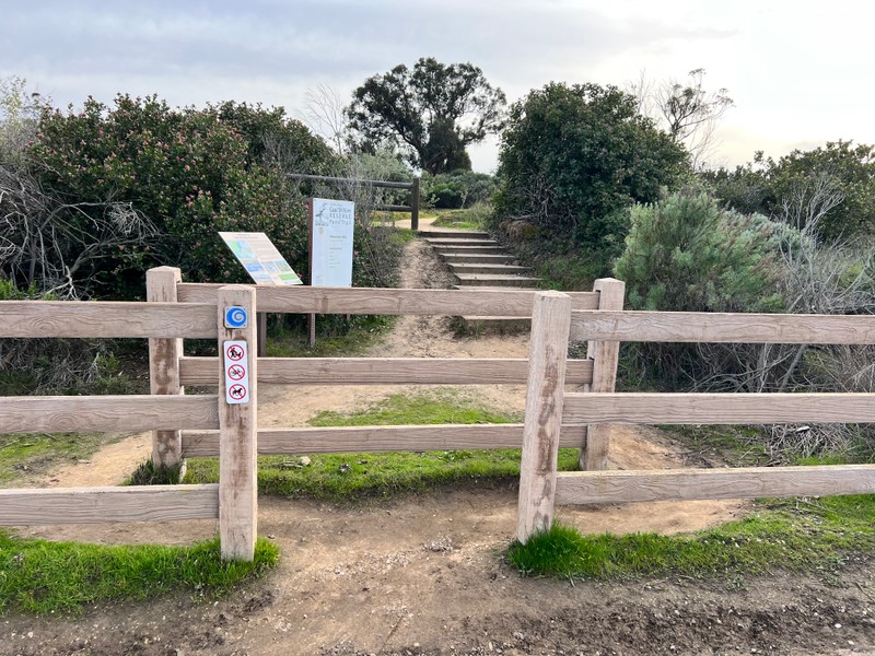
On the left, look for wooden fencing that has an opening to it and a sign that says: “Coal Oil Pond Trail.” That is where we are going to stop. When you see the name “Coal Oil Point,” you may have a similar thought as I did when I first saw it: what do fossil fuels have to do with this place? “Coal oil” is actually a specific kind of oil -- shale oil if we want to get specific. There is a lot of oil off of the coast of Ellwood Devereux
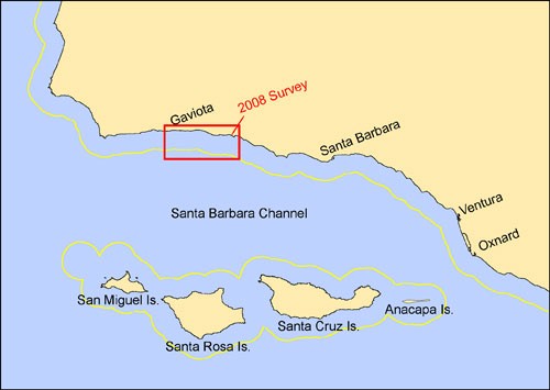
The Santa Barbara Channel, which is what we call the ocean area between mainland of California (from Point Conception to Point Mugu) and the Channel Islands, has many oil seeps within the sea floor. The Channel is also the home to one of the most biologically productive ecosystems on the planet. Because of how it is situated, between the Channel Islands to the north and the mainland to the south, this is known as a transition zone, meaning that it has a lot of species diversity and biomass (which refers to the total weight of organisms)! The latter is, in part, where the oil comes from. The dead organic material goes through a chemical process over time to become oil and then leaks (or seeps) out of cracks in the ocean. The Coal Oil Point seep field is part of this bigger network, and because of its location and productivity, it is one of the most studied oil seeps in the world.
But these reasons are, in part, why this part of the California coast has also been one of the most exploited.
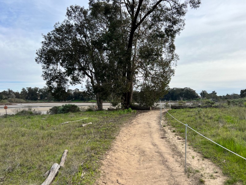
Wander up the trail for about fifteen minutes (as long as you follow the trail, you will not get lost).
Images
Entrance to Coal Oil Point Trail
Coal Oil Point Trail
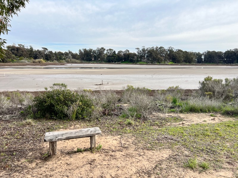
Pond Trail on Coal Oil Point
Map of the Santa Barbara Channel
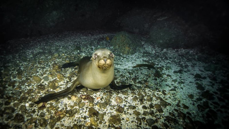
California Sea Lion
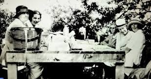
The Campbells and Rusticating Friends
Backstory and Context
Author-Uploaded Audio
Listen to a narration of this entry's description by Nicky Rehnberg.
Text-to-speech Audio
The land that now makes up Coal Oil Point Reserve has a long history, a lot of which we can see when we walk the pond trails. When this area was passed down to Nicolas A. Den’s sons and after California’s statehood in 1850, the land grant Rancho Dos Pueblos was split into smaller parcels of land, which increased the population in the area. Many ranchers during this time were small business enterprises or large families working toward sustaining themselves. That is how the land now known as Goleta began to grow.
The social population began to change with its floral population, but the latter is something we can more clearly see and think about at the next stop (and a few other stops after – I am a plant nerd, and you have been warned).
One of the major social changes to the area after California statehood and the breaking up of bigger land grants into smaller properties was that wealthy European and Euro-American socialites began to flock to Santa Barbara’s shoreline. In 1920, Colonel Colin Campbell bought 500 acres of the land that now makes up Coal Oil Point and the West Campus of UCSB. And while making the land his home, he decided to make some changes.
Campbell was a Scottish career military man in the Central Indian Horse Regiment. He wanted a large amount of land to build a polo field and breed Cairn terrier dogs. This sounds very, very British, don’t you think? Campbell’s wife, Nancy Leiter Campbell, was the daughter of the Marshall Field department store magnate Levi Leiter, so the couple had millions of dollars between them. This could fund lots of changes to the land, and after purchasing the property, Campbell dredged the slough to make a harbor and introduced another invasive species: olive trees. He spent over $1 million (but in today’s dollars that would have cost over $11 million) to build what he considered a perfect house with 30 rooms and 18 bathrooms, with over 20,000 square feet and two stories, in, of course, the Spanish Colonial Revival style that you have likely seen all over Santa Barbara County.
Soon after purchasing the land and to get what is called “a return” on their property’s investment, the Campbell’s leased their land to small oil companies, which began to dot the immediate coast in earnest. The oily history of this area kept growing after this point, and it is something that we will talk about in more detail in a few stops.
Colonel Campbell only lived here for three years, until his death in 1923. His wife Nancy lived here until her death in 1930. They were buried at a large Celtic cross that you can visit at Coal Oil Point Reserve until they were exhumed and moved a few decades later to a family crypt in Washington, DC. Colin Campbell, Jr. and his wife, Elizabeth, moved to the property shortly after. They maintained the “rusticating,” or rural vacationing, life of their parents, establishing a landing strip for friends with airplanes to land from Hollywood.
The Campbells abandoned the property during World War II, fearing an attack on its shores. This was really common in this area, especially after the attack on Pearl Harbor, which was in Hawaii, but on “US” land nevertheless and on the Pacific Ocean. The US military installed US Marine Base Santa Barbara where the Santa Barbara Airport is today, and soldiers’ barracks were installed around Ellwood Devereux.
Oil extraction continued after the war and continues today, but not at Coal Oil Point, as it has been a part of the UC Natural Reserve System since 1970. This was an auspicious year for environmental activism, especially for those who studied the environment and lived around UCSB – we will talk about why in a few stops.
Environmental experts at UCSB viewed the landscape as a treasure trove of biota not as disturbed as others found in more developed parts of the California coast. For decades, there has been interest among environmental scientists, especially connected to UCSB, to preserve the coastal landscape, especially the dune fields and slough. This was because the intertidal zones and adjacent dune fields were at risk because of coastal development following World War II. Environmental experts at UCSB viewed the landscape as a treasure trove of biota not as disturbed as others found in more developed parts of the California coast. The reserve was going to become a field site for botanical research, but the site has a much longer history of that, as we will discuss at the next site!
Exploration Questions
- Would you have guessed there is so much oil in this area? Describe any experience you have had with the oil seeping out of the Santa Barbara Channel, using a different sense (i.e. sight, hearing, touching, smelling, but hopefully not tasting).
- Write a short story imagining yourself as any flora or fauna in the Santa Barbara Channel. Use this source or this source to pick. What would you see? Describe a day in the life of you as this organism.
- Let’s check in: what do you think environmental exploitation means? What does it look like? Can you see any evidence of it as you walk around the Coal Oil Point Pond Trail?
Sources
Coal Oil Point Reserve Management Plan, Report, (UC Natural Reserve System, University of California, Santa Barbara. Santa Barbara, CA, 2004) 129.
Guerrini, Anita. “The Story of the Campbells: From Montecito to Goleta and Back” in Montecito Magazine, Spring-Summer, 2010.
Modugno, Tom. "Attack on Goleta." Goleta History. https://goletahistory.com/attack-on-ellwood/
National Oceanic and Atmospheric Administration: Office of Response and Restoration. "What Are Natural Oil Seeps?" https://response.restoration.noaa.gov/oil-and-chemical-spills/oil-spills/resources/what-are-natural-oil-seeps.html
Pavid, Kate. "What is the Anthropocene and why does it matter?" Natural History Museum (London, UK). https://www.nhm.ac.uk/discover/what-is-the-anthropocene.html
Santa Barbara Channel Keeper. "About the Santa Barbara Channel." https://www.sbck.org/about-us/about-the-santa-barbara-channel/
Photograph by Nicky Rehnberg
Photograph by Nicky Rehnberg
Photograph by Nicky Rehnberg
https://pubs.usgs.gov/of/2009/1289/summary.html
https://channelislands.noaa.gov/visit/what-will-i-see.html
https://www.edhat.com/news/coal-oil-point-campbell-ranch-and-devereux-school