Claverach Park Historic District
Introduction
Text-to-speech Audio
Now home to Claverach Park Historic District, this land was platted in 1922 and named Moorlands Park. The land was re-platted in 1930 and re-named Claverach Park. That first decade saw growth that reflects the era of rapid development in St. Louis County following the 1904 World's Fair's and the transition from streetcar to automobile suburbs. The district encompasses more than 200 dwellings and survives as one of the final projects completed by lauded urban planner and surveyor, the Prussian-born Julius Pitzman. It also stands as a reminder of the prevalence of private place subdivisions developed by individuals who could control the nature of the housing and selling practices. Claverach Park homes had deed restrictions in the 1920s that included minimum building costs and restrictions against non-Caucasian families that assured a community filled with similar residents. Those restrictions were no longer enforceable following the 1948 Supreme Court case Shelley v. Kraemer, and the community formally removed that language from deeds in the early 1990s.

Images
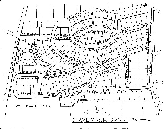
The Claverach Park map
Backstory and Context
Text-to-speech Audio
Claverach Park, in suburban Clayton, has been the county seat of St. Louis County since 1875. In 1895, the St. Louis Country Club moved from Florissant to near Clayton followed by the arrival of the Clayton Electric Railway, which stopped at the country club and downtown Clayton. The 1904 World's Fair and increased streetcars to Clayton (and other parts west of St. Louis proper) also helped the town grow. By 1913, Clayton incorporated. But, the town's most robust expansion occurred in the early 1920s when its population rose from 3,000 people in 1920 to 7,000 in 1925; Claverach Park (platted as Moorlands Park) appeared in 1922 during that growth.
As commercial districts expanded greatly and encroached upon residential districts in cities during the late nineteenth century, suburbs grew more attractive to the middle class; they had the financial means to afford the new housing and the cost of taking trains and streetcars back and forth to the city. Clayton's earliest subdivisions usually consisted of "private place subdivisions," developed privately by individuals who could ostensibly have control of the community environment and its clientele. Private place subdivisions generally consisted of a gated street or neighborhood closed to through traffic (for privacy) and owned and maintained by one of its residents instead of a municipality. Deed restrictions defined building setback lines, minimum building costs, and street association membership, among other things. Julius Pitzman, who designed Claverach Park, attacheded deed restrictions to home sales that limited homeowners.
The Claverach Park name dates back to the mid-nineteenth century. Benjamin Franklin Thomas started a farm in the mid-1850s and named it Claverach, a Welsh word meaning "cloverfield," because of the thick red and white clovers that grew on the farm. Shortly before he died, Thomas divided the farmstead among his children. His daughter, Catharine, and her husband, John Lewis Boland expanded their portion by acquiring adjacent acreage so that by the early 1890s, the Bolands owned approximately 230 acres that extended northward to the streetcar line.
Capitalizing on the popularity of the surrounding subdivisions, Catherine Boland established Claverach Park Realty and Investment Company in 1918 (headed by her son, John L. Boland, Jr.) in anticipation of deeding the family's farmstead for development. In 1921, they sold a tract to the Moorlands Land Company, which became Claverach Park. Moorlands Land Company hired the renowned Pitzman, to design the subdivision in 1921.
Pitzman, who immigrated to the U.S. from Germany as a teenager, was one of the largest proponents of developing private place communities in St. Louis. While working as St. Louis' chief engineer and surveyor, Pittman, oversaw the completion of countless community-design projects in St. Louis City and County, which involved surveying, designing infrastructure, and planning parks, all of which became integral components of his private place subdivision designs. Clayton believed strongly in limiting commerce and industry to city centers. Pitzman quit his government job to form his own company, with his first private development occurring in 1868 with the private development of a subdivision in Lafayette Square in St. Louis city.
Pitzman filed the plat for Moorlands Park in 1922. The original plan included strict building restrictions and high-end amenities such as the best type of paving, gas, water, and sewer utilities. Although most of Pitzman's private place subdivisions in St. Louis City adhered to the city's broader grid plan, his suburban developments routinely departed from that standard design. The Claverach Park design incorporated curving streetscapes that followed the natural landscape rather than altering the natural setting to fit a plan (like a city grid system). Pitzman also incorporated open park-like spaces and tree-lined paths, a feature rarely seen in older city neighborhoods at that time. Moreover, the deed restrictions included minimum building costs so that only the middle and upper classes would build homes in the community. The intended result was a homogenous white and reasonably wealthy community, but the homes also included language known as restrictive covenants that banned the selling of property to non-whites.
For example, a 1922 deed included the following phrase, which was removed seventy years later. “No person not wholly of Caucasian blood shall acquire any estate or interest in any land in said tract, nor be allowed to occupy any building erected therein unless employed as servants in the family of an owner or occupant of any one or more of said lots.” These kinds of racially restrictive covenants were enforceable by law until a 1948 U.S. Supreme Court case.
Initial plans also included building around a central circular three-acre parcel, which held the Boland House occupied by Catherine Boland. However, in 1923, both Boland and Pitzman died, resulting in new plans that included clearing the Boland Family homestead and subdividing the land into a dozen lots. Planners filed a modified plat with the additional twelve lots in 1930, describing the neighborhood's new name: "Claverach Park."
One unique feature attached to the Claverach plans involved an intention to include automobile use by its residents, thus making it an early "automobile suburb" instead of a "streetcar suburb" or "railway suburb," common in the late nineteenth century. As such, residents found Claverach attractive partly because the homes had front driveways (suitable for automobiles), winding streetways that followed the landscape, and because one could enjoy a scenic drive through nearby Forest Park on their way to their Claverach home. So, while many of the residents still relied on streetcars to take them to the city for work or leisure, many of Claverach Park's original residents selected house plans that included garages.
In 1983, after sixty years as a private neighborhood, residents voted to provide the City of Clayton with some control over the community, including approval of a three-year tax to partially pay for new roads, sidewalks, granite curbs, and streetlights; Clayton took over the responsibility of maintaining the subdivision's streets.
Cite This Entry
Powers, Mathew and Clio Admin. "Claverach Park Historic District." Clio: Your Guide to History. May 25, 2023. Accessed April 14, 2025. https://theclio.com/entry/168645
Sources
Keenoy, Ruth, Karen Bode Baxter, et. al. "Registration Form: Claverach Park." National Register of Historic Places. mostateparks.com. 2015. https://claverachparkneighborhood.files.wordpress.com/2016/11/registration-national-register-of-historic-places.pdf.
"Our History." Claverach Park Neighborhood. Accessed May 17, 2023. https://claverachparkneighborhood.com/history/.
McManus, Ruth. “Suburban and Urban Housing in the Twentieth Century.” Proceedings of the Royal Irish Academy. Section C: Archaeology, Celtic Studies, History, Linguistics, Literature 111C (2011): 253–86.
Indenture – Original (1921), Claverach Park Neighborhood. Accessed May 24th, 2023. https://claverachparkneighborhood.com/natl-register-historic-places-2/indenture-original-1921/.
https://claverachparkneighborhood.com/