Gardner Junction
Introduction
Text-to-speech Audio
Gardner Junction is an historic site on Highway 56 about a mile southwest of Gardner, Kansas. A modern park marks the location of the spot where the northern and southern routes of the Santa Fe Trail converged and where the Oregon and California Trails split from the Santa Fe Trail. The junction is named for the nearby town of Gardner, founded as a Free-Stater settlement by Massachusetts immigrants in 1857. Nothing remains of junction today. The National Park Service has installed 6 interpretive signs on trail history in the park.

Images
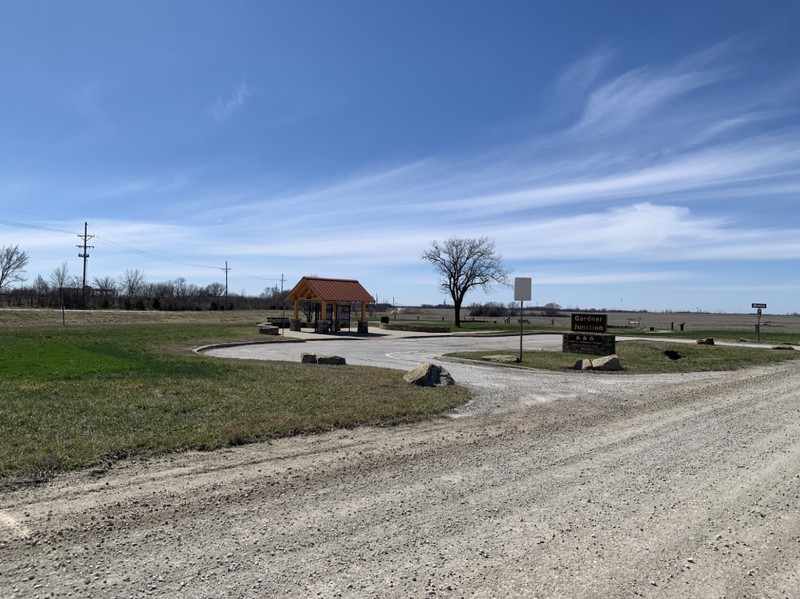
The Gardner Junction Park
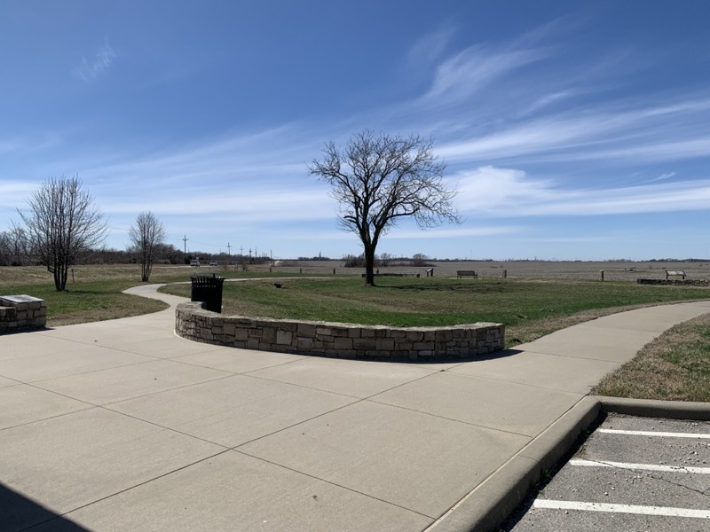
Historic plaza at Gardner Junction Park
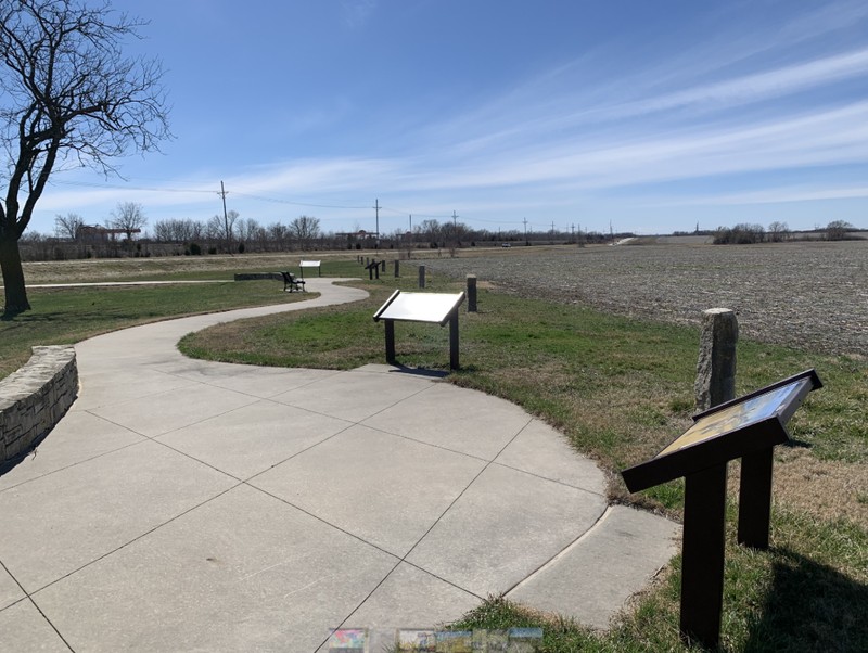
Interpretive Signs at Gardner Junction Park
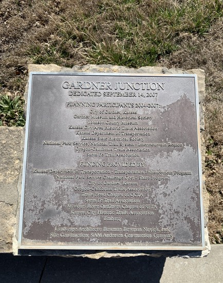
Dedication Plaque at Gardner Junction Park
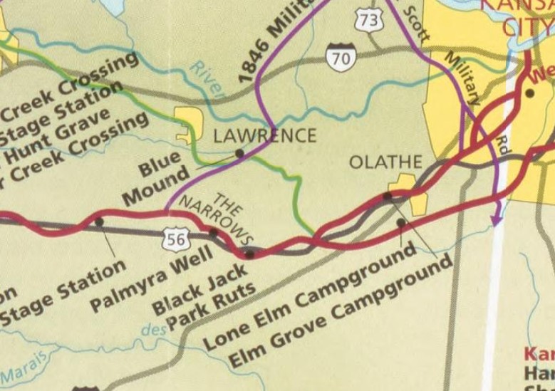
Santa Fe Trails Association Map showing Gardner Junction. The red lines are the Santa Fe Trail. The Green line is the Oregon/California Trail.
Backstory and Context
Text-to-speech Audio
This location was the site of the convergence of the northern and southern routes of the Sante Fe Trail as it left Missouri. The earlier southern route, which originally started in 1821 in New Franklin, and later Independence, Missouri, crossed the Kansas border at about 123rd St. and State Line Rd. in Leawood. It crossed this location as it headed southwest toward Santa Fe. The later northern route from Westport, Missouri travelled southwest through Overland Park and Olathe, Ks. before joining the southern route at this location. This location became a camping and gathering stop on the trail. About 1841, the junction became the southernmost trailhead for the Oregon and California Trails, which headed northwest from this location towards what is today Lawrence, Ks. and beyond. Historical accounts tell of a wooden sign placed at the junction marked “To Oregon.” It is estimated that as many as 500,000 people travelled the California and Oregon Trails between 1841 and 1884, many of them passing through this location.
In 1857, the Free-Stater settlement of Gardner was established on the Santa Fe Trail about a mile northeast of this location, mainly by men from Massachusetts. The settlement was named for Henry Gardner, the Governor of Massachusetts at the time. This historic location came to be known as the Gardner Junction. Gardner’s location near the junction of the trails made it an easy target during the Civil War. It could be attacked from four directions and there were four avenues of escape. William Quantrill led a band of Bushwackers to Gardner on Oct. 22, 1861. They robbed business and loaded stolen wagons with the loot before escaping east on the Santa Fe Trail. Bushwackers raided Gardner twice more during the war and passed through the junction on the morning of August 21,1863 on their way north on the Oregon Trail to Lawrence, where they pillaged the town and killed 150 men.
After the Civil War, as railroads pushed west, the historic trails were abandoned. They were quickly erased by farms and modern roads. Their exact routes were forgotten. Gardner Junction, once an important convergence of the Santa Fe and Oregon Trails, doesn’t even appear in the 1874 Atlas Map of Johnson County, created only a few years after the trail's abandonment.
In an effort to educate the public about the history of the site, the Gardner Junction Park was created in 2008 as a joint project between the National Park Service, the Santa Fe Trail Association, the Kansas Department of Transportation, the Kansas City Area Historic Trails Association, the Kansas State Historical Society, the Johnson County Museum and the City of Gardner, which manages the site. The two-acre park contains a short walking path and 6 interpretive signs provided by the NPS, which outline the history of the trails and the role that Gardner eventually played in the settlement of the west.
Cite This Entry
Wolff, Chris. "Gardner Junction." Clio: Your Guide to History. March 26, 2025. Accessed March 30, 2025. https://theclio.com/entry/190757
Sources
Gardner Junction Park National Historic Trails, Kansastravel.org. Accessed March 25th, 2025. http://kansastravel.org/gardnerjunctionpark.htm#map.
Gardner Junction Park, NPS.Gov. Accessed March 25th, 2025. https://www.nps.gov/places/000/gardner-junction-park.htm.
"New Gardner Park includes educational trails." Kansas City Star (Kansas City, Mo.) November 8th, 2007. .
Caught in the Crossfire: Johnson Cunty and the Civil War, Jocohistory.com. April 23rd, 2015. Accessed March 25th, 2025. https://jocohistory.wordpress.com/2015/04/23/caught-in-the-crossfire-johnson-county-the-civil-war/.
Santa Fe National Historic Trail, Colorado, Kansas, Missouri, New Mexico, Oklahoma, official map and guide., Library of Congress Website. Accessed March 25th, 2025. https://www.loc.gov/resource/g4052s.ct011742/?r=0.561,0.02,0.073,0.042,0.
Blair, Ed. The History of Johnson County Kansas. Lawrence, Ks. Standard Publishing Company, 1915.
Photo Courtesy of Chris Wolff
Photo Courtesy of Chris Wolff
Photo Courtesy of Chris Wolff
Photo Courtesy of Chris Wolff
Santa Fe National Historic Trail, Colorado, Kansas, Missouri, New Mexico, Oklahoma, official map and guide., Library of Congress Website. Accessed March 25th, 2025. https://www.loc.gov/resource/g4052s.ct011742/?r=0.561,0.02,0.073,0.042,0.