District of Columbia North Cornerstone
Introduction
Text-to-speech Audio

Images
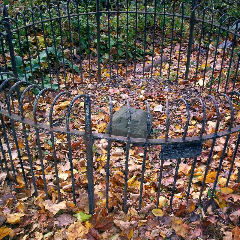
North Corner Boundary Marker of the Original District of Columbia. Image by zhurnaly (Mark Zimmerman) on Flickr/Wikimedia Commons (CC BY 2.0)
Backstory and Context
Text-to-speech Audio
On July 16, 1790 (amended March 3, 1791), the Residence Act granted President George Washington authorization to choose a 100-square-mile plot of land to serve as the nation's capitol. It was to be located on the Potomac River, between the cities of Alexandria, Virginia and Williamsport, Maryland. Washington selected the southernmost location, which encompassed what is now Old Town Alexandria and a busy port.
Once Washington has chosen the site, Secretary of State Thomas Jefferson instructed Major Andrew Ellicott, a prominent surveyor, to begin demarcating the 10-mile square of the city limits. Work on the project began February 11, 1791. Ellicott hired the Maryland astronomer and surveyor, Benjamin Banneker, to provide the astronomical observations and calculations needed to fix the south corner. The Masonic Lodge of Alexandria, Virginia commemorated the completion of the initial survey on April 15th by placing a small, ceremonial stone at the southernmost location.
The marker stones were quarried from Aquia Creek, Virginia and weighed approximately half a ton. The cornerstones were larger than the intermediate stones. Each of the markers are separated by about one-mile, with those placed more than a mile apart featuring an additional marking indicating the extra distance. On the side facing D.C. territory is the mile number and the inscription, "Jurisdiction of the United States." The opposite face features the name of the state the stone borders. The other sides state the magnetic variance of their location and the year the stone was set in place.
Thirty-six of the marker stones are still in situ, or close to their original location. Many of them are extremely weathered, as they were constructed from relatively soft sandstone. The North Corner Boundary Marker of the Original District of Columbia is still extant and marks the northernmost point of Washington, D.C. It lies on the 1880 block of East-West Highway (south side); between Washington, D.C. and Montgomery County, Maryland; and indicates the border between the two regions.
In 2011, the District of Columbia geographic information system (G.I.S.) program used Global Positioning and contemporary survey technology to validate the efforts of Ellicott's team. It found that the historical surveying effort had been conducted with a high level of accuracy. Owing to the historical significance of these markers, this stone was among those added to the National Register of Historic Places on November 1, 1996.
Cite This Entry
Admin, Clio and Genna Duplisea. "District of Columbia North Cornerstone." Clio: Your Guide to History. July 19, 2020. Accessed March 22, 2025. https://theclio.com/tour/1446/10
Sources
"Boundary Stones of the District of Columbia." Boundarystones.org. Accessed October 1, 2016. www.boundarystones.org/. "Boundary Markers of the Original District of Columbia." Wikipedia, the Free Encyclopedia. Accessed October 1, 2016. https://en.wikipedia.org/wiki/Boundary_Markers_of_the_Original_District_of_Columbia.
https://en.wikipedia.org/wiki/National_Register_of_Historic_Places_listings_in_western_Washington,_D.C.#/media/File:Boundary_Stone_(District_of_Columbia)_North_Stone.jpg