Federal Boundary Stone: Southwest 1
Introduction
Text-to-speech Audio

Images
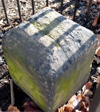
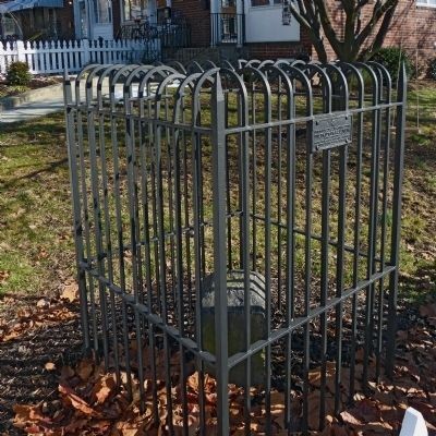
This boundary stone was one of a series of stones that marked the original boundary of the District of Columbia.
Backstory and Context
Text-to-speech Audio
The original District of Columbia was larger than it is today. Today the western boundary extends along the Potomac River but initially it extended from Alexandria to Falls Church. As such, the District was, back then, fully in the shape of a square. The passage of the Residence Act of 1790 authorized President George Washington to choose a 100-acre site on the Potomac River to establish a capital city. He selected this location because he wanted to include Alexandria, which was at the time one of the young country's busiest ports. Work got underway in February 1791 was completed in 1792. Major Andrew Ellicott, a professional surveyor, was tasked with the job. He hired astronomer Benjamin Banneker, an African American, to make astronomical observations and calculations to mark the first marker at the southernmost point (this is another Clio entry).
Cite This Entry
M., Ben and Genna Duplisea. "Federal Boundary Stone: Southwest 1." Clio: Your Guide to History. July 19, 2020. Accessed March 22, 2025. https://theclio.com/tour/1446/6
Sources
"Original Federal Boundary Stone SW 1." The Historical Marker Database. Accessed August 19, 2019. https://www.hmdb.org/marker.asp?marker=72932.
"SW1." Boundarystones.org. Accessed August 19, 2019. http://boundarystones.org/view.php?stone=SW1.
The Historical Marker Database
The Historical Marker Database