Cross Lake: Before it was Rest Lake
Introduction
Text-to-speech Audio
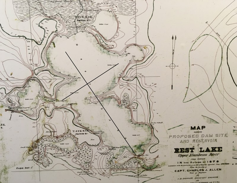
For thousands of years, Indigenous communities like the Ojibwe prized the rich resources present in our lakes, streams and forests. In 1846, geologist A. B. Gray traveled to our community, documenting his discoveries in a detailed journal and map. Fortunately, his expedition's documents were published in the U. S. Congressional Record, delivering unique insights regarding Manitowish Waters. Gray discovered that a Lac du Flambeau Chief named White Thunder lived on Cross Lake. His wigwams, garden, and other belongings were located on a high point of land that created one arm (peninsula) of the "cross." Most modern residents and tourists are unaware that Fox Island was a peninsula before there was the Rest Lake Dam. White Thunder's seasonal residence was likely located on the western tip of Fox Island and washed away from the dam's rising waters. After a newer Rest Lake Dam was completed by 1902, researchers claimed that Fox Island was 20 acres. Modern GIS mapping of Fox Island claims the island is a little over 9 acres. Importantly, White Thunder remains the earliest documented resident of Manitowish Waters.
Images
1878 Map of Rest Lake published by the Army Corps of Engineers. The cross was added to illustrate how well pre-dam Rest Lake fits A. B. Gray's description.
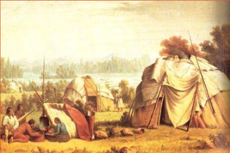
Ojibwe summer village, similar to the one described by A. B. Gray.
Highlighted travel from 6 Pause Portage to Cross Lake

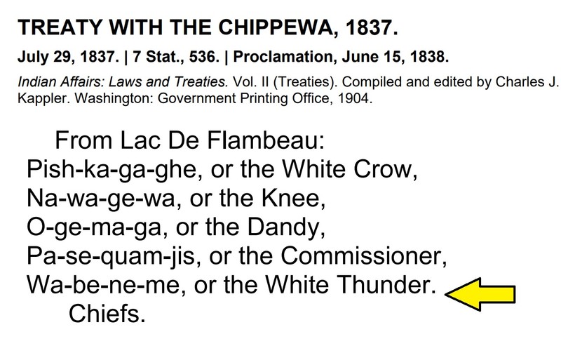
1837 Treaty or Pine Treaty with the Chippewa
Backstory and Context
Text-to-speech Audio
How “Cross Lake” became “Rest Lake” is unknown. By 1878, the name had changed to Rest Lake. The legacy of White Thunder as the first documented resident in Manitowish Waters is clearly cited in 1846 by geologist A. B. Gray: “Our course up the river for about 10 or 15 miles, to this lake, was easterly, although the stream curved around in every direction, occasionally opening into small and picturesque lakes, surrounded by high land, with excellent pineries, and narrowing again to a width barely sufficient for the passage of a canoe. In the evening we entered ‘Cross’ lake from the river - so called by the Indians from its resembling a cross in shape - and encamped upon a high point of land jutting out and forming one of the arms of the cross. Upon this point are two large wigwams and several acres of ground cleared and cultivated, being the summer residence of ‘White Thunder,’ a tall and athletic looking Indian.”
White Thunder and other Ojibwe chiefs who signed the 1837 Treaty were highly impactful. The Treaty of 1837 was the first to secure Treaty Rights for the Ojibwe in the Northwoods and set precedent for all future treaties. The Treaty Rights of the Ojibwe to hunt, fish and gather on ceded territory makes the Ojibwe unique compared to many Indigenous communities and empowers the Ojibwe today. Ojibwe often mention that their decisions (like treaties) are based on the needs of seven generations into the future. Ojibwe also resisted the removal process to the west of the Mississippi River in later treaties, establishing large reservations like Lac du Flambeau.
Today, Rest Lake's footprint is much larger due to the Rest Lake Dam. As you travel through Rest Lake, it is relatively easy to envision Fox Island as a peninsula in lower water, revealing the cross shape that A. B. Gray document way back in 1846.
Sources
TREATY WITH THE CHIPPEWA, 1837. July 29, 1837. | 7 Stat., 536. | Proclamation, June 15, 1838. Indian Affairs: Laws and Treaties. Vol. II (Treaties). Compiled and edited by Charles J. Kappler. Washington: Government Printing Office, 1904.
U.S., Congress, House of Representatives, The War Department. Mineral Lands on Lake Superior. House Doc. 211. 29th Congress, 1st sess., 1846.
Manitowish Waters Historical Society
Manitowish Waters Historical Society
Report taken from the Journals of A.B. Gray -1846 29th CONGRESS Doc. No. 211. House. of Representatives. 1st Session . War Dept. War Dept. , MINERAL LANDS ON LAKE SUPERIOR
TREATY WITH THE CHIPPEWA, 1837. July 29, 1837. | 7 Stat., 536. | Proclamation, June 15, 1838. Indian Affairs: Laws and Treaties. Vol. II (Treaties). Compiled and edited by Charles J. Kappler. Washington: Government Printing Office, 1904.