Pleasant Plain (Ghost Town)
Introduction
Text-to-speech Audio
Founded in 1875, Pleasant Plain (also called Nixville or Niptight) used to be a booming town with several businesses, churches, and a schoolhouse with both elementary and high school classes. Its post office existed from April 1875 until February 1905. But, like many small towns it fell victim to the automobile. And, Pleasant Plain's demise was hastened by the closure of its high school and the depletion of many of Jefferson Township's oil wells. It was de-platted in 1928, and all that stands today is a small cluster of farms.
Images
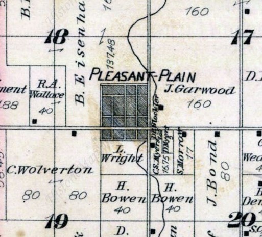
Pleasant Plain in 1879
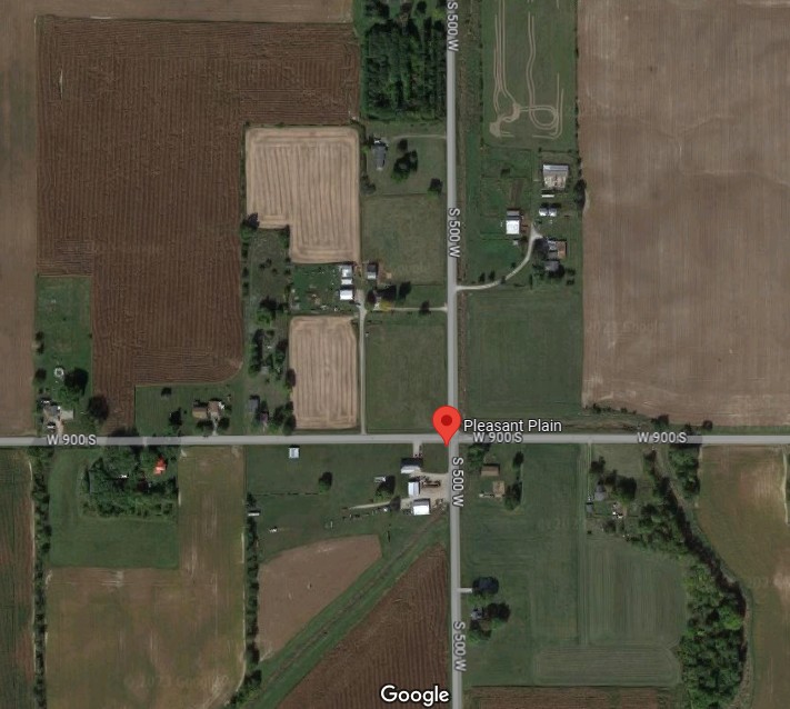
Modern Aerial of Pleasant Plain
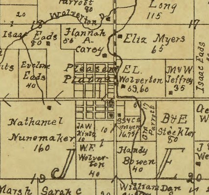
Pleasant Plain in 1903
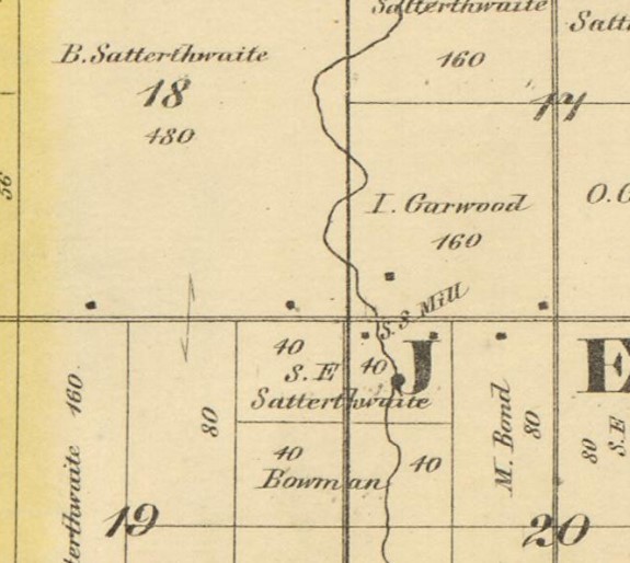
Pleasant Plain in 1866
Backstory and Context
Text-to-speech Audio
The origins of Pleasant Plain date to the founding of a Friends (Quaker) Church in 1870. Originally it was called Nixville after the founder Charles Nix whose wife was a daughter of Benny Satterthwaite, the owner of the land in 1866. Another nickname was Niptight (occasionally spelled Niptite), whose origins are unknown but may arise from the saying: 'he could take a nip [of alcohol] and get tight if he wished."
The town was officially founded in 1875 with the filing of the first plat, and the application for a post office. At that time it became Pleasant Plain. It is the only village ever platted in Jefferson Township with the exception of portions of Mt. Etna. The post office operated from April 1875 until Feb 1905.
As time passed and the town thrived during the oil boom. At one point there multiple blacksmiths, several general stores, a doctor, a barber, a sawmill, a drugstore, an ice cream shop, and a two-story brick schoolhouse. The latter was an early graded school in the county and part of it became Jefferson Township's first high school in 1894 – 1905. Classes would have been in the second room of the two-room school building. After the closure of the high school in Pleasantville, Jefferson Township remained without a one until 1924 when a K-12 township school was built two miles east at the township's center. Until then, students wishing higher education had to travel to a neighboring township's school. So, most finished schooling after eighth grade. At one time, there was also a “singing school," which in 1892 had over twenty students (this may have been part of the combined church Sunday Schools held at that time).
The town also featured 3 churches: The Wesleyan Church, The Friends Church, and the Methodist Episcopal Church. The Wesleyan Church sold their parsonage in 1901. The Friends Church was "Laid down" (disbanded) in 1917, and the Methodist Episcopal Church was closed in 1926 when it merged with the Otterbein church and relocated to the center of Jefferson Township.
In May 1928 the Beedy family filed a petition in the county's circuit court asking to vacate (abolish) the plat of Pleasant Plain. They owned the land that encompassed all of the former town and had begun farming it. In order to make future sales of that portion of their property easier, they wanted to vacate the plat. This would allow them to sell the land "occupied by streets and alleys" as well as the former lots as a single parcel. Their petition was granted, and the village officially ceased to exist.
Cite This Entry
Kirby, Sarah A. V.. "Pleasant Plain (Ghost Town)." Clio: Your Guide to History. August 14, 2023. Accessed April 27, 2025. https://theclio.com/tour/2503/8
Sources
- Ghost Towns of Huntington County. 1971. Doris Chambers, p90-98
- 'Request Filed to Abolish Pleasant Plain, a Town that Hoped to be City.' Huntington Press, 3 May 1928, p8.
- Community news: 'Warren base ball boys went to Niptight Sunday." Warren Tribune, 8 Oct 1909, p7
- 'Pleasant Plain Only Shadow of Once Booming Oil Town.' F. S. Bash. Huntington Herald, 6 Nov 1926, p1-2.
- Ancestry.com. U.S., Appointments of U. S. Postmasters, 1832-1971 [database on-line]. Provo, UT, USA: Ancestry.com, 2010. Original data: Record of Appointment of Postmasters, 1832-1971. NARA Microfilm Publication, M841, 145 rolls. Records of the Post Office Department, Record Group Number 28. Washington, D.C.: National Archives
- History of Huntington County, Indiana: A Narrative Account. 1914. Frank Sumner Bash. Chicago: Lewis Pub. Co., p104, 162-3
- Huntington County, Indiana History: Township by Township. 2004-2005. Jean Gernand.
- Map of Huntington Co., Indiana. 1866. Warner, Hayes & Warner. Ligonier, Ind.: E.B. Gerber & C.S. Warner.
- Combination Atlas Map of Huntington County, Indiana. 1879. Kingman Bros.
- Huntington County, Indiana. 1903. Herman Taylor, Warsaw, Ind.: National Map Co. Rockford, Ill.: Hixson Map & Litho. Co.
- Modern aerial photo. Google Maps. Intersection of 1200S and N 1100E. https://www.google.com/maps/place/Pleasant+Plain,+IN+46792 Accessed 14 Aug 2023.
1879 Combined Atlas of Huntington County
Google Maps
1903 Map of Huntington County
1866 Map of Huntington County