Santa Fe Trail Marker #16; Burlingame, Kansas
Introduction
Text-to-speech Audio
This is the sixteenth of 96 markers placed by the Kansas Chapters of the Daughters of the American Revolution from 1906 to 1908. This series of historical markers traces the route of the Santa Fe Trail through the State of Kansas. The town of Burlingame was chosen because it was second in importance only to Council Grove for trade on the Santa Fe Trail. The trail's significance to the city's founding can still be seen in the extra-wide streets that were designed to facilitate a complete turn of a wagon. The Osage County Old Settlers Association chose the original location for the stone, which was the site of the town’s well at Topeka Ave and Santa Fe Avenue just east of its current location near the city's history museum, which was constructed in 1902 and served as a public school for nearly a century. The school (now a museum) stands at the site of Osage County's first courthouse, reflecting Burlingame's centrality and growth in the mid-19th century before the county seat moved to nearby Osage City. The marker was dedicated on June 19, 1907, in a ceremony that also honored Mrs. Fannie Geiger Thompson, who proposed the idea of marking the Santa Fe Trail but perished before the project was completed. The marker was moved to this location in 1961 as part of the town's celebration of Kansas's centennial. Established initially as Council City in 1855, Burlingame is named in honor of abolitionist Anson Burlingame, who visited the town in 1857 and delivered an anti-slavery speech that so impressed the residents that they renamed their community in his honor.

Images
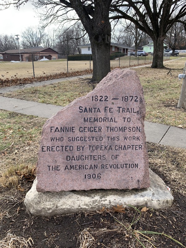
Santa Fe Trail Marker #16 at its current location, on the school grounds at the southwest corner of Dakotah and Santa Fe Ave.
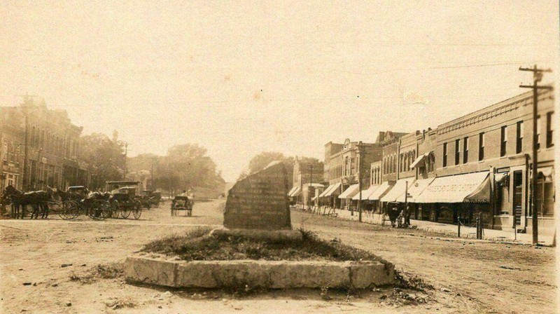
Santa Fe Trail Marker #16 at its original location in the center of Burlingame, Topeka Ave and Santa Fe Ave.
The DAR marker in its original location in the center of Burlingame
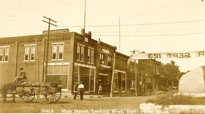
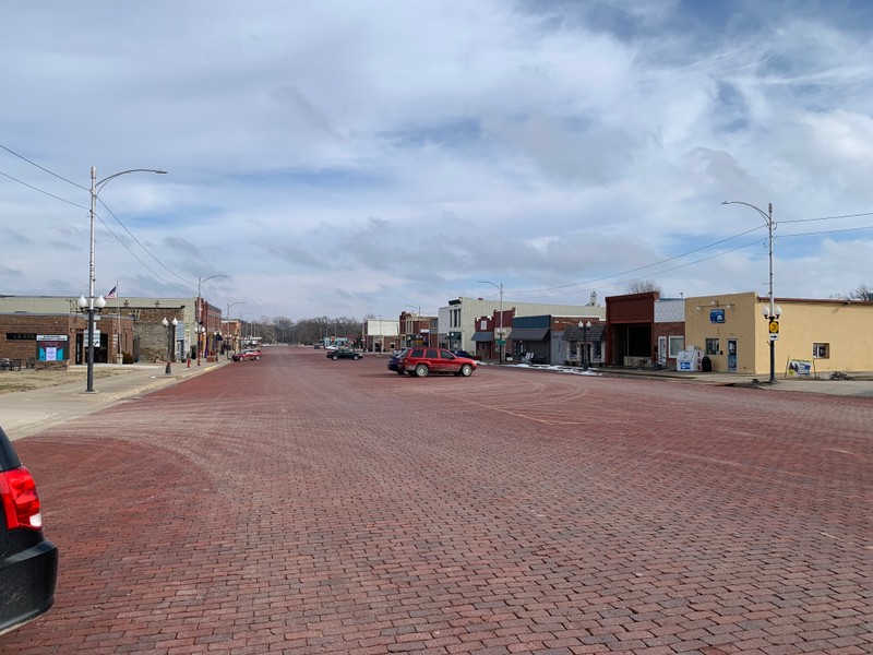
Downtown Burlingame today
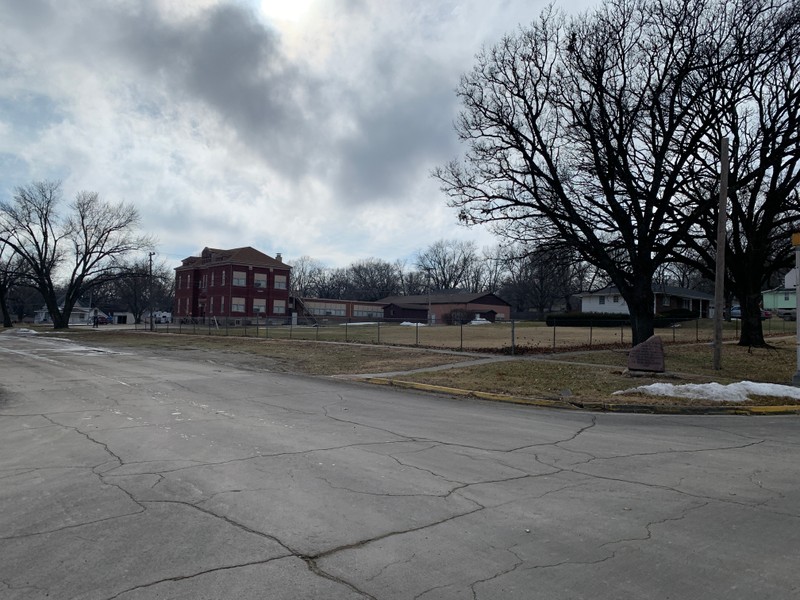
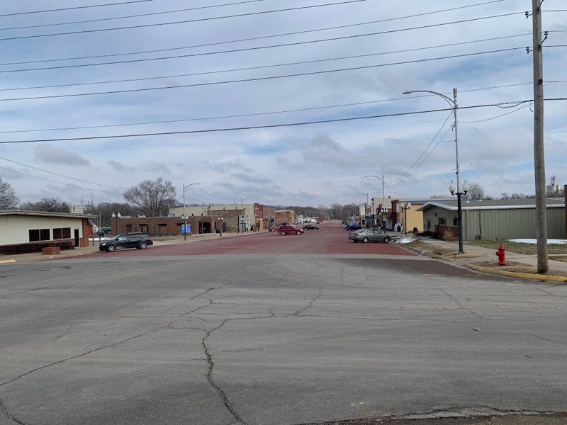
Downtown Burlingame viewed from the Santa Fe Trail marker at Dakotah and Santa Fe Ave.
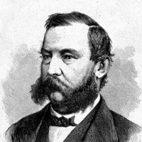
Anson Burlingame
Backstory and Context
Text-to-speech Audio
History of this Marker
The marker was dedicated with a grand ceremony on June 19, 1907, attended by most of the city of Burlingame. The members of the Topeka Chapter of the Kansas Daughters of the American Revolution were in attendance, as were members from chapters around the state. Mrs. M.M. Miller, president of the Topeka chapter, gave a lengthy address in honor of Mrs. Thompson that outlined the organization’s project. Her address was later published in the Burlingame Enterprise newspaper. There were also addresses by the mayor, officials from the state historical society, and several “old settlers,” who told tales of their lives on the trail. The festivities were punctuated with the singing of patriotic songs and a picnic lunch.
The marker was originally installed in the town center at the intersection of Topeka Avenue and Santa Fe Avenue. This had been the location of the original town well. It was later moved in 1961 to its present location as part of celebrations for the Kansas Centennial. The marker is adjacent to the former Schyler School, now a local history museum.
Short History of Burlingame and its Namesake, Anson Burlingame
Since 1827, a bridge built by John Switzler and funded by the army crossed Switzler Creek at this location on the Santa Fe Trail. It was here in 1854, shortly after Kansas was opened to settlement that Phillip Schuyler and Samuel Caniff located claims just west of the Switzler Bridge. A town company looking to establish a proposed town called Council City decided to locate it on their claims. Soon, a steam-powered sawmill was built in the center of the proposed town, and the town began to grow around it with stores, hotels, churches, and houses.
In 1857, a new survey was done to enlarge the town. That same year, famous abolitionist and one of the founders of the Republican Party, Anson Burlingame, visited the town and gave an anti-slavery speech that so moved residents that they renamed the town Burlingame in his honor. The previous year, Anson Burlingame had risen to fame after accepting a challenge to a duel by the pro-slavery South Carolina Congressman Preston Brooks. Brooks made the challenge in response to Burlingame's anti-slavery speech in which he called the South Carolinian a coward for attacking the elderly Charles Sumner on the floor of the Senate in May 1856. When Brooks did not show up to the duel he initiated, Anson Burlingame became a symbol of courage and integrity among Northerners and anti-slavery advocates. Burlingame was appointed as a diplomat to China by Abraham Lincoln during the Civil War. After the war, Burlingame negotiated a treaty based on mutual self-interest for both nations centered on the concept of equality of both nations, beneficial trade, and a more welcoming stance towards immigrants.
The city of Burlingame grew rapidly as a center of trade on the Santa Fe Trail, which was the main street of the town. The extra wide span in the center of town was to facilitate the traffic of wagon trains and to provide space for them to turn around if needed. It became second only to Council Grove in importance to the trail trade and contained numerous stores, blacksmiths, wagon shops and other businesses needed to maintain the wagon trains. The city well in the center of downtown provided clean water in the driest of times.
Burlingame was a center for abolitionists, which drew the ire of pro-slavery forces during the Bleeding Kansas period. During the Civil War, a large number of its men, including African American residents of the area, enlisted in the Union Army. A small fort was built at Burlingame around the town well, with armed citizens, including the occasional townswoman, stationed to protect the town from Bushwackers, in particular, “Bloody” Bill Anderson, who had once lived in neighboring Morris County and had threatened to burn the town. Considering the number of towns in eastern Kansas that Bushwackers sacked during the war, it was a threat that Burlingame took seriously. According to the city's mythology, the whole population of the town could have fit within the fort if necessary.
After the war, Burlingame became a stop on the Atchison, Topeka, and Santa Fe Railroad, which reached the town in 1869. At this point, Burlingame became the jumping-off point for the trail trade for a short time. Soon, the railroad extended further west, and traffic on the Santa Fe Trail dwindled before ending altogether. Nevertheless, the railroad had secured Burlingame’s future and gave it its motto, “Where rail meets trail.”
Mrs. Fannie Geiger Thompson (1857-1903)
D.A.R. leader Fannie Geiger was born in Ohio in 1857 and moved with her family to Topeka in 1867. She attended Bethany College in Topeka and, after graduating, married Dr. Alton H. Thompson in 1875. The couple had two children, including a daughter, Isabel, who died at 9 years old in 1897. Following the death of their daughter, Mrs. Thompson joined the various clubs for women in Topeka, including the Daughters of the American Revolution, where she devoted herself to their work. She was elected State Regent for the organization in 1901 and learned of the work other state chapters across the country were doing to raise money for the marking and preservation of historic sites. It was her desire that the Kansas Chapters collaborate on a project to mark places significant to Kansas History. This was the genesis of her proposal in 1902 that the Kansas Chapters of the Daughters of the American Revolution should commission stone markers to trace the route of the Santa Fe Trail in the state. Unfortunately, Mrs. Thompson passed away in 1903 before her proposal was formally accepted. However, the DAR moved forward with the project, and the Topeka Chapter financed this marker to honor her contributions.
History of the 96 Santa Fe Markers of Kansas
One of the tenets of the Daughters of the American Revolution is “To perpetuate the memory of the spirit of men and women who achieved American Independence, by the acquisition and protection of historical spots, and the erection of monuments.” With no sites directly associated with the American Revolution in the State of Kansas, the four Kansas chapters of the D.A.R. explored how they might support this mission while contributing to some local projects, such as the Zebulon Pike monument in Republic County. Prior to their state conference in 1902, the organizations hadn’t spearheaded a project of their own. At that conference, leaders proposed an ambitious project to mark the route of the Santa Fe Trail through Kansas, and they announced their plans the following year. The trail saw a rapid decline in use following the completion of the transcontinental railroad and other rail routes, and had been completely abandoned by 1872. As a result, most of the trail's route had been lost to time, and many parts we covered by modern roads or home to farms and towns. With much of the former trail lost, the Daughters of the American Revolution worked to rediscover its route, a task made even more difficult by the fact that travelers along the trail often took slightly different paths.
Over the next few years, a committee of D.A.R. volunteers consulted old maps and interviewed original settlers to ascertain the original route of the trail. As word of the project spread, D.A.R. members received many letters from locals offering to help. Their assistance was invaluable, especially in the western sections, where the trail split into northern and southern branches. From their research, they commissioned their own map detailing the route through each county. By 1904, the D.A.R. was ready to petition the state legislature for funding. D.A.R. members worked with various women's clubs in each of the communities through which the trail passed to determine the best locations for markers. They also determined the size and format for the markers, a bronze plaque on a red granite boulder sourced from Oklahoma. Their inspiration for this model marker was the Santa Fe Trail marker in Kansas City, Missouri’s Penn Valley Park. While they initially hoped to craft unique markers that shared the history of each of the 96 sites, cost constraints and the limited space for text led them to chisel the same inscription on the face of each monument.
Even with the economy of scale in producing 96 identical markers, their budget for the project averaged $20 per marker to cover construction and installation. A state appropriation of $1000 would only support half of that amount, so D.A.R. members appealed to Kansas school children, asking that they each donate a penny to the cause. This raised another $700. A few private individuals also sponsored the stones in their communities, and Douglas County paid for its five stones. The markers were constructed and delivered throughout 1906 and early 1907. A team of workers was arranged ahead of time in each community to receive and install the stone at the prescribed location. Each dedication was a cause for celebration for the various communities. In all, the D.A.R. had successfully delivered and installed 96 stone trail markers across the entire length of the Santa Fe Trail in Kansas in just two years. This is the sixteenth of those 96 markers and was financed by the Topeka Chapter of the organization.
Cite This Entry
Wolff, Chris and Clio Admin. "Santa Fe Trail Marker #16; Burlingame, Kansas." Clio: Your Guide to History. February 12, 2025. Accessed March 23, 2025. https://theclio.com/tour/2796/18
Sources
"The Santa Fe Trail Marker." Peoples Herald (Quenemo, Ks.) June 27th, 1907. .8.
"Fannie Geiger Thompson." Burlingame Enterprise (Burlingame, Ks.) June 27th, 1907. .1.
Kansas Society Daughters of the American Revolution. The Century Survey of the Kansas Santa Fe Trail DAR Markers Placed by the Kansas Society Daughters of the American Revolution in 1906. Topeka, Ks. Kansas Society Daughters of the American Revolution, 2010.
Cordry, Mrs. T.A.. The Story of the Marking of the Santa Fe Trail. Topeka, KS. Crane & Company, 1915.
The Other Burlingame....Kansas, Burlingame voice. November 10th, 2019. Accessed February 8th, 2025. https://www.burlingamevoice.com/2019/11/the-other-burlingamekansas.html.
Hidden History: Burlingame always open to friends of freedom, osagecountyonline.com. May 20th, 2016. Accessed February 8th, 2025. https://www.osagecountyonline.com/archives/21587.
Alexander, Kathy . Osage County, Kansas Santa Fe Trail, Legends of America. January 1st, 2025. Accessed February 8th, 2025. https://www.legendsofamerica.com/ks-santafetrailosco/.
Blackmar, Frank W.. Kansas: a cyclopedia of state history, embracing events, institutions, industries, counties, cities, towns, prominent persons, etc.. Volume III. Chicago, Ill. Standard Publishing, 1912.
Cutler, William G.. History of the State of Kansas. Chicago, Ill. A.T. Andreas, 1883. Accessed online, 2/7/2025, KanColl.org, https://www.kancoll.org/books/cutler/osage/osage-co-p5.html
Photo Courtesy of Chris Wolff
Photo of Burlingame, Osage County, Ks., Wichita State University, Special Collections website, accessed 2/7/2025, https://specialcollections.wichita.edu/kw/images.asp?xfile_name=kw_burlingame_osage_ks1.jpg
Hill, John, Burlingame History Geeks Facebook page, accessed 7/7/2025, https://www.facebook.com/groups/822972174952068/search/?q=dar%20marker
Photo Courtesy of Chris Wolff
Photo Courtesy of Chris Wolff
Harper’s Weekly, May 30, 1868