Santa Fe Trail Marker #17, Dragoon Crossing & Havana Stage Station
Introduction
Text-to-speech Audio
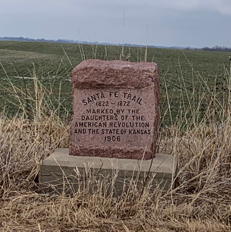
This is the seventeenth of 96 markers placed by the Kansas Chapters of the Daughters of the American Revolution between 1906 and 1908 to trace the route of the Santa Fe Trail through the State of Kansas. This site was chosen by the Osage County Old Settlers Association owing to the significance of two nearby sites, the trail crossing of Dragoon Creek, and Havana Stage Station. The ruins of the former stagecoach station are still visible today and located on the south side of 31 Highway, about 150 yards southeast. Trail ruts are visible in the fields to the south of 31 Highway and are marked by a sign. This marker sits back from the highway along the fence line and is easy to miss. It is on the north side of 31 Highway, across from the trail ruts sign.

Images
Santa Fe Trail Marker #17
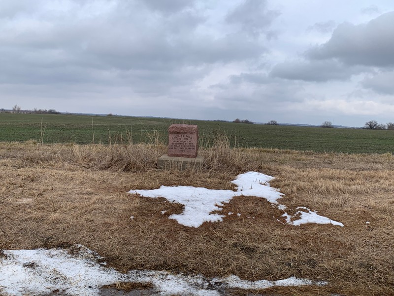
Santa Fe Trail Marker #17. The Marker sits far off the road and can be obscured by tall grass
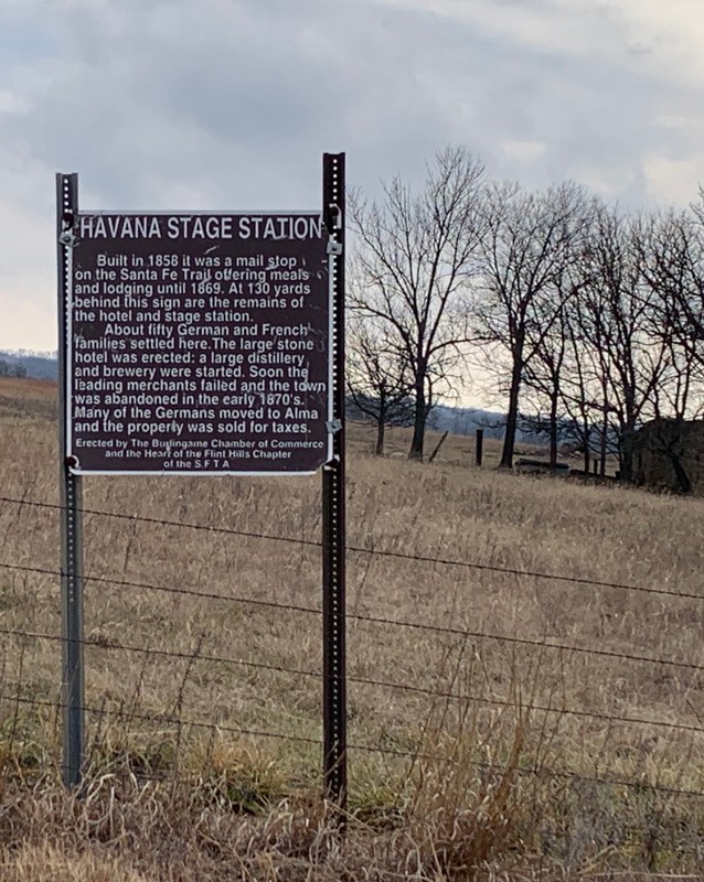
Havana Station interpretive sign on the south side of 31 Highway, just past S. Davis Road. The station ruins are visible in the background.
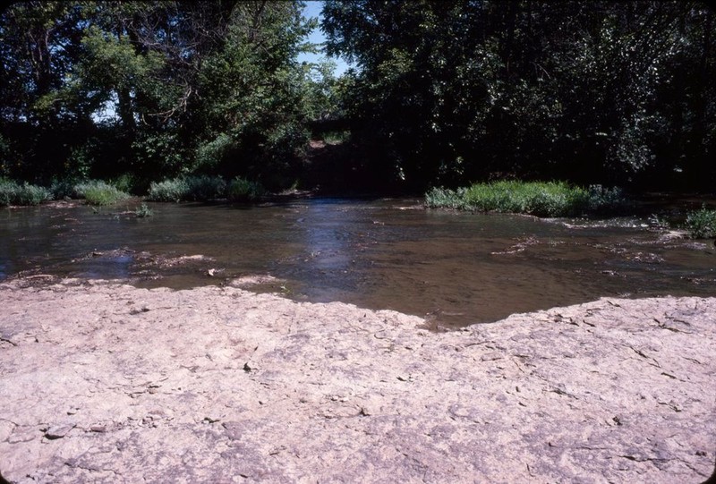
The spot known locally as "Rocky Ford" is one of the possible locations of Dragoon Crossing.
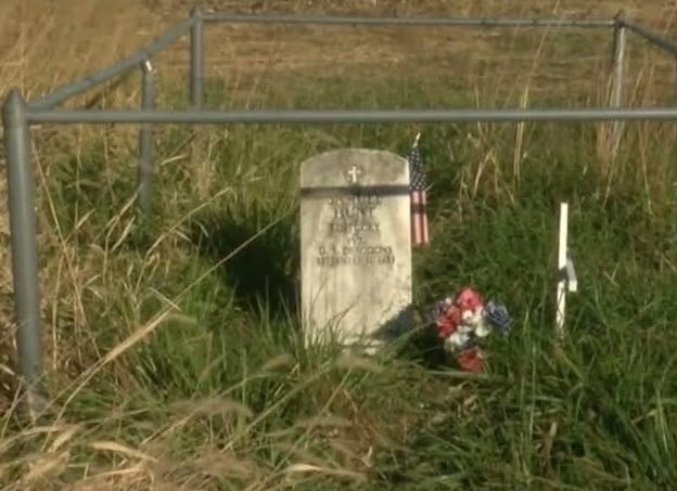
The grave of Private Samual Hunt
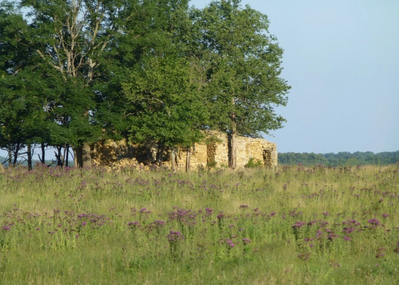
The ruins of Havana Stagecoach Station
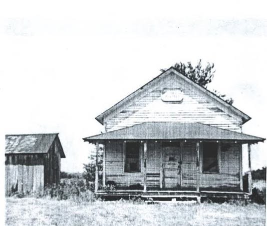
The Havana School. This building has been incorporated into a house at 31 Highway and S. Davis Rd.
Backstory and Context
Text-to-speech Audio
This marker was dedicated on July 20, 1907 by the Osage County Old Settlers Association. Contemporary newspaper articles suggest that the location was chosen to mark the location of the Havana Stage Station, an important stop on the trail. No mention of the Dragoon Creek Crossing is mentioned and its association with the marker was likely assumed later. One article mentions that the funds to pay for the marker’s installation had not been raised at the time of its dedication, which likely explains why there is no mention of a community celebration associated.
Three miles west of Burlingame, the Santa Fe trail crossed Dragoon Creek at a spot where a natural rock outcropping made fording easy. The creek is supposedly named for a group of soldiers out of Fort Leavenworth, commonly referred to as “Dragoons,” who travelled the Santa Fe Trail on an expedition to the Rocky Mountains in 1835. One of the soldiers, Private Samuel Hunt, passed away at age 23 while the company camped along the creek on their return voyage. They buried him on the spot and his grave has since been marked. The exact spot of the Dragoon Creek Crossing is a matter of debate. The location of the crossing on a 1856 map lacks the natural rocky outcropping described in contemporary accounts. A site proposed by the National Park Service, known locally as “Rocky Ford,” does have a solid rock bottom but the west bank is very steep and would have been impractical. The most recent archaeological survey of the area in 1995 was not able to determine positive proof supporting either location.
The Havana Stage Station is located on the south side of 31 Highway, about 150 yards southeast of this marker. The ruins, which are inaccessible and located on private land, can be seen from the road. An interpretive sign marks the location. The station was constructed in 1856 when a group of German immigrants platted out a townsite named Havana. About 50 families settled in the area, which grew to include a store and a small hotel near the station. A schoolhouse was built years later on the north side of 31 Highway. The Havana Stage Station provided a place for stagecoaches to exchange horses or mules for the next leg of the journey, along with food and lodging for travelers. The stagecoach stop operated until about 1869, when the completion of our rail lines caused traffic on the trail to dwindle before stopping altogether. Most of the families moved on to Alma, Kansas.
Today the ruins of the Havana Stage Station still stand and can be seen from 31 Highway. The most recent archaeological investigation in 1995 identified the foundations and remains of other buildings at the site as well as the surviving pump on the town well.
Cite This Entry
Wolff, Chris and Clio Admin. "Santa Fe Trail Marker #17, Dragoon Crossing & Havana Stage Station." Clio: Your Guide to History. February 9, 2025. Accessed March 23, 2025. https://theclio.com/tour/2796/19
Sources
King, Marsha. Archaeologists Investigate Santa Fe Trail Sites in Osage County. Kansas Preservation News, vol. 17, no. 44 - 5. Published July 1st, 1995. https://www.kansasmemory.gov/item/198458/page/844.
"Another Santa Fe Trail Marker." Osage City Free Press (Osage City, Ks.) August 1st, 1907. .8.
"There was no meeting." Osage County, Chronicle (Osage City, Ks.) July 25th, 1907. .6.
Kansas Society Daughters of the American Revolution. The Century Survey of the Kansas Santa Fe Trail DAR Markers Placed by the Kansas Society Daughters of the American Revolution in 1906. Topeka, Ks. Kansas Society Daughters of the American Revolution, 2010.
Cordry, Mrs. T.A.. The Story of the Marking of the Santa Fe Trail. Topeka, KS. Crane & Company, 1915.
Staresinic-Deane, Diana. Exploring the Santa Fe Trail: Osage County, Kansas, dianastaresincindeane.wordpress.com. Accessed February 9th, 2025. https://dianastaresinicdeane.wordpress.com/tag/dragoon-creek-crossing/.
Photo Courtesy of Chris Wolff
Photo Courtesy of Chris Wolff
Photo Courtesy of Chris Wolff
Hill, John, Burlingame History Geeks Facebook Page, accessed 07/07/2025, https://www.facebook.com/groups/822972174952068/search/?q=havana%20stage
Hill, John, Burlingame History Geeks Facebook Page, accessed 07/07/2025, https://www.facebook.com/groups/822972174952068/search/?q=havana%20stage
Staresinic-Deane, Diana. Exploring the Santa Fe Trail: Osage County, Kansas, dianastaresincindeane.wordpress.com. Accessed February 9th, 2025. https://dianastaresinicdeane.wordpress.com/tag/dragoon-creek-crossing/.
Hill, John, Burlingame History Geeks Facebook Page, accessed 07/07/2025, https://www.facebook.com/groups/822972174952068/search/?q=havana%20stage