Oregon Railway and Navigation Company Railroad Bridge
Introduction
Text-to-speech Audio

Images
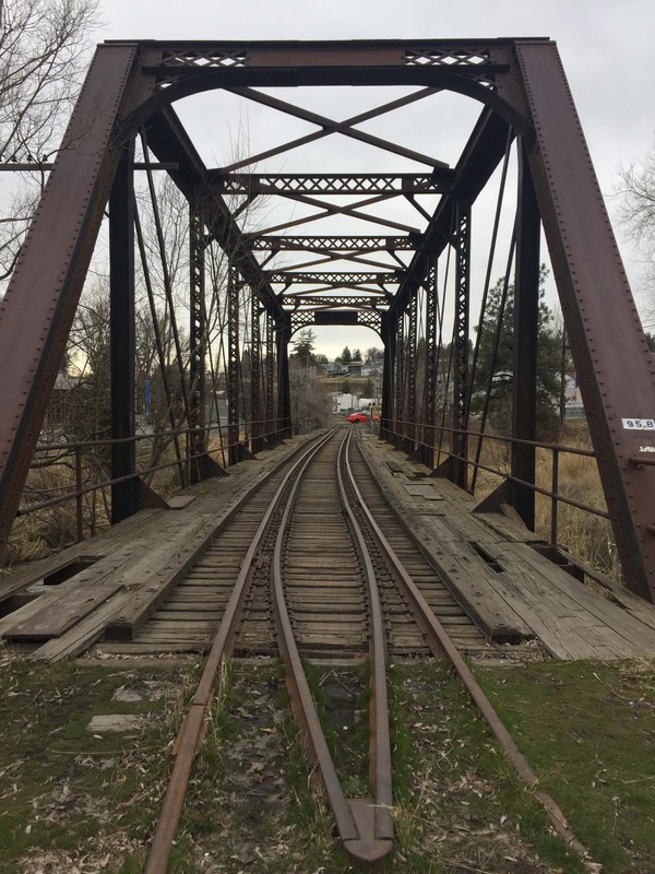
View looking through the bridge and down the tracks, taken February 2018.
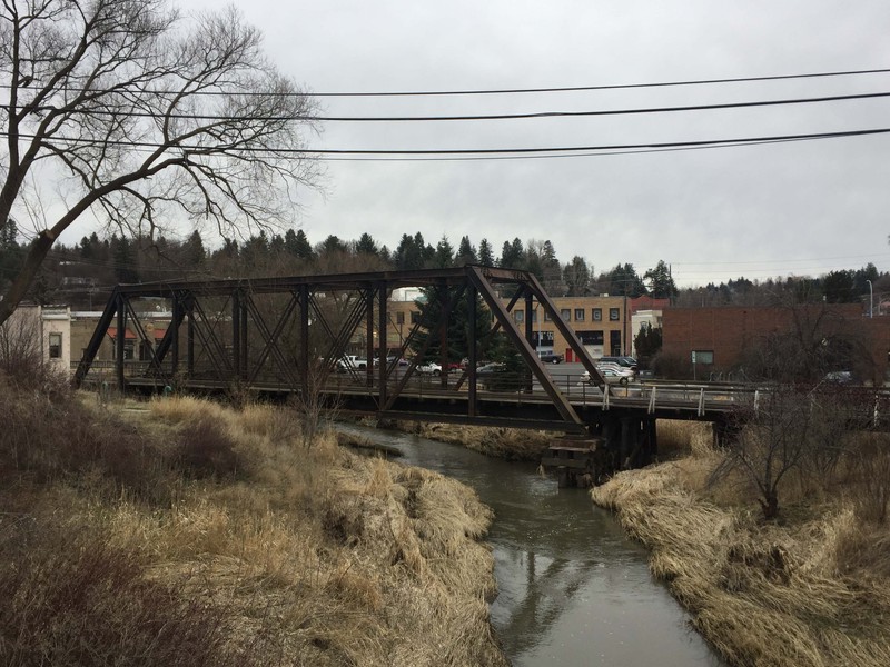
View looking back at the bridge, taken February 2018.
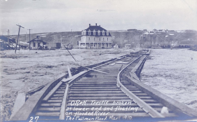
Looking west at the former Union Pacific Depot, with the Oregon Railroad & Navigation Trestle broken at the lower end and floating in flooded Palouse River in 1910. Taken by Robert Burns. Courtesy WSU Special Collections. http://content.libraries.wsu.edu/
Backstory and Context
Text-to-speech Audio
The Oregon Railway and Navigation Company Railroad was the first rail line to arrive in Pullman. A subsidiary, the Columbia and Palouse Railway laid additional track and ran the first train, which arrived in Pullman on September 8, 1885. This railroad was an extension of the Portland to Wallula line, and was continued incrementally eastward between 1881 and 1885, first with an extension from Walla Walla to Riparia and Bolles to Dayton in 1887, then from Connell to Colfax in 1883, and from Colfax to Pullman in 1885.1 By 1900, the Oregon Railroad and Navigation Company became a subsidiary of the Union Pacific and, over time, the Union Pacific completely absorbed the company.2
This bridge was constructed in ca. 1900 to span the South Fork of the Palouse River. The bridge is a steel Pratt through-truss bridge; through-truss refers to the type of bridge and Pratt refers to the style of truss. Truss bridges feature numerous small structural members which form a series of interconnected triangles. The design of through-truss bridges allow them to carry heavier traffic loads.
Engineer Thomas Pratt (1812–1875) designed the Pratt truss in 1842 and received a joint patent with his father, Caleb, in 1844 (patent no. 3523). The Pratt truss grew in popularity over the years and became the most popular bridge type in the United States for railroad and highway spans less than 250 feet.3
The bridge was damaged during the flood of 1910, the largest recorded flood event since the settlement of the city, when the South Palouse River flooded and destroyed bridges, buildings, and streets in downtown Pullman. The region had experienced heavy snowfall during the winter and cold temperatures had kept snow on the ground since December. A Chinook wind blew warm, dry air into the area, quickly melting the snow.4 During the flood, a building collapsed onto the Kamiaken Street bridge, heavily damaging it; the bridge then crashed into the Oregon Railroad & Navigation trestle.
When walking along the Riverwalk path near the Oregon Railroad & Navigation trestle, look for the small and easily overlooked Scout’s Park just above the intersection of Dry Creek and the South Fork of the Palosue River. It is widely believed that these waterways—along with Missouri Flat Creek that feeds into the South Fork of the Palouse River just to the north—inspired early European-American explorers to establish a townsite near this location. Years of sporadic flooding led city engineers, in 1990, to place much of Dry Creek in culverts underneath South Grand Avenue. Visitors to Scout’s Park can view several walking tour sites from the park benches.
Cite This Entry
Katie Pratt on behalf of City of Pullman. "Oregon Railway and Navigation Company Railroad Bridge." Clio: Your Guide to History. March 6, 2018. Accessed April 18, 2025. https://theclio.com/tour/438/6
Sources
2. The Oregon-Washington Railroad & Navigation Company,” The Pacific Northwest Chapter, National Railway Historical Society, https://www.pnwc-nrhs.org/hs_or_n.html (accessed January 26, 2017).
3. Parsons Brinckerhoff and Engineering and Industrial Heritage, “A Context for Common Historic Bridge Types: NCHRP Project 25-25, Task 15,” prepared for the National Cooperative Highway Research Program, Transportation Research Council, National Research Council (October 2005), http://onlinepubs.trb.org/onlinepubs/archive/NotesDocs/25-25(15)_FR.pdf, 3-25.
4.“Bridges Crushed and Buildings Carried Away by Angry Water,” The Pullman Herald, March 4, 1910: 1.