Grand Glaise (Jackson County, AR)
Introduction
Text-to-speech Audio
There is a sign on the side of the road traveling between Bradford and Newport, AR and it says Old Grand Glaise Public Access White River that represents so much of the community. Grand Glaise is located a few miles north Possum Grape and was another community that made up the Glaize Township. Grand Glaise was at one time the epicenter on commerce for the community of Possum Grape and its own. This is community played a important role in the surrounding area not only because of its strategic setting for the Civil War but also the fact that the White River it was settled on was once full of rich resources for the area. Grand Glaise was community that hit hards times but the community was willing to work together to back on their feet. In twenty-first century the Grand Glaise community is an important part of Jackson County and Arkansas history because of its rich history in the economic role it played for not only Arkansas but for Jackson County. Today the town is still very much a part of the community and residents in the area are very proud of their heritage that came out this place even though it was later combined as a part of community of Bradford, AR in the census records.

Images
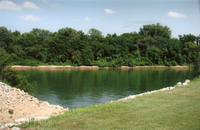
The view of the White River from Old Grand Glaise
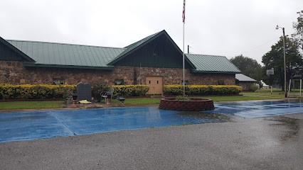
Old Glaise Missionary Baptist Church
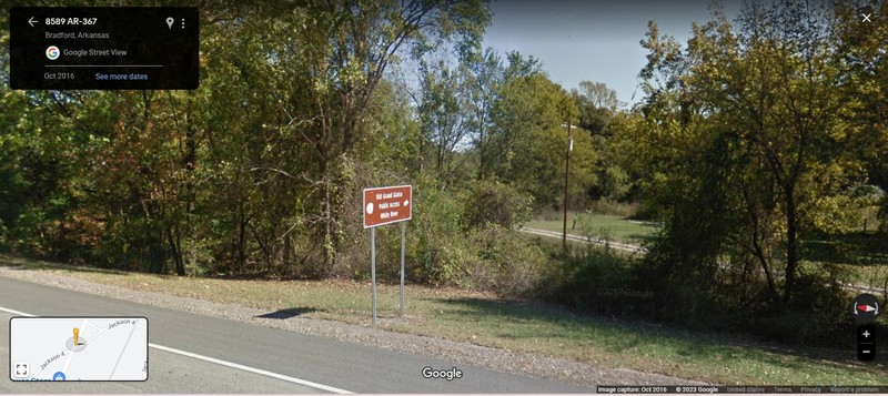
Old Grand Glaise Public Access White River
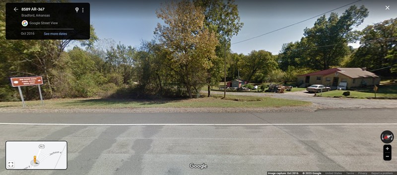
Old Entrance into Grand Glaise with White River Public Access Sign
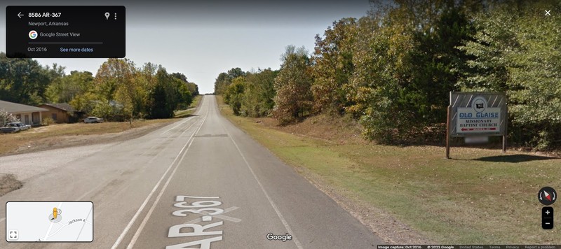
Old Glaise Missionary Baptist Church Sign with other entrance into Grand Glaise
Backstory and Context
Text-to-speech Audio
If you are traveling between Bradford and Newport you will notice a sign on the side of the road that says Old Grand Glaise Public Access White River that has a rich history to the area. Grand Glaise which is located not far from what was once Possum Grape in the 1800s was an important part of Jackson County’s economy. Grand Glaise had one of the largest towns of the area, and served as the commercial hub of Jackson County. Stith Tucker was the first white settler in Grand Glaise, but it would be James H. Patterson and his ferry operated from 1855-1876 that would bring business to Grand Glaise. Patterson bought the Grand Glaise site in 1851 selling half of his interest to James Saffold, and the two men would work together for the area to be established into a thriving community. Grand Glaise became known as a thriving river port, Laurel being the very first steamboat to dock at the port, and with further construction of roads to connect the area to Searcy and several other roads, resulted in the state legislature to authorize a bridge and toll road south of town in 1855. Eventually the community would comprise of seventy-five residents with two cotton gins, three stores, two saloons, four doctors, and a Methodist church that was established in 1856 by the Grand Glaise circuit. Eventually a post office was added to the community and Ewin B. Califf became its first postmaster in 1851, and even the Freemasons created Byers Lodge No. 81 on November 9, 1854.
Patterson would also be responsible for developing the early mercantile businesses and packing house, which brought about the market for cattle, and A.P. Allen’s barrel factory would be town’s largest employer. During the Civil War many male residents supported the Confederacy, creating the Grand Glaize Rifles, which is known later in history as the Seventh Arkansas Infantry. Because of the ferry, cattle packing house, and nearby salt licks, the area became the center of a smaller skirmish called the Skirmish at Stewart’s Plantation on Jun 27, 1862 during the Civil War, but after the war ended Grand Glaise would try to rebuild again.
With the declining river commerce, the future of Grand Glaise began to look bleak. By 1869 the local post office was discontinued, and official moved to a different area in 1874. The Cairo and Fulton Railroad was the serve blow to Grand Glaise economy because when construction was completed for the railroad in 1870 the tracks were located three miles west, on higher ground bypassing Grand Glaise, resulting in many residents to relocated to the newer established town of Bradford in White County. Grand Glaise would see a short uplift in the 1890s with the discover of freshwater pearls from the White River, and the mussel shells for buttons, but events like the Great Depression resulting the stock market crash of the 1930s would end the use of these commercial goods. In 1935, only one general store and 100 people were still living in Grand Glaise. Though Grand Glaise had a short term of excitement when the so-called White River Monster was spotted by a resident near the river town, and years later in 1973 the legislature created the White River Monster Refuge which extended between the southern part of the river known as Grand Glaise to the northern part of the White River known as Rosie. Another threat would take place in the 1940s in the construction of U.S. Highway 67, resulting in more people to move to the new transportation route.
Although in 1957 the population stayed steady, the only businesses left were two fish markets, a movie theatre, and a shell yard. In the 1960s the shell production would resurge when Japanese companies were looking to acquire shells for cultured production, but modern dredgers would deplete the shell supply in 1970. Currently in the twenty-first century very few people still live in the Grand Glaise area, one of the only businesses that exists the Ozark Premium Sand LLC, and the Old Glaise Missionary Baptist Church is only remaining church in the area.
Cite This Entry
Johnson, Lezlie. "Grand Glaise (Jackson County, AR)." Clio: Your Guide to History. May 5, 2023. Accessed April 24, 2025. https://theclio.com/tour/2453/2/reverse
Sources
Polston, Mike. Grand Glaise (Jackson County), Encyclopedia of Arkansas. September 1st, 2022. Accessed April 26th, 2023. https://encyclopediaofarkansas.net/entries/grand-glaise-jackson-county-6417/.
Polston, Mike. White River Monster Refuge, Encyclopedia of Arkansas . Accessed April 26th, 2023. https://encyclopediaofarkansas.net/media/white-river-monster-refuge-8572/.
Old Glaise Missionary Baptist Church, Zaubee. Accessed April 29th, 2023. https://zaubee.com/biz/old-glaise-missionary-baptist-church-u7qd5h0a.
Johnson, Lezlie. Old Grand Glaise Public Access White River, Google Mapes. Accessed April 29th, 2023. https://www.google.com/maps/@35.4901883,-91.4009743,3a,15y,54.85h,83.47t/data=!3m6!1e1!3m4!1sx5ZmIM_USYFaqhOn54jy0Q!2e0!7i13312!8i6656.
Johnson, Lezlie. Old Entrance Into Grand Glaise with White River Public Access Sign, Google Maps. Accessed April 29th, 2023. https://www.google.com/maps/@35.4902739,-91.400929,3a,75y,123.73h,95.95t/data=!3m6!1e1!3m4!1szKorQ3lVbEZ30jKfF52oUg!2e0!7i13312!8i6656.
Johnson, Lezlie . Old Missionary Baptist Church Sign With Another Entrance Into Old Glaise, Google Maps. Accessed April 29th, 2023. https://www.google.com/maps/@35.4917337,-91.4001584,3a,37.5y,210.1h,86.86t/data=!3m6!1e1!3m4!1sigW6jZqnp-VM1HceUdT94g!2e0!7i13312!8i6656.
Photo by Mike Polston, courtesy of Encyclopedia of Arkansas
Photo by NA, courtesy of Zaubee
Photo by: Lezlie Johnson, courtesy of Google Maps
Photo by Lezlie Johnson, courtesy of Google Maps
Photo by Lezlie Johnson, courtesy of Google Maps